Amberley to Washington, West Sussex, 4th June 2024
The photos in this post are a mix of Olympus EM-1 MIII mirrorless camera images using a 12-100mm (24-200mm full-frame) lens, with a few phone pics for detail. The photos have been cropped, marked and enhanced in places using Adobe Lightroom. I do not purposefully use Generative AI in any of my photos, which is basically sacrilege.
This is a prime early summer walk from June 2024, taking in my most frequented stretch of the South Downs. I had just returned from Switzerland when I did this walk. Arriving into Amberley on the train I realised how much my sense of altitude had changed when I saw the Downs appearing through the window. They looked so low! They have gradually grown back again in my estimation as my experience of the Swiss Alps has melted away into the past.
Every walk has its moment, for this one it was being attacked by a protective female pheasant at Kithurst Meadow. Thank goodness for my walking pole…
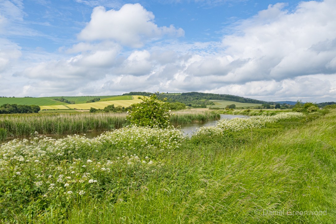
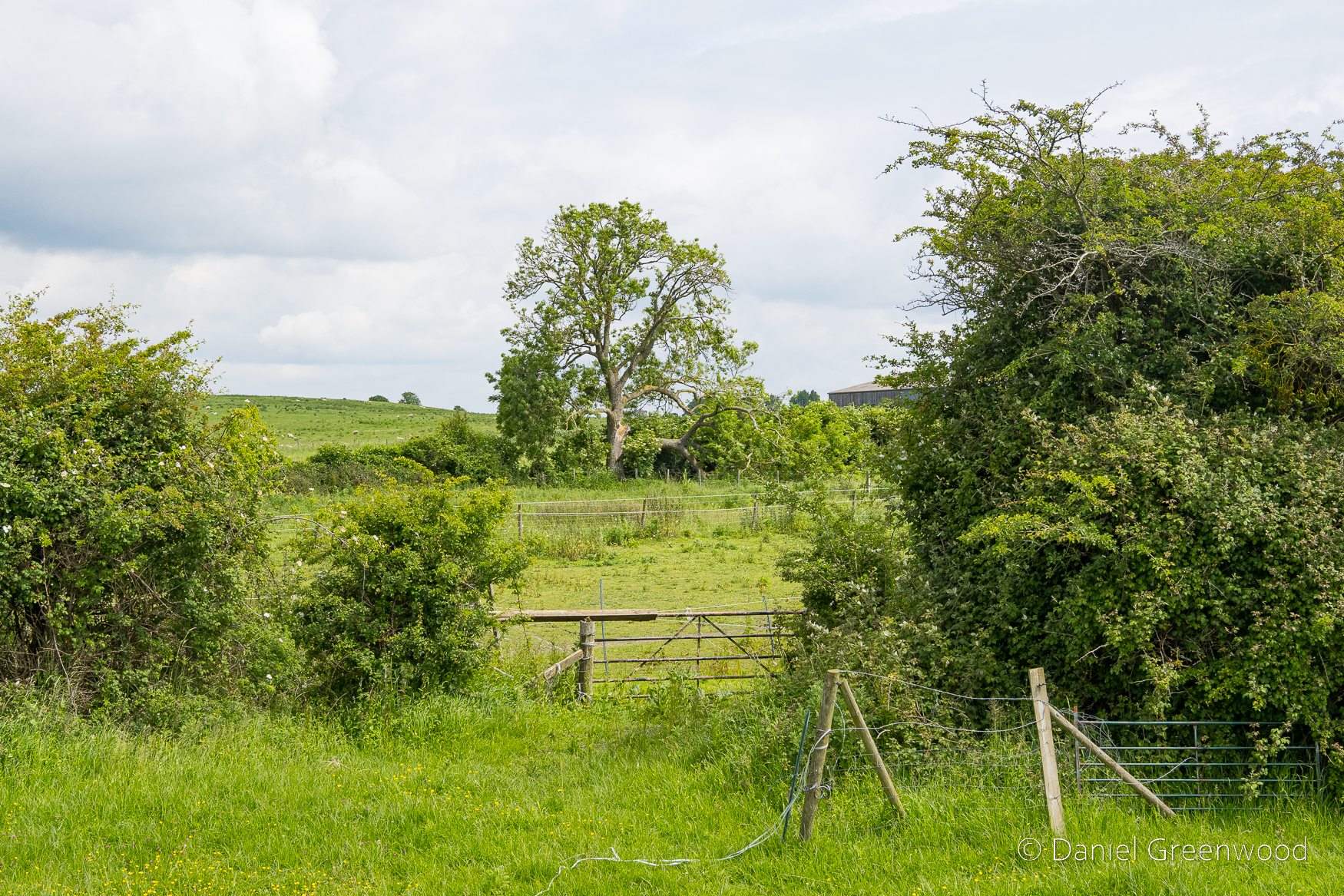
Everything was a shade of green and white as I left the station and began the walk along the eastern banks of the Arun. Ash leaves were abundant at the path edges.
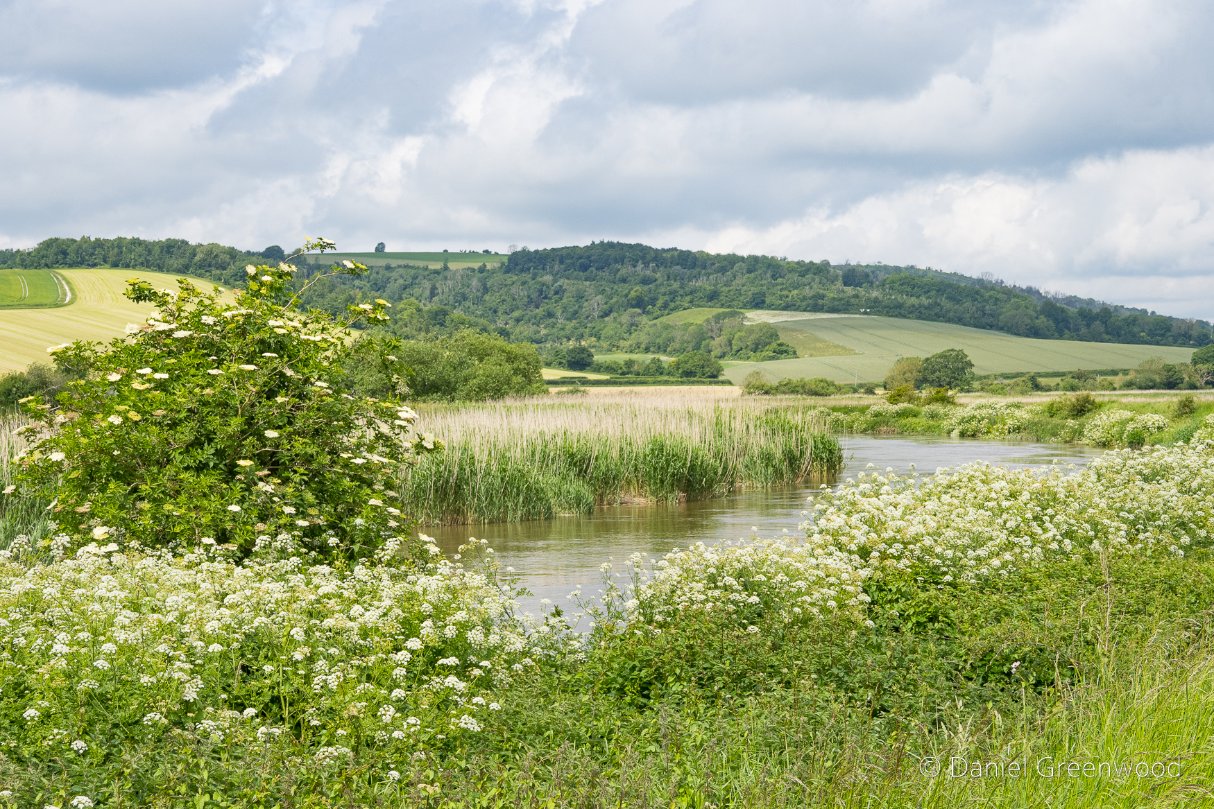
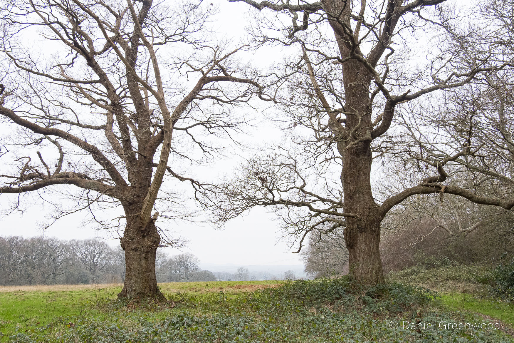
The white flowers of umbellifers ran along the banks of the river, with the ubiquitous presence of elder reaching higher. In the distance you can see the lone blog of the Bury Hill ash tree in an open field.
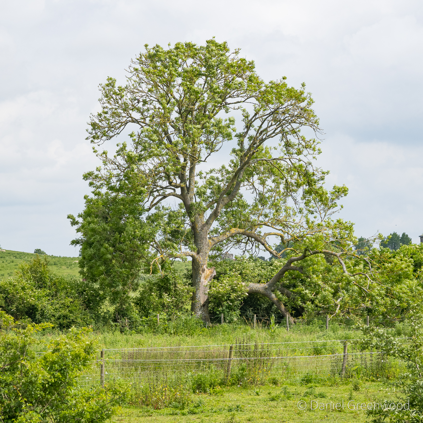
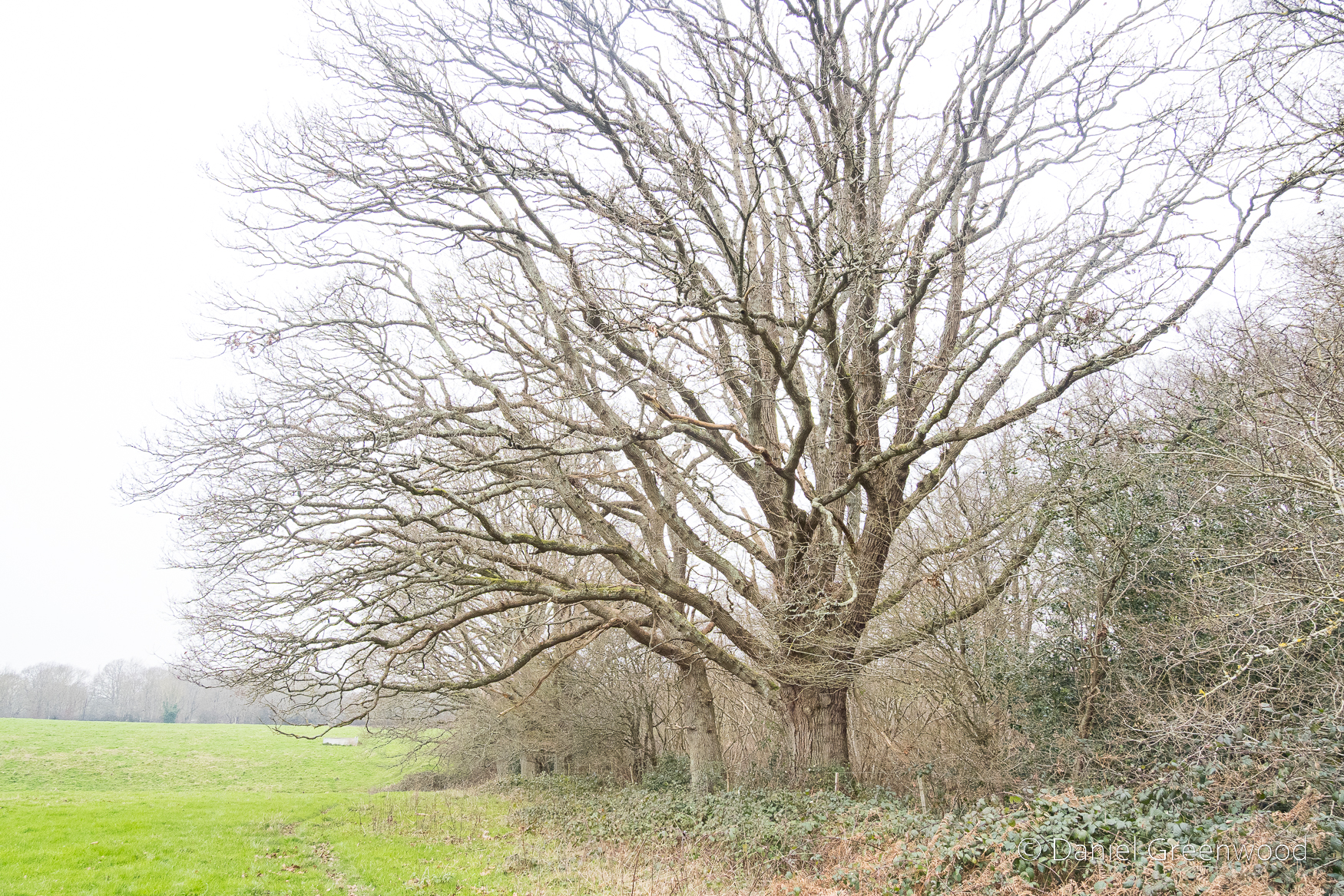
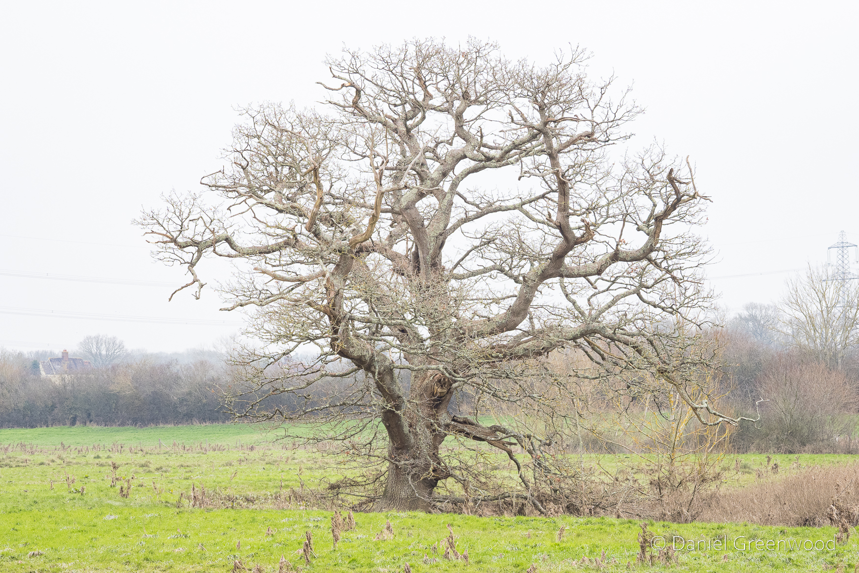
Speaking of ash trees, this is a lovely one set back from the footpath in a field margin.
As you can see a large limb has fallen from the core of the trunk. Ash trees are prone to ‘summer limb-drop’, where a limb can fall from the tree without any clear warning signs. This ash looks to have some light dieback, meaning it may have been weakened by ash dieback disease.
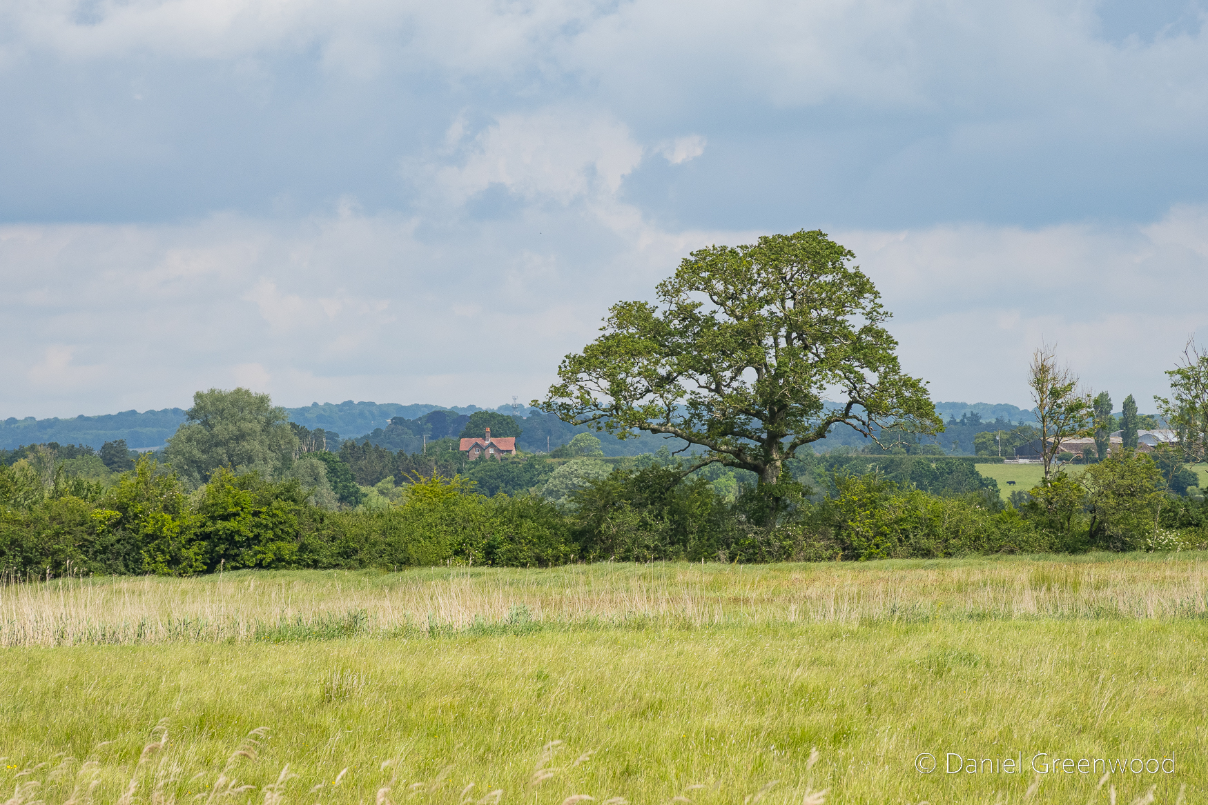
This tree looks to have the structure of a sycamore but it could be an oak.
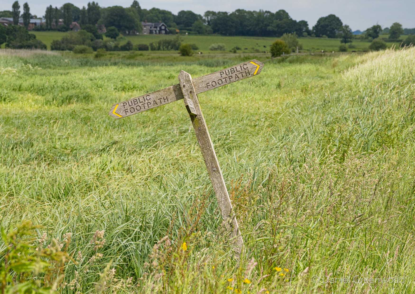
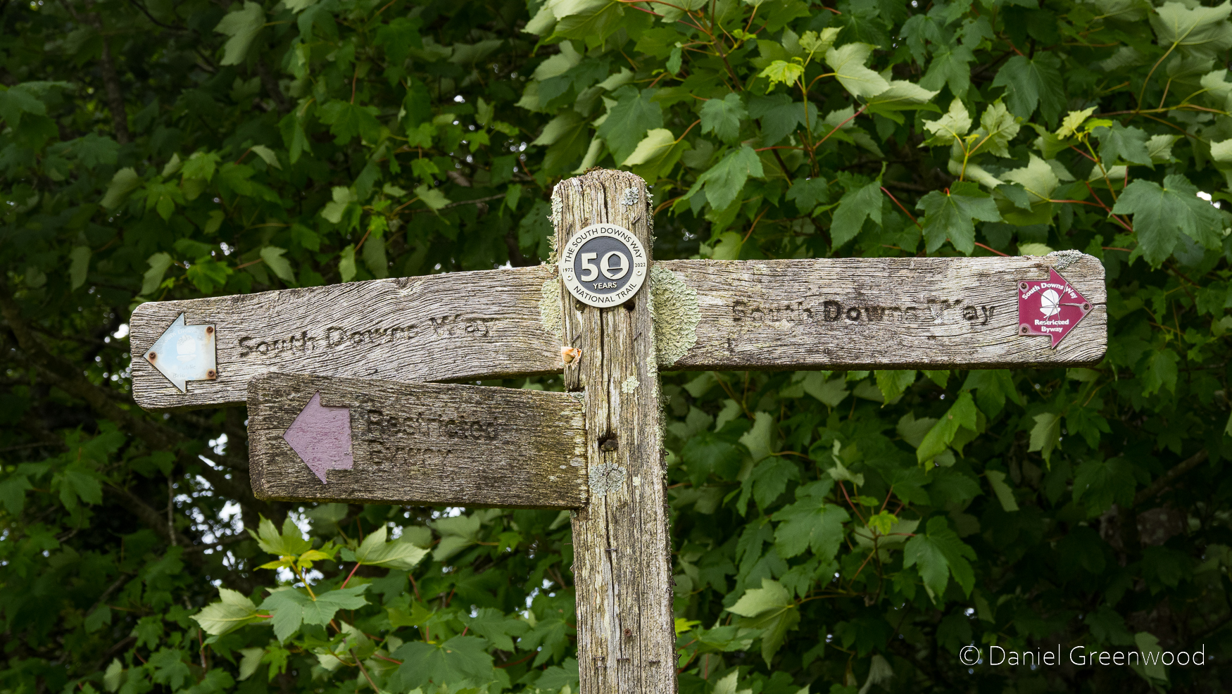
I always enjoy this finger post, the Arun valley’s very own leaning tower of Pisa.
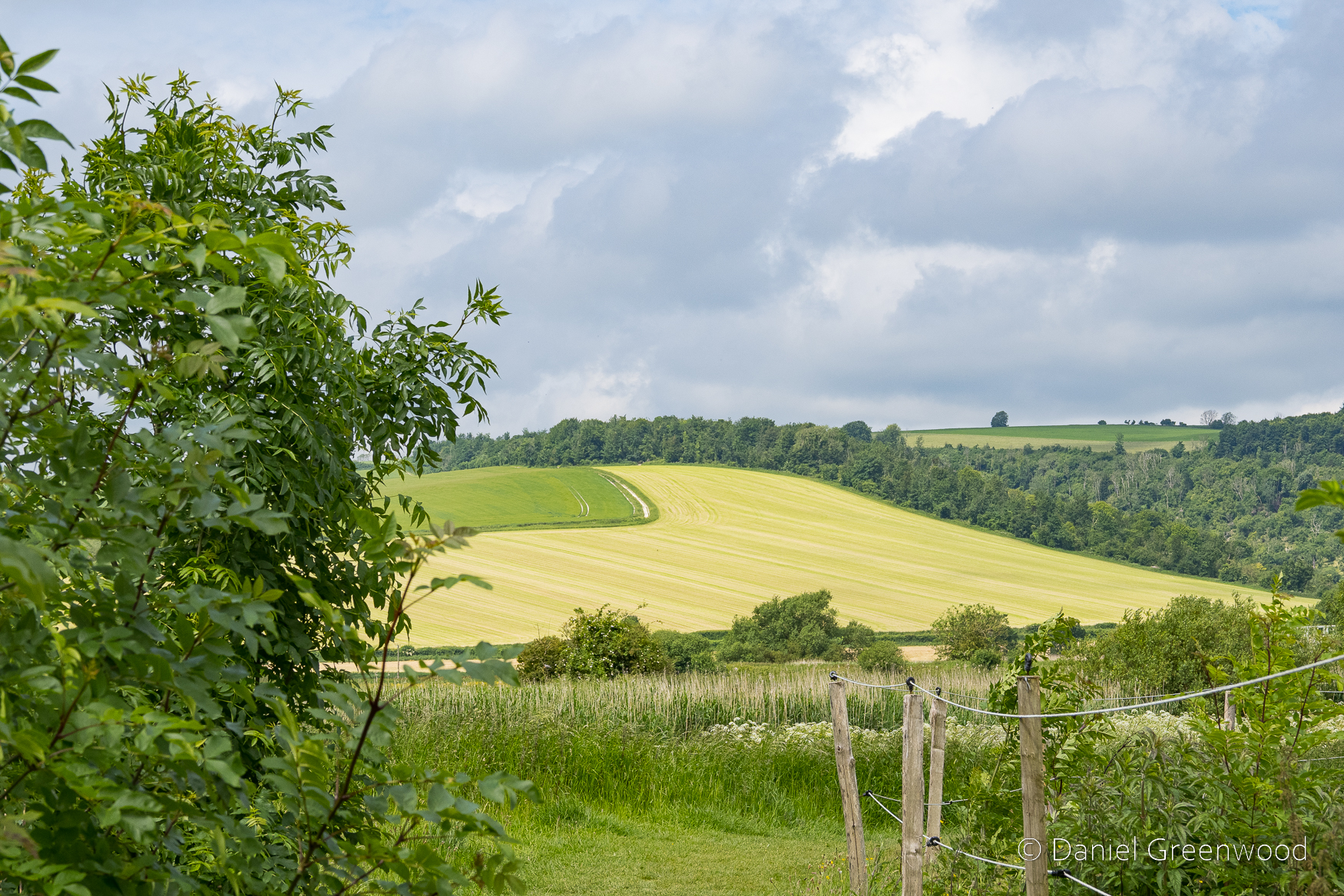
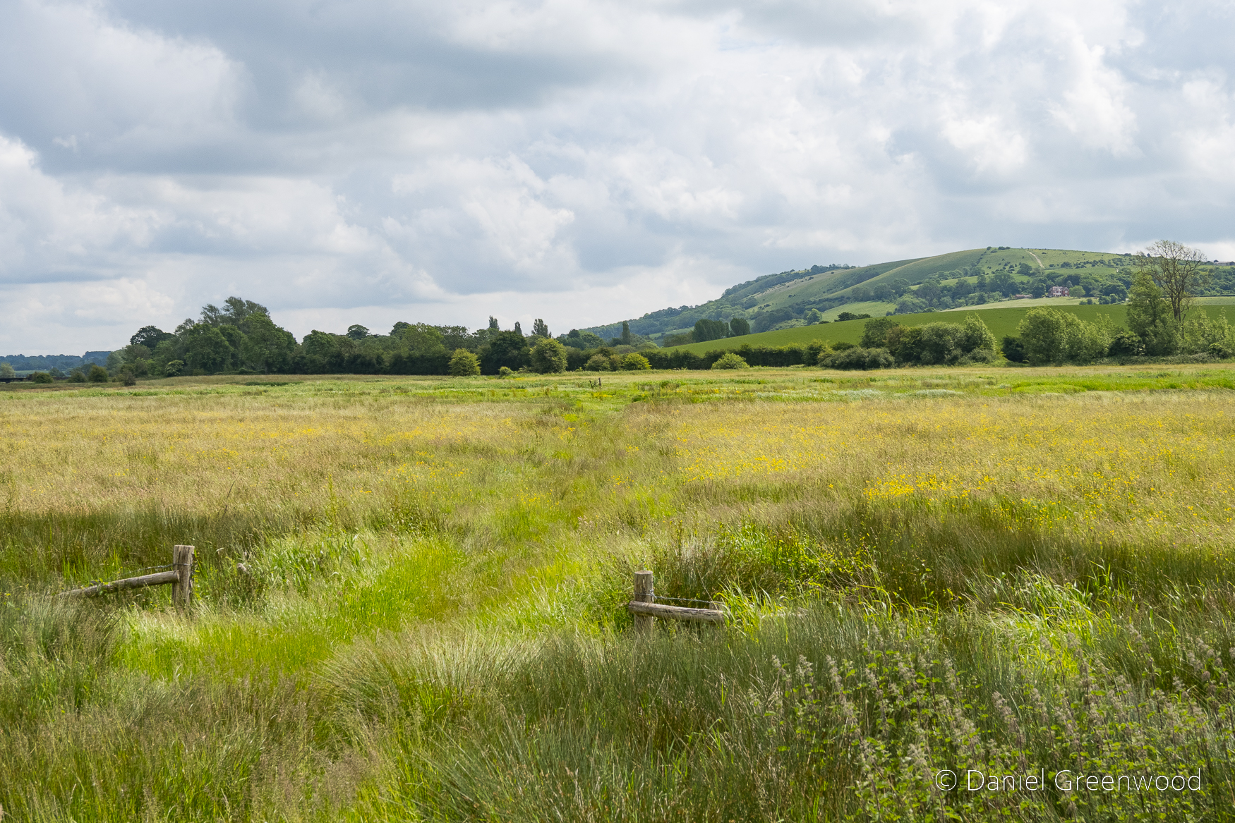
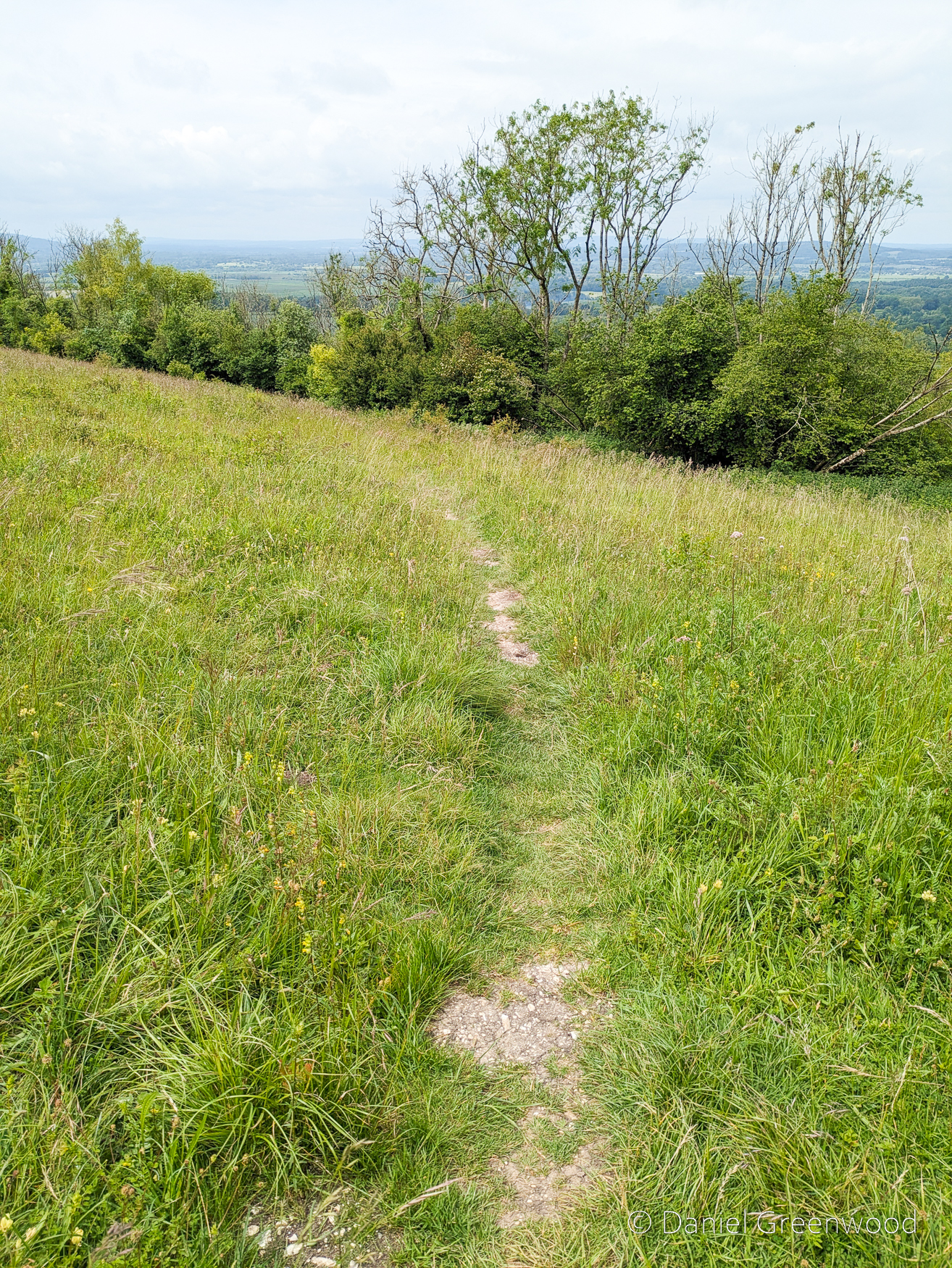
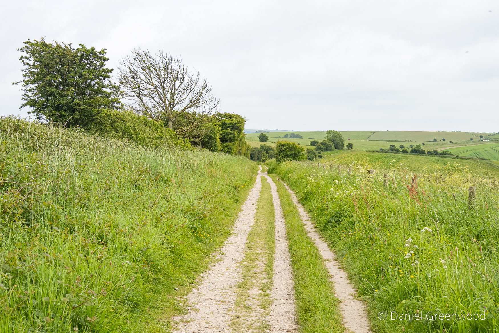
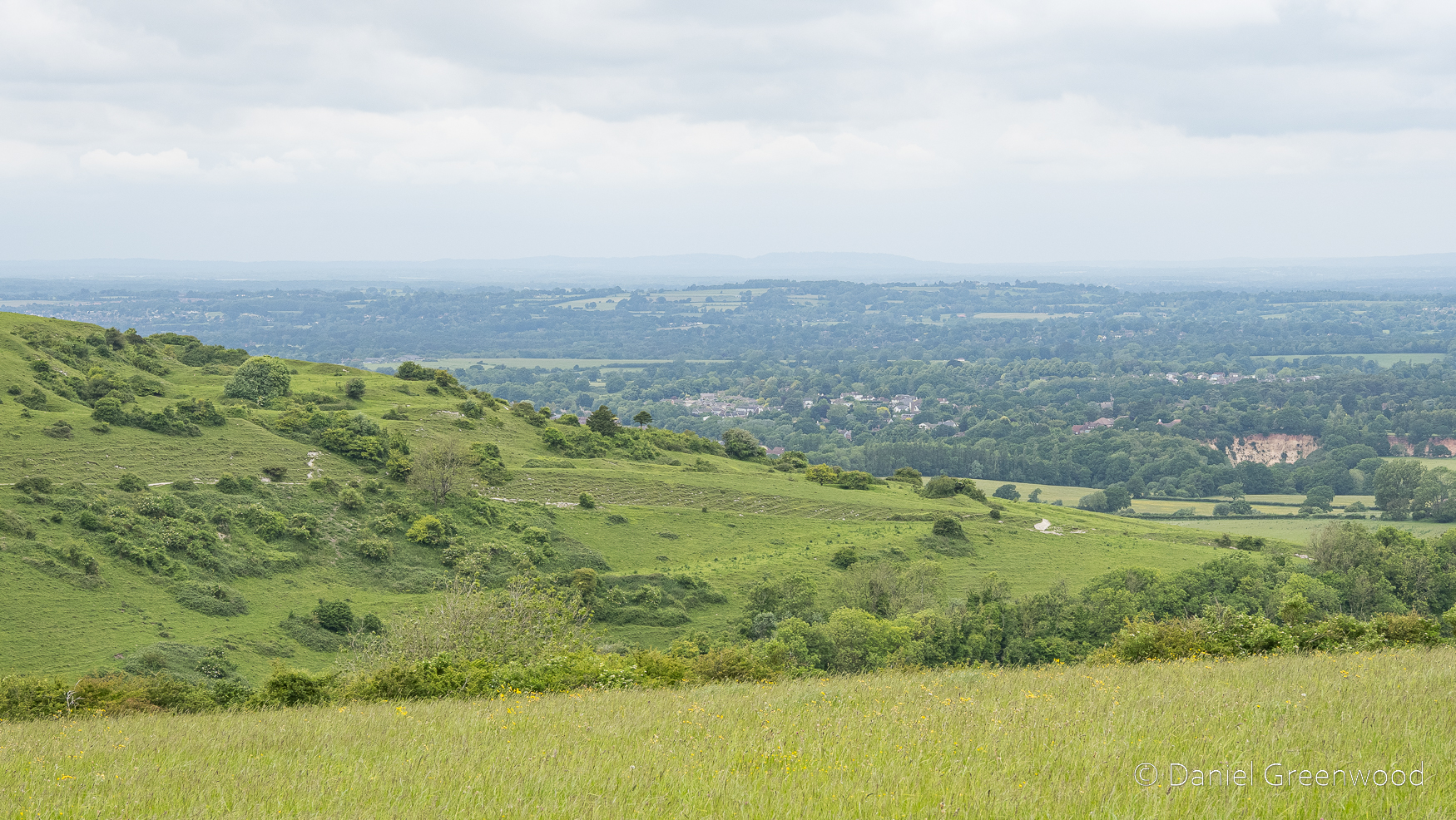
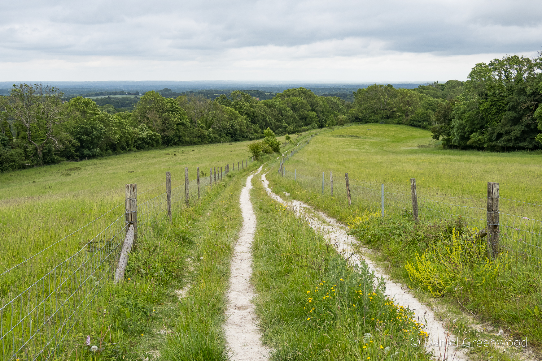
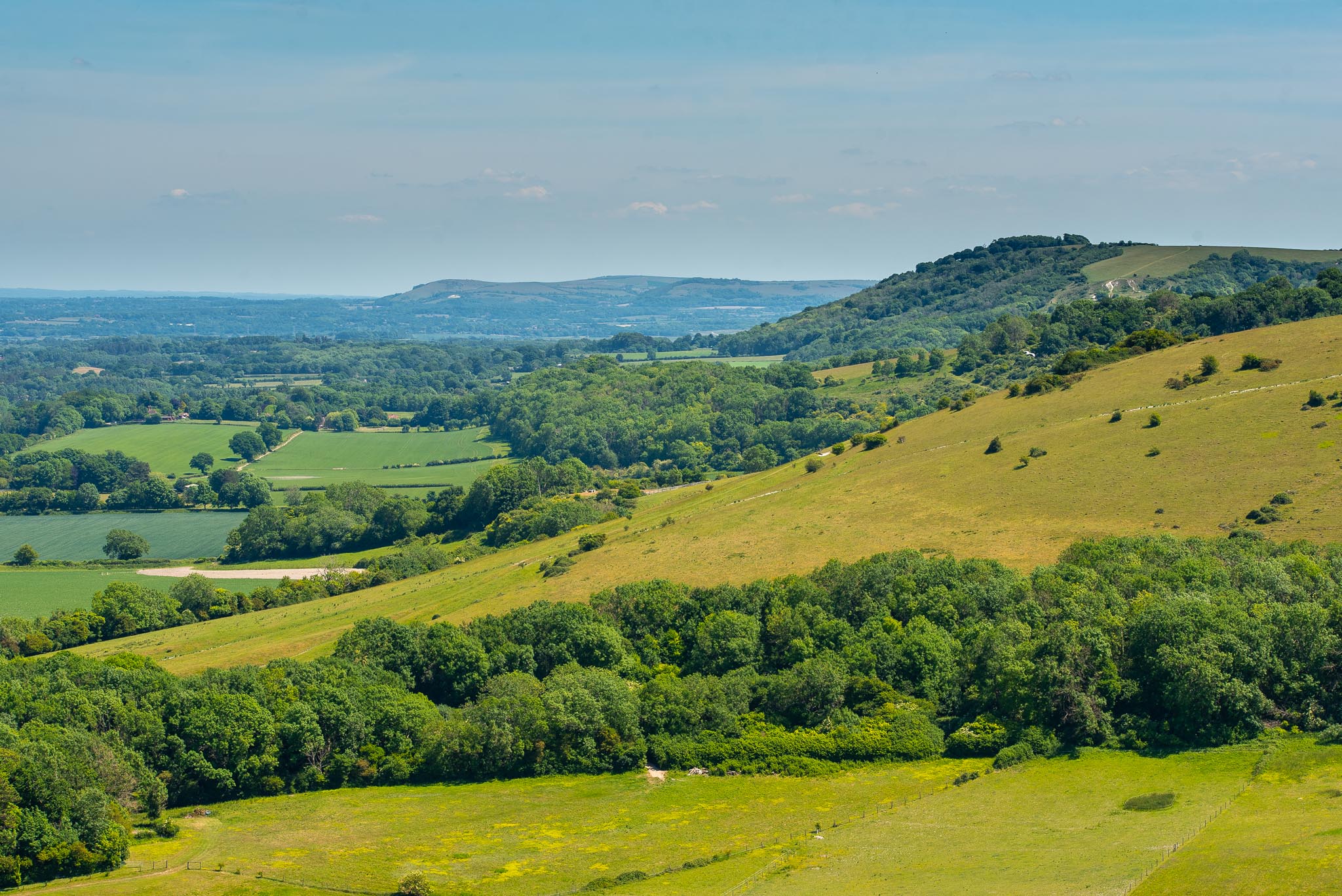
In the distance is Amberley Mount where the South Downs Way passes, through ancient burial mounds and chalk grasslands (as well as plenty of intensive agriculture). The path between the fence posts here is very wet in winter but is ok for walking boots between June and September if it hasn’t rained too much.
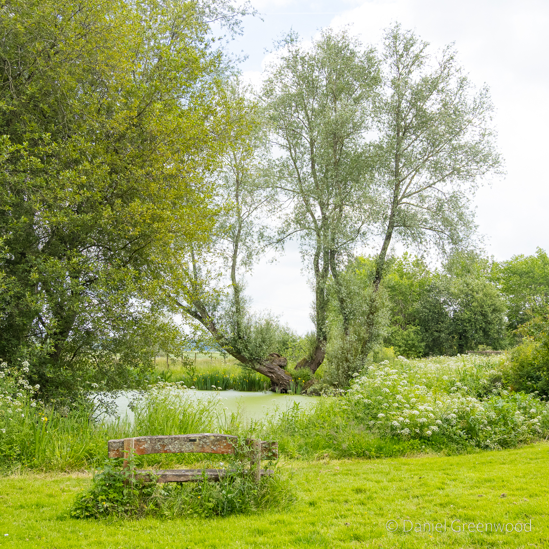
After passing alongside Amberley Castle this large pond appears before the village. This is it at its best, I would say.
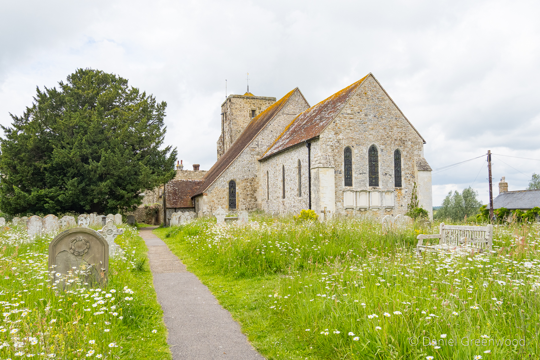
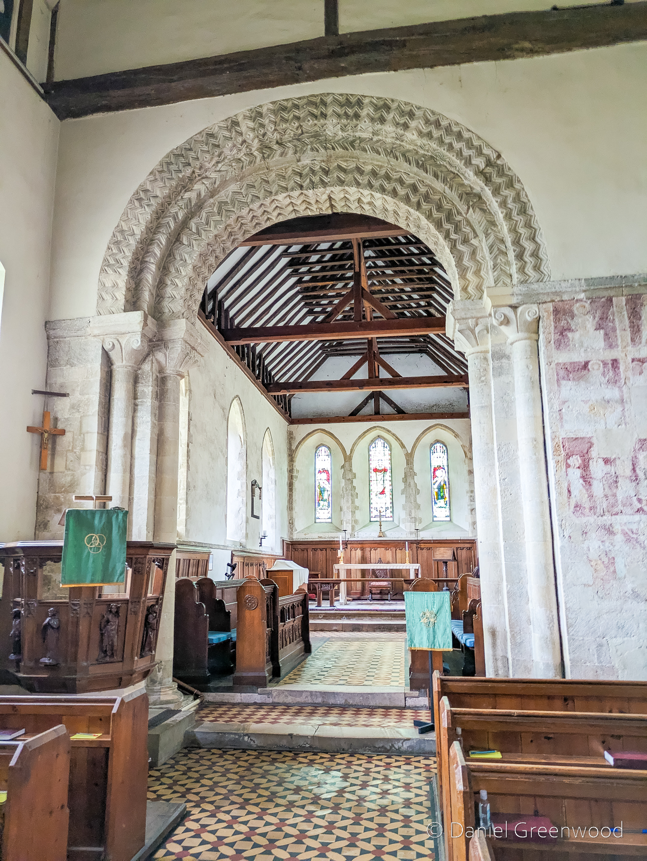
Amberley lies above the water meadows of the Arun and the adjacent castle (now a hotel) was an episcopal residence. It was built in place of a manor about 1380, though the church had enjoyed the favour of the bishops from a much earlier date. Neither has changed much since the Burrell Collection drawing of 1788.
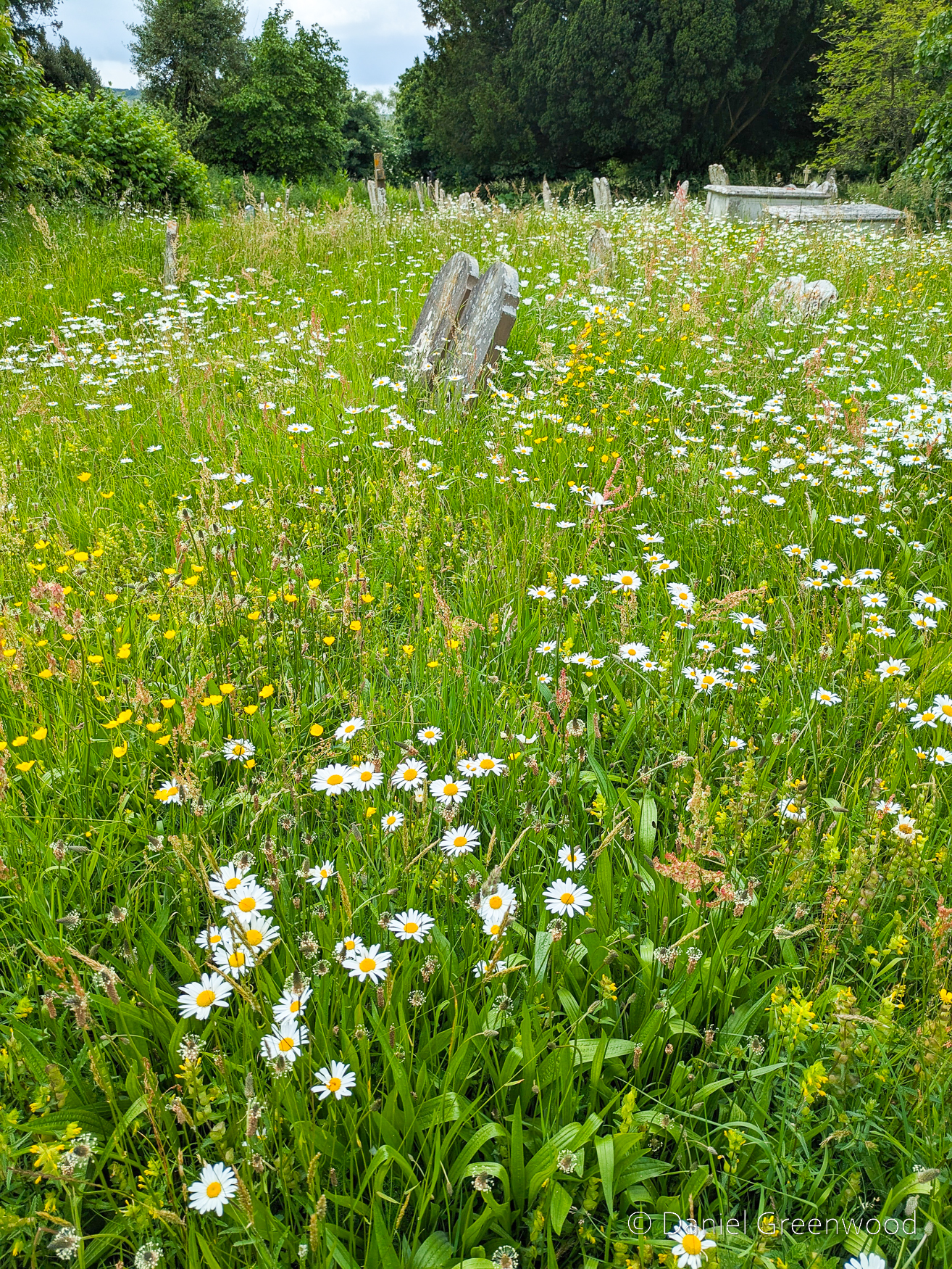
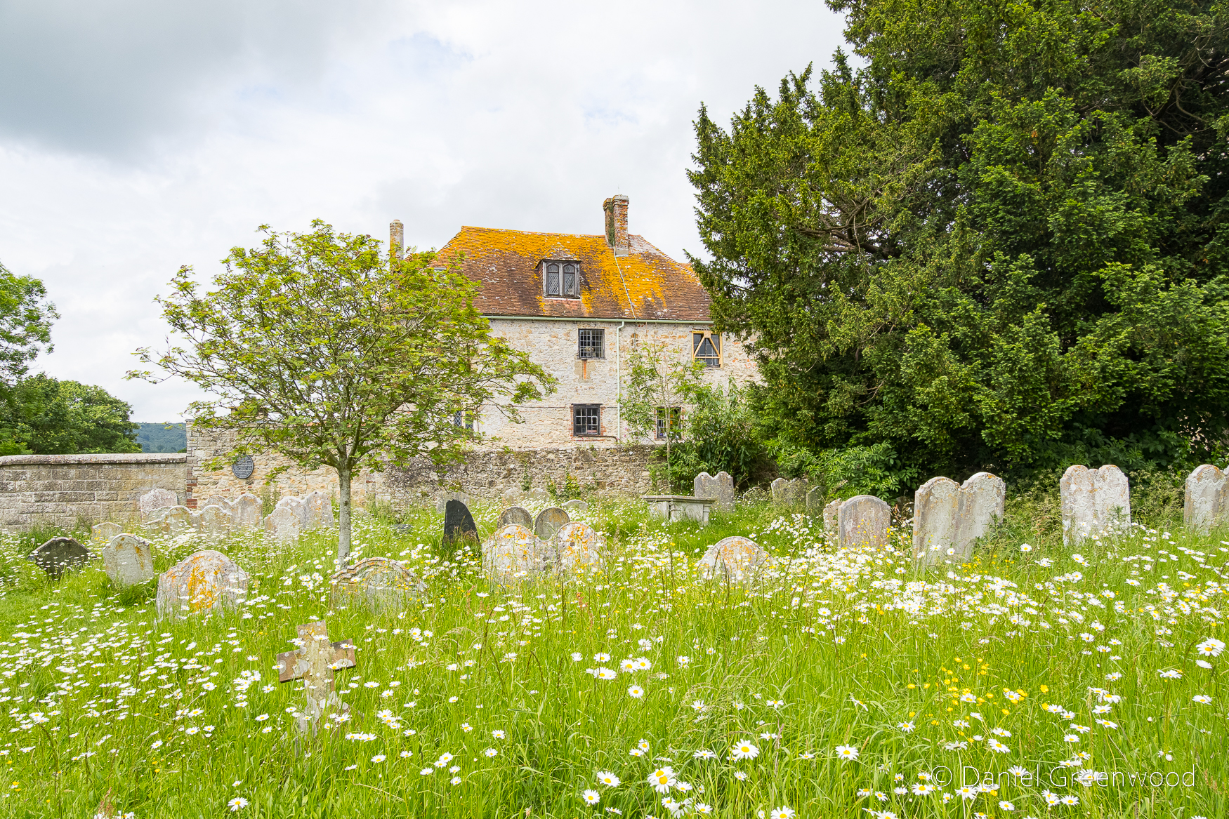
The churchyard meadows are a model of good management, with oxeye daisies aplenty in June, though they seemed to flower earlier in 2025.
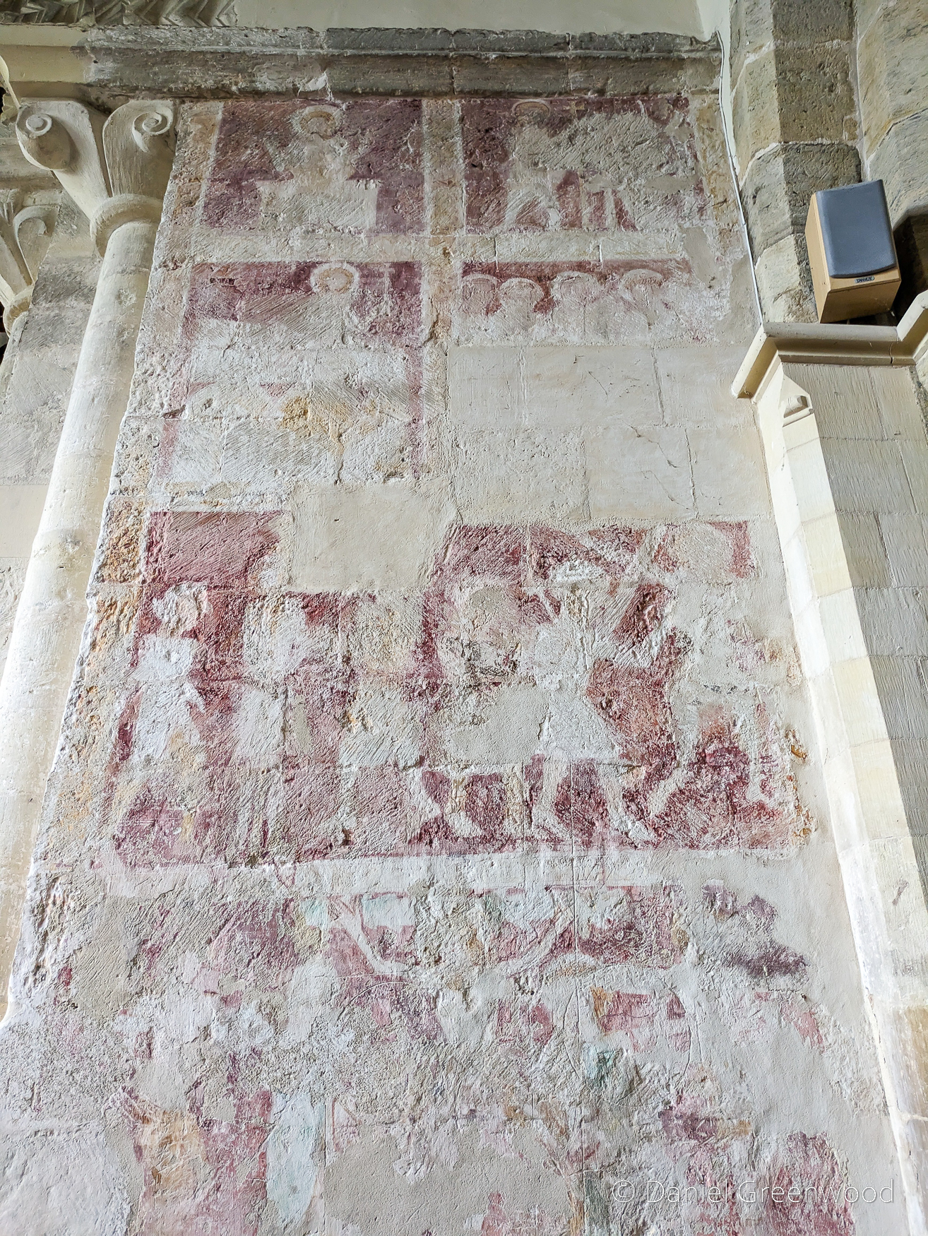
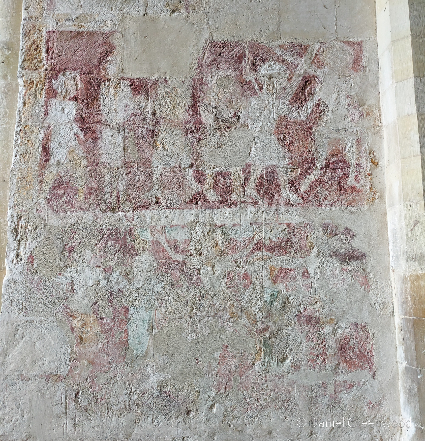
The wall paintings seen here inside the church are thought to date to the 1300s. There’s more detail about the paintings on the church’s official website. The paintings depict the resurrection of Christ, as can be seen in the central painting with the cross.
One more sniff of the meadows for the road.
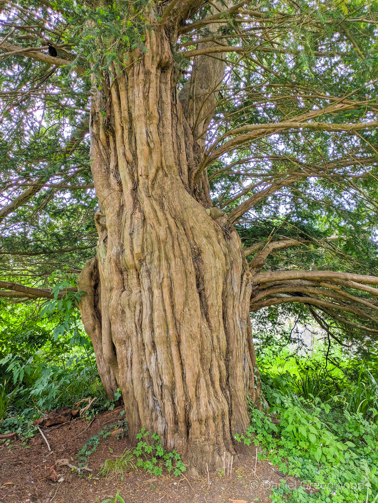
Elsewhere in the churchyard is a large yew tree, likely dating to several hundred years.
Skipping over Amberley village and up towards the South Downs Way, this ash tree was declining in 2024 and was felled at some point in 2025.
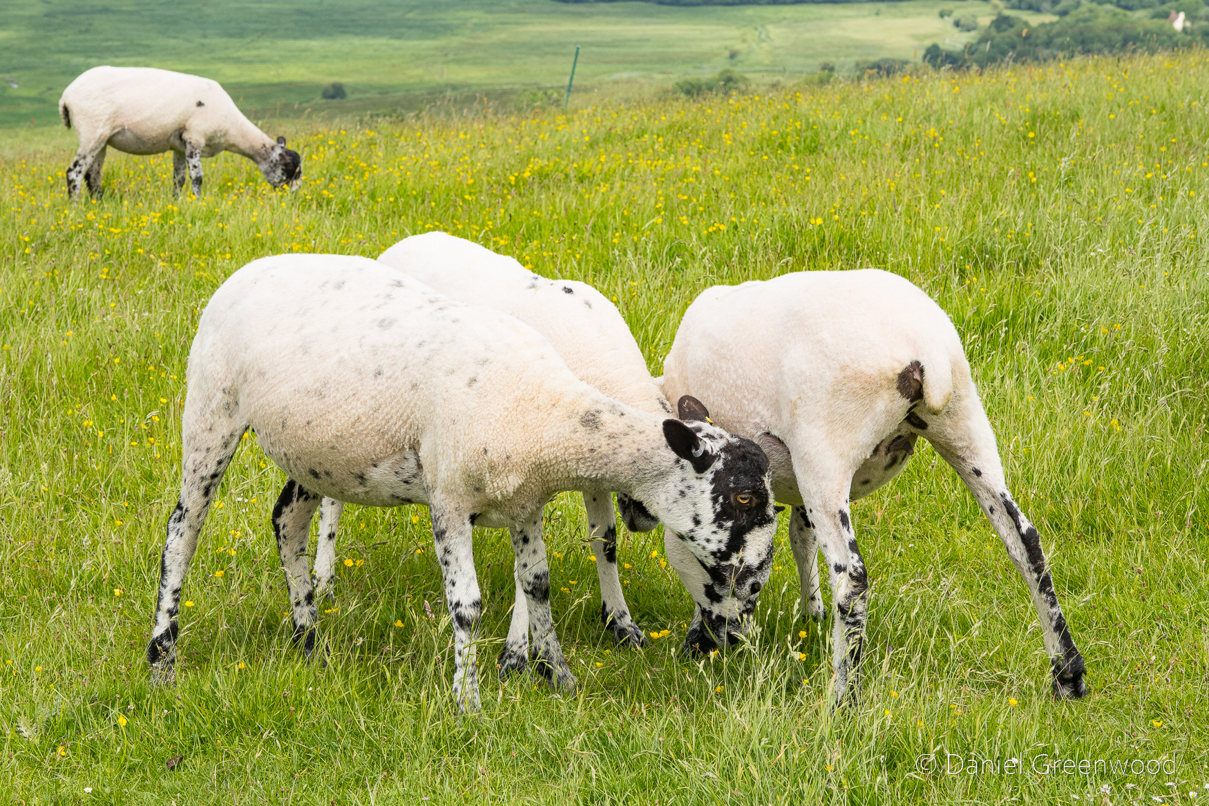
I don’t know what breed of sheep these are, but they were newly shorn.
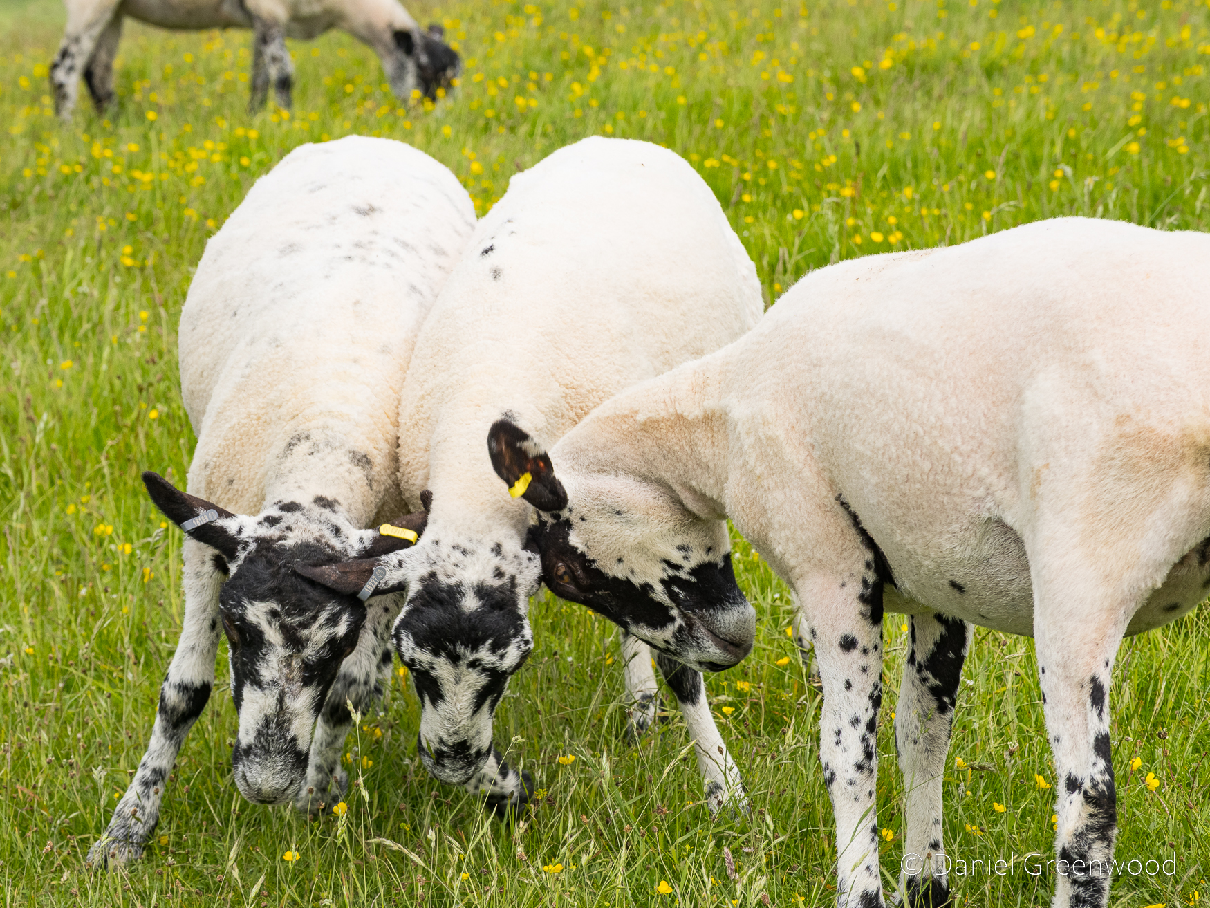
I think these are 2024 lambs, they were very playful.
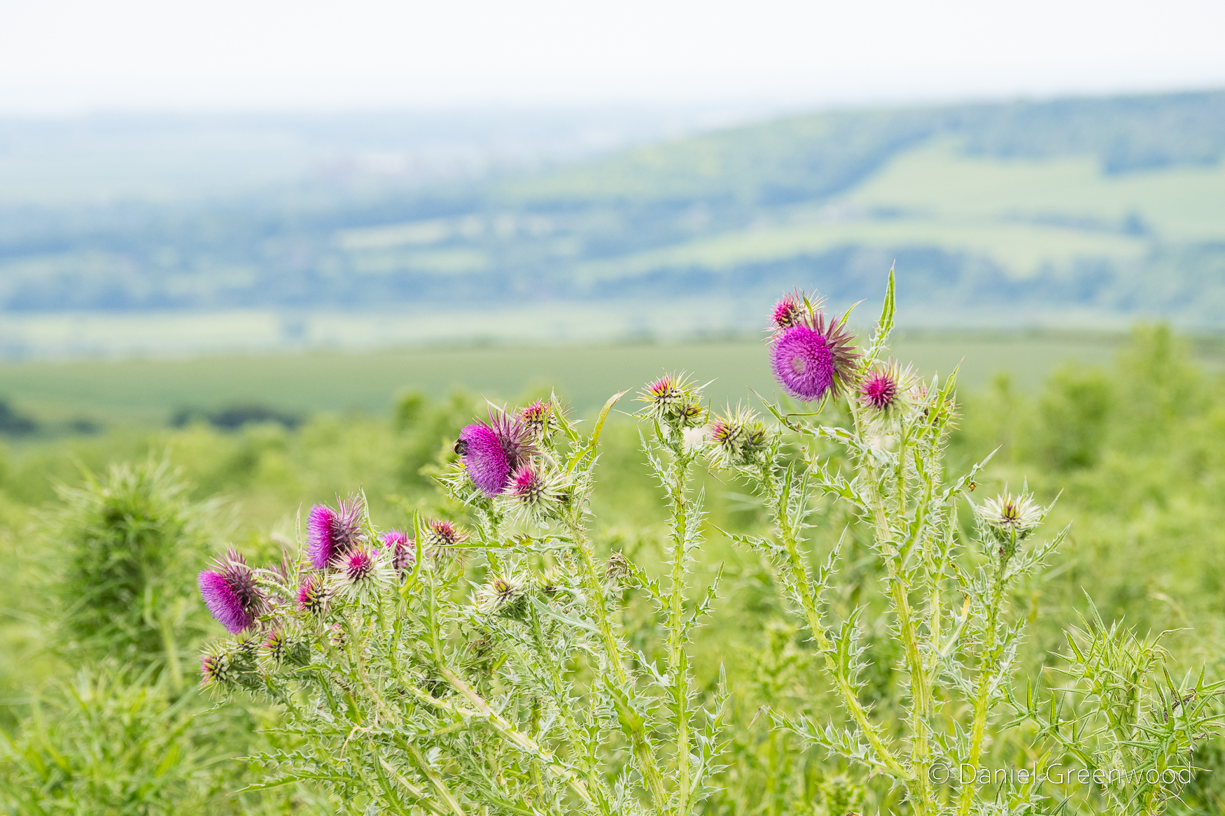
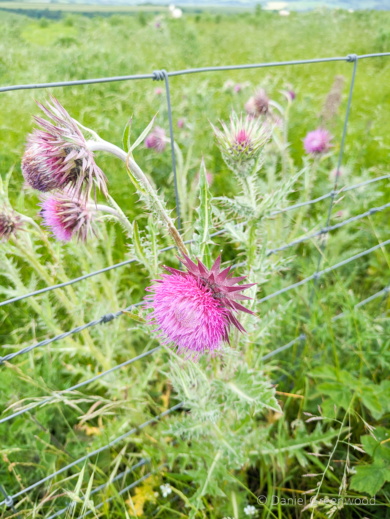
Musk thistle (Carduus nutans on iNaturalist) is a beautiful flower and popular with bees. It flowers along the margins of the South Downs Way. The first photo is mirrorless camera, the second is from the phone.
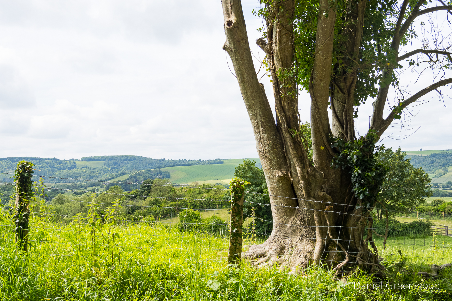
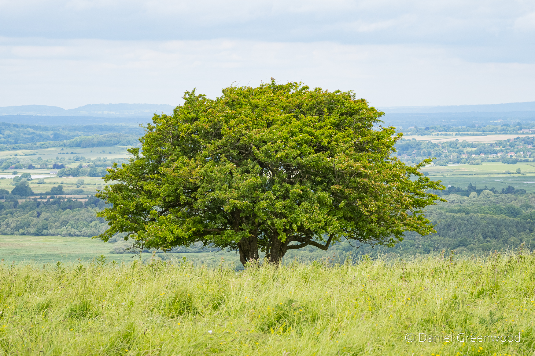
One of the iconic hawthorns with the Arun valley expanding away in the distance.
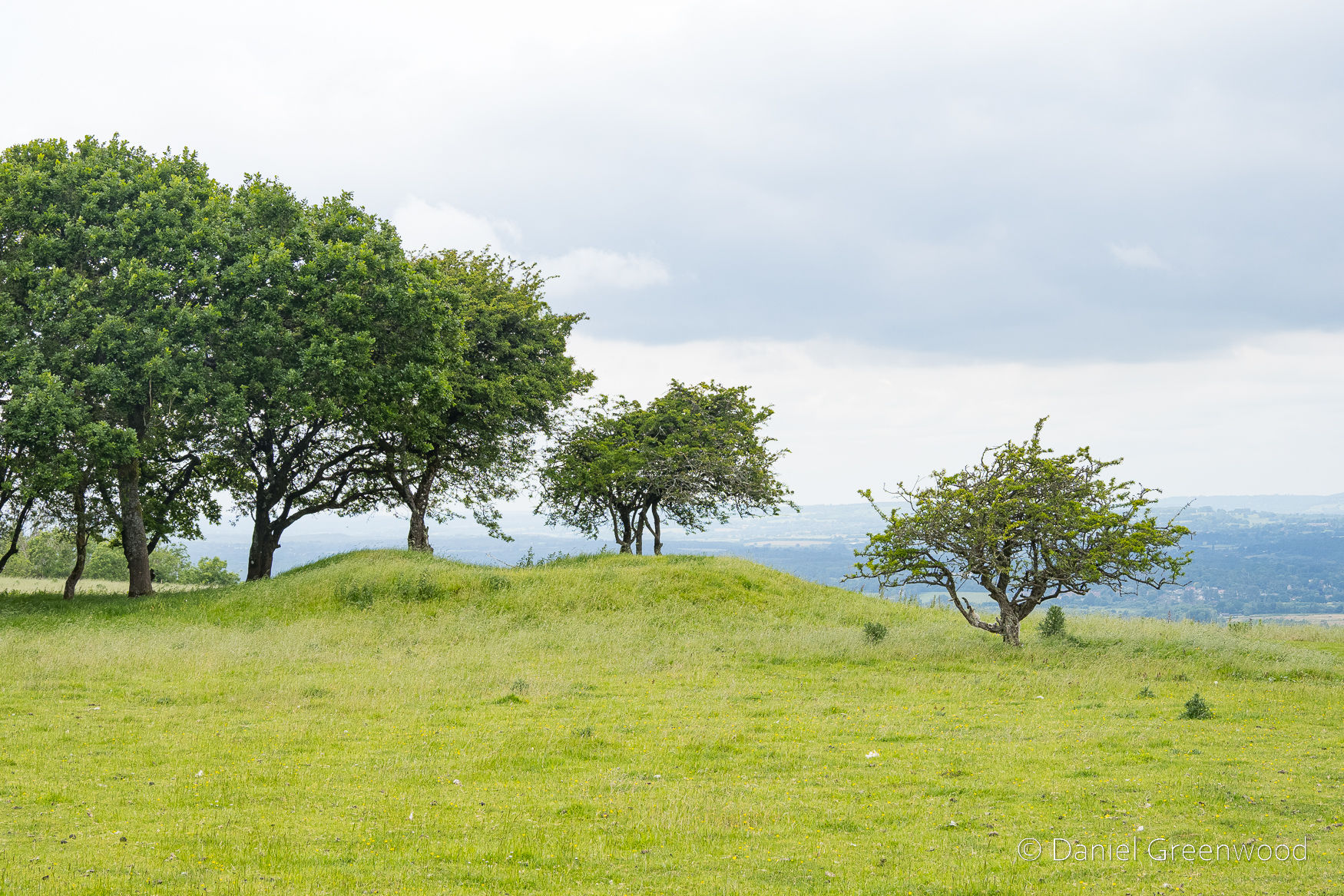
On the northern side of the South Downs Way you can see the ‘lumps and bumps’ of tumuli – burial mounds that date back to at least the Iron Age (1200-550BC). There is evidence of Iron Age communities living below Amberley Mount, which this walk passes over:
We know that Late Bronze Age/early Iron Age families lived amidst their fields here around 1100 BC: two circular huts of this period on the south-face of Amberley Mount were excavated and remains of horses and ponies were discovered and were presumably used on the farm. One hut was 36 ft in diameter, the other 25 ft: sizeable dwellings that must have supported quite large family groups.
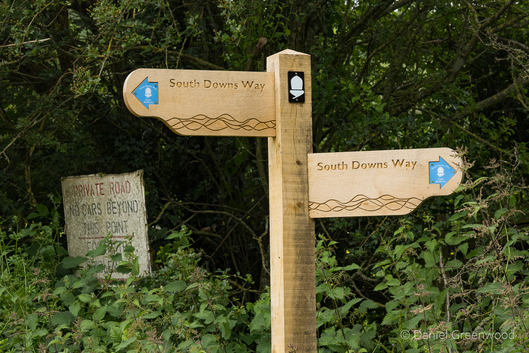
A South Downs Way fingerpost aged in lichen and weathered by rain.
This lovely scene at Kithurst meadow became a momentary nightmare after a little pheasant chick crossed my path. Their mother appeared and attacked me for a good minute or so, not allowing me to head back towards the South Downs Way.
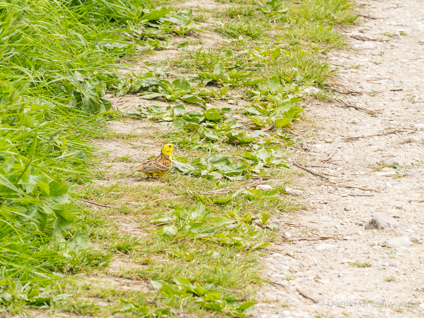
Yellowhammer foraging along the South Downs Way. Thankfully it did not attack and I was allowed to pass.
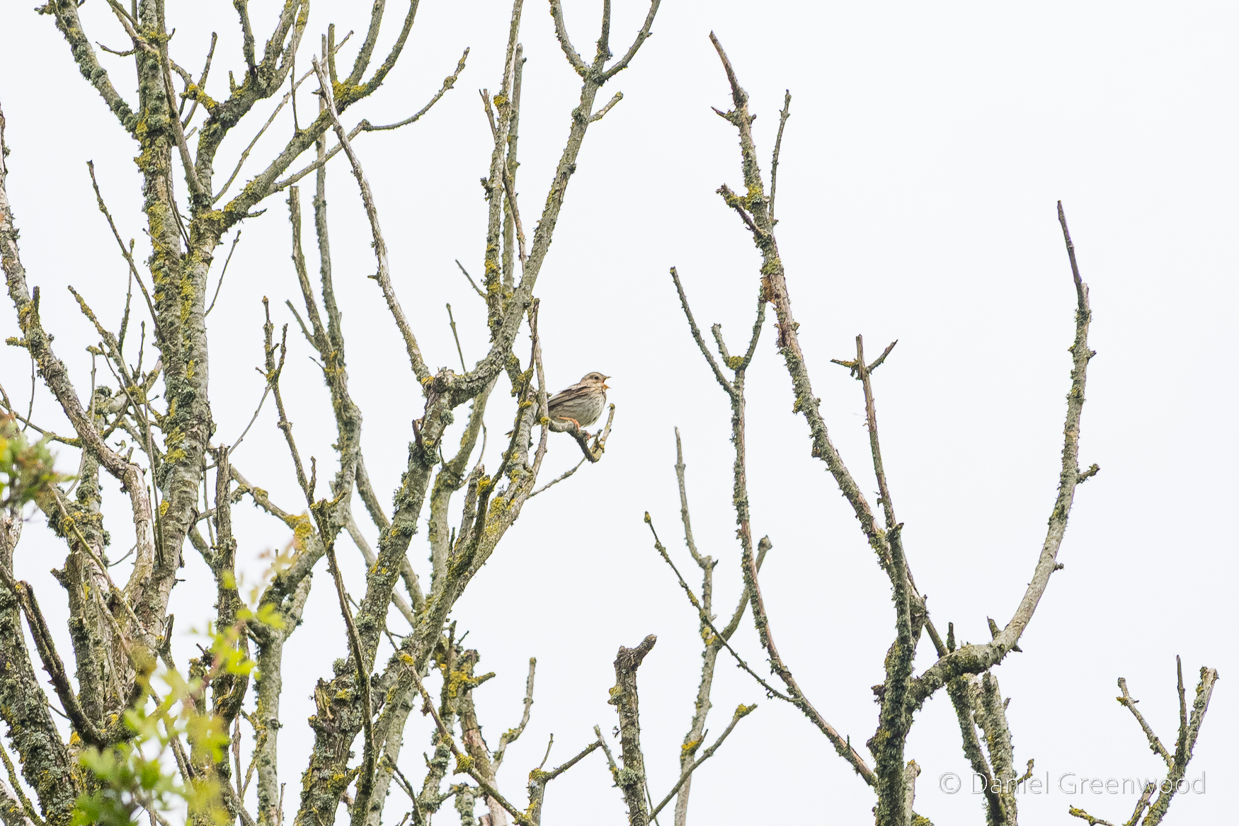
Corn bunting, a now much rarer bird, along a stretch of the South Downs Way where I always find them in the spring and summer.
And here it is – Corn Bunt’ Alley.
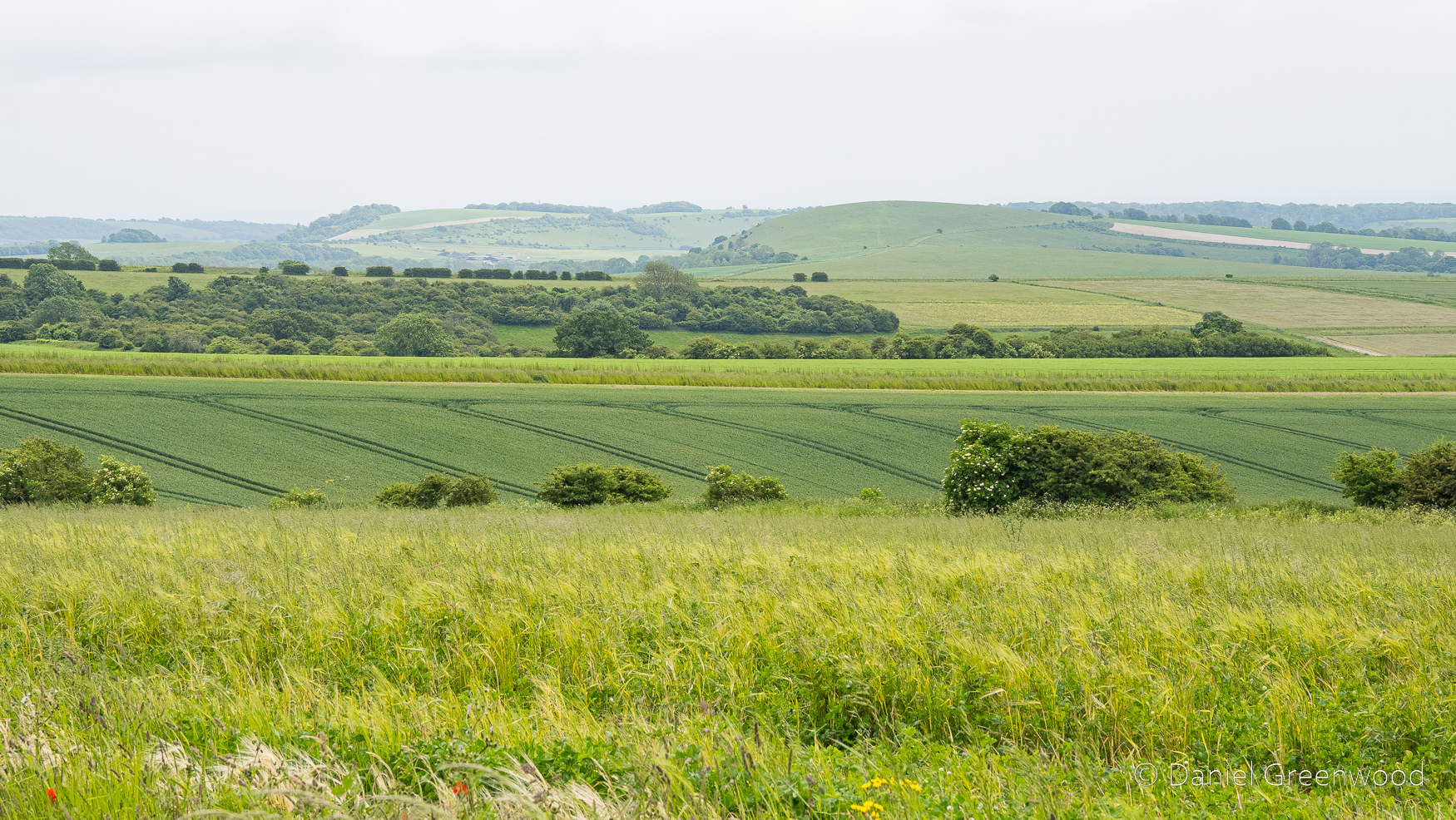
The Downs plateau into arable fields here, sweeping towards the coastal towns.
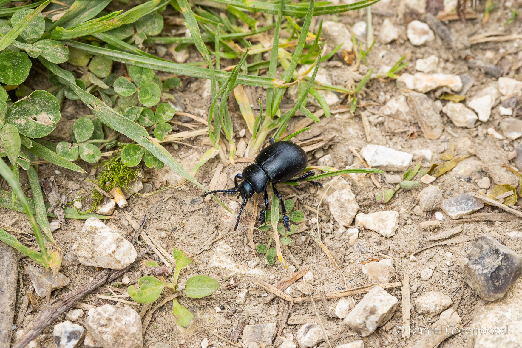
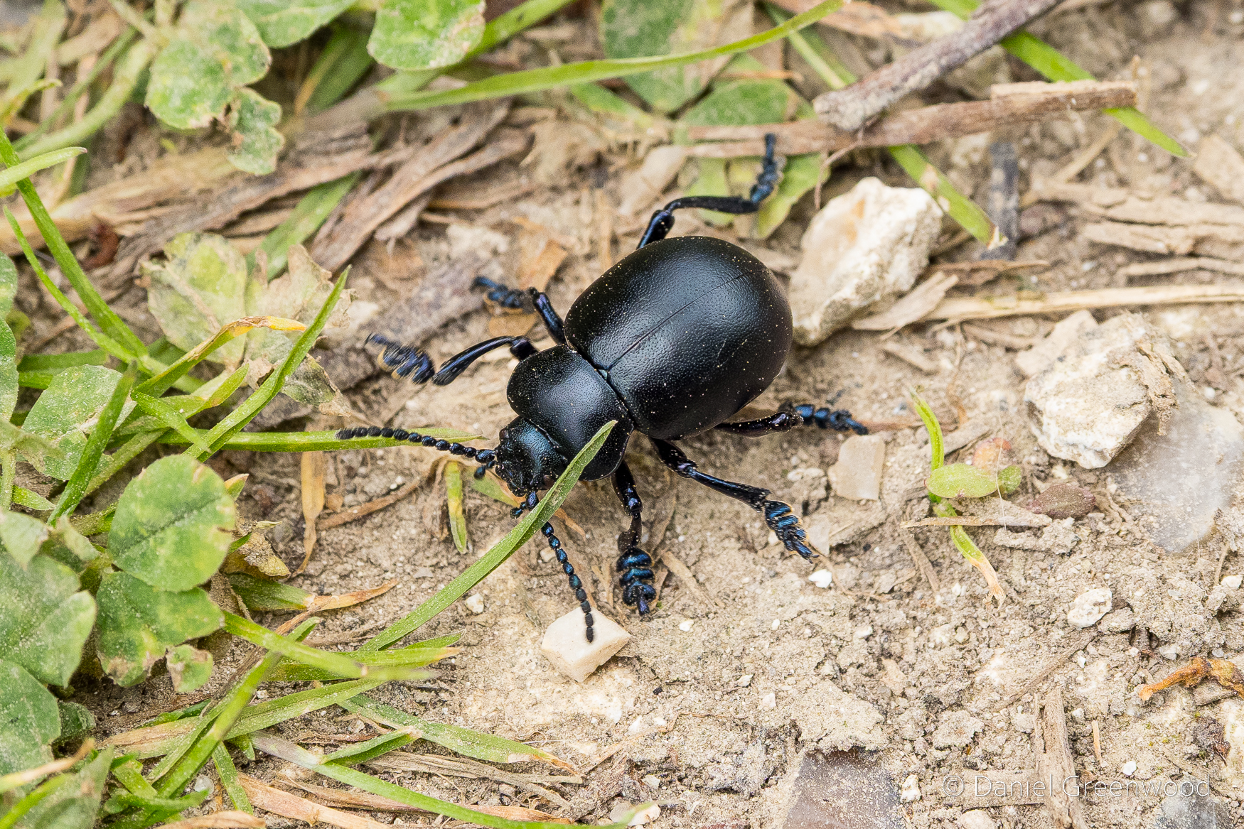
Bloody-nosed beetle. I enjoy their boots.
A view north into the Sussex Weald.
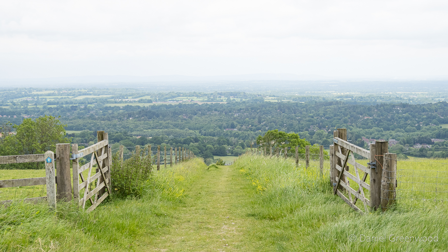
Exiting the South Downs Way towards Washington.
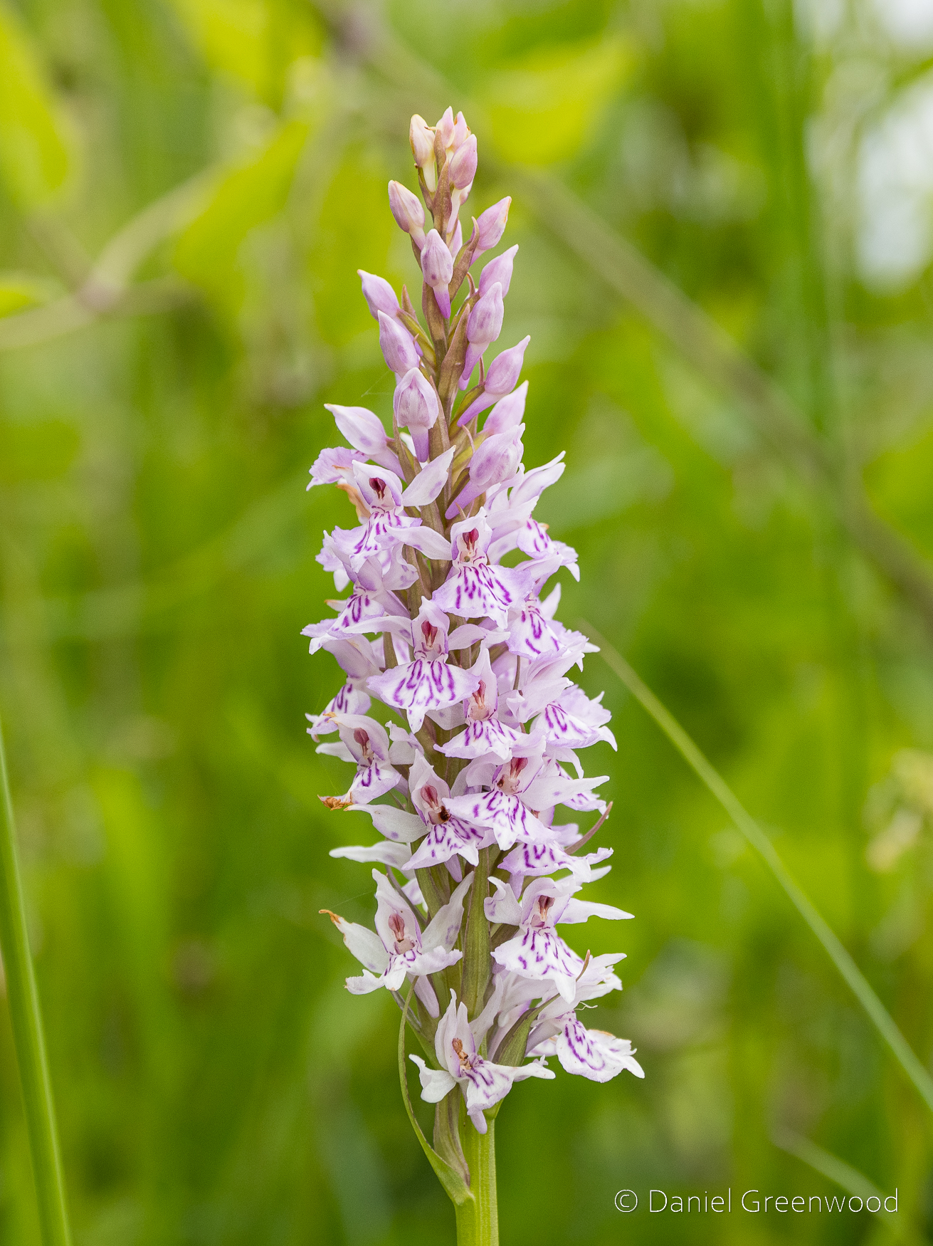
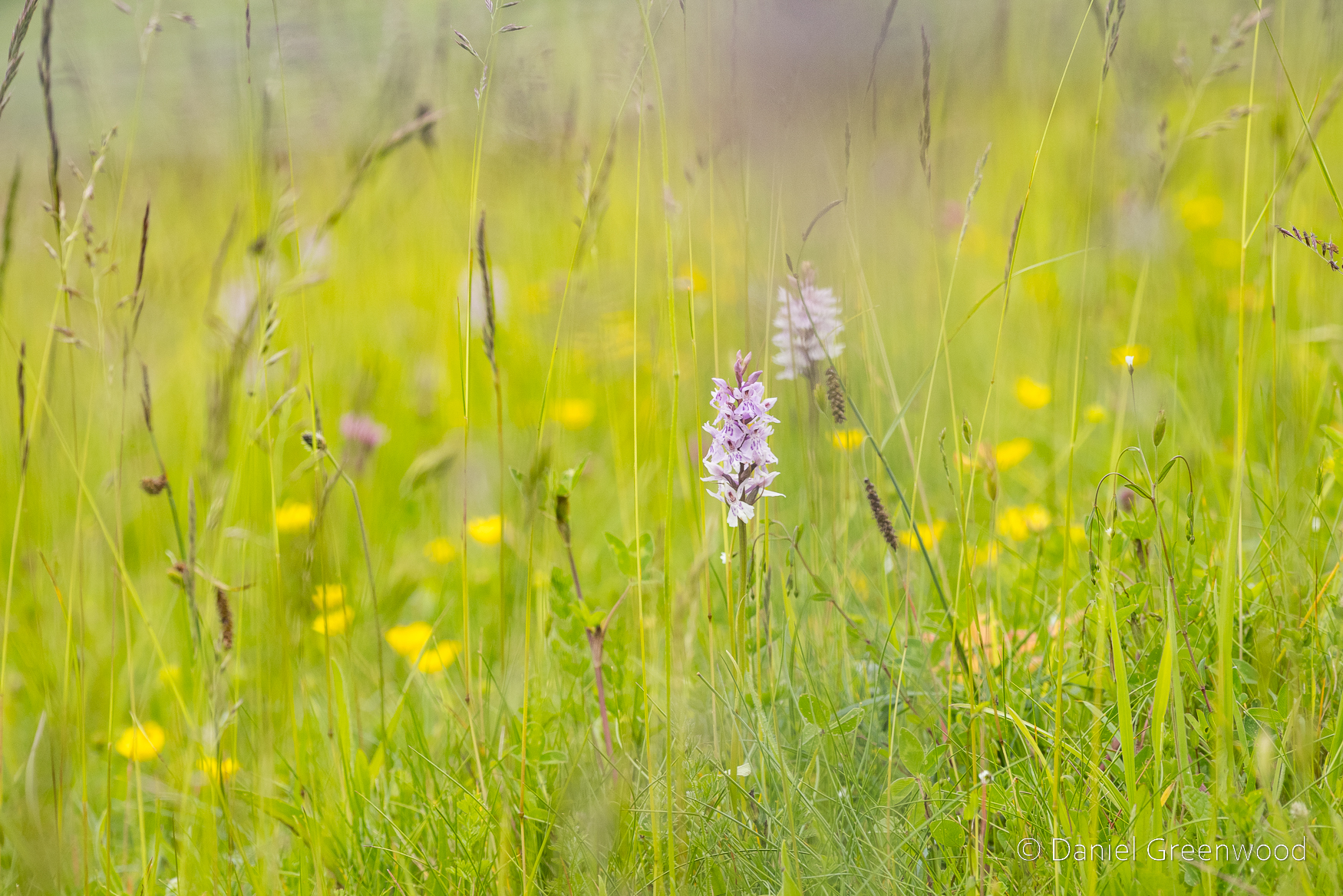
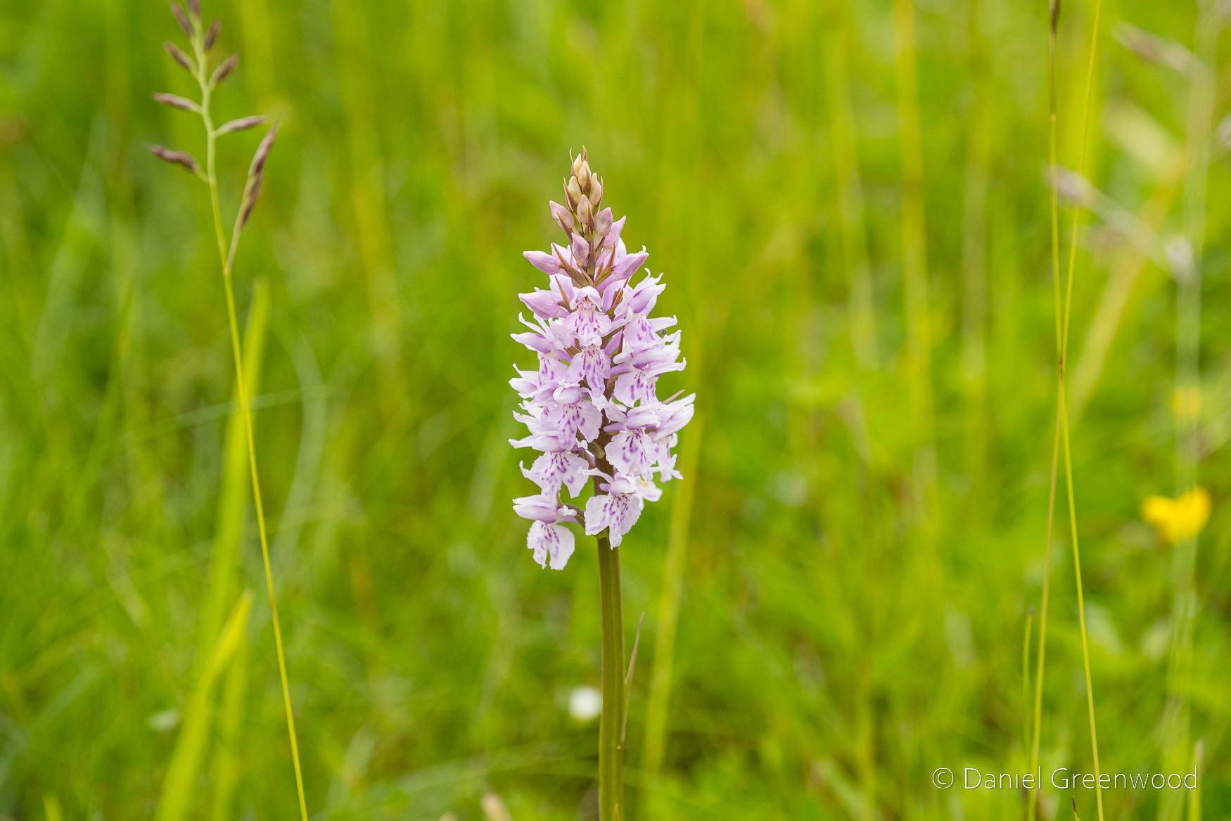
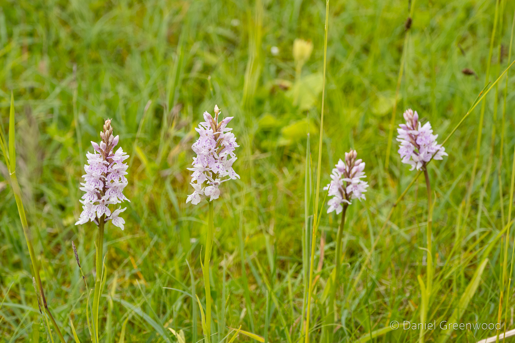
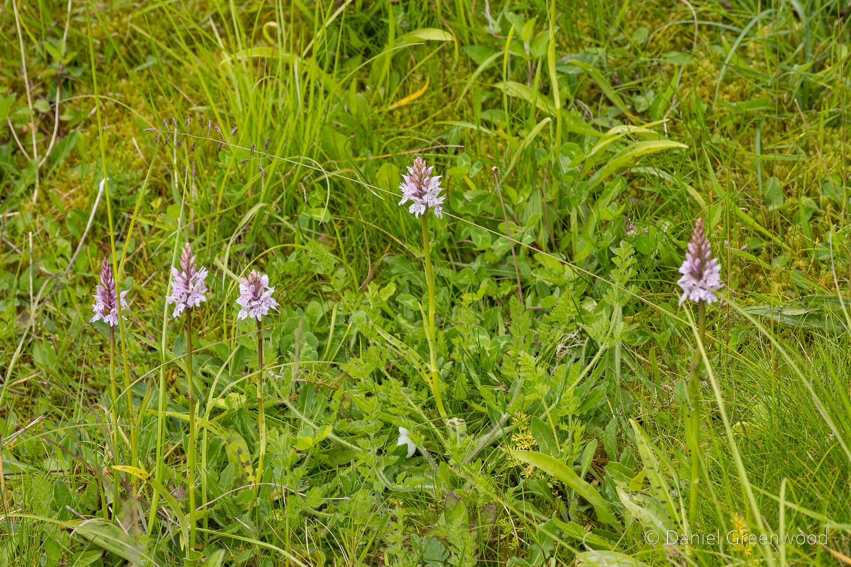
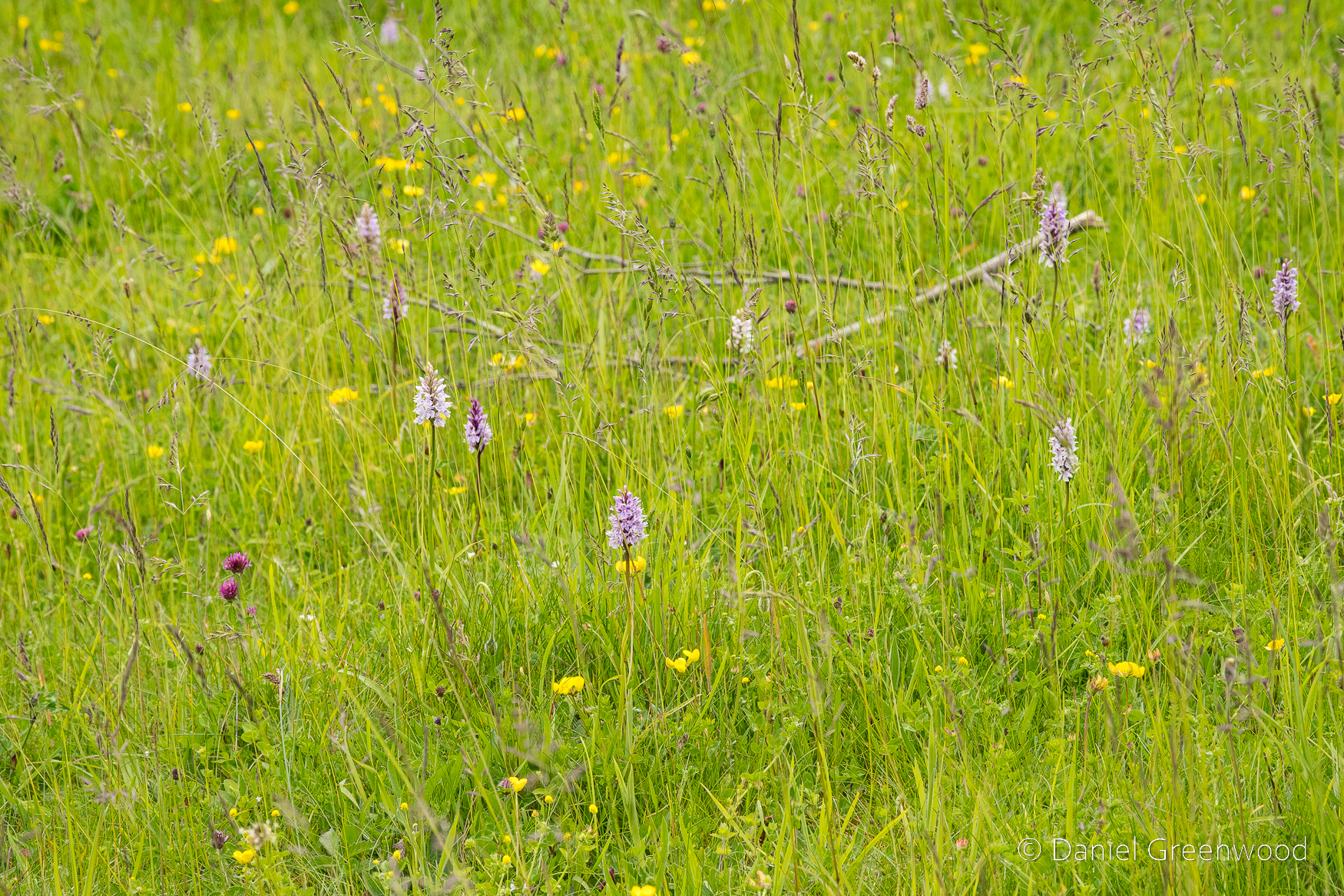
Common spotted orchids live up to their name on the Downs.
The meadows to the left are some of the richest on this walk, particularly at the top of the hill.
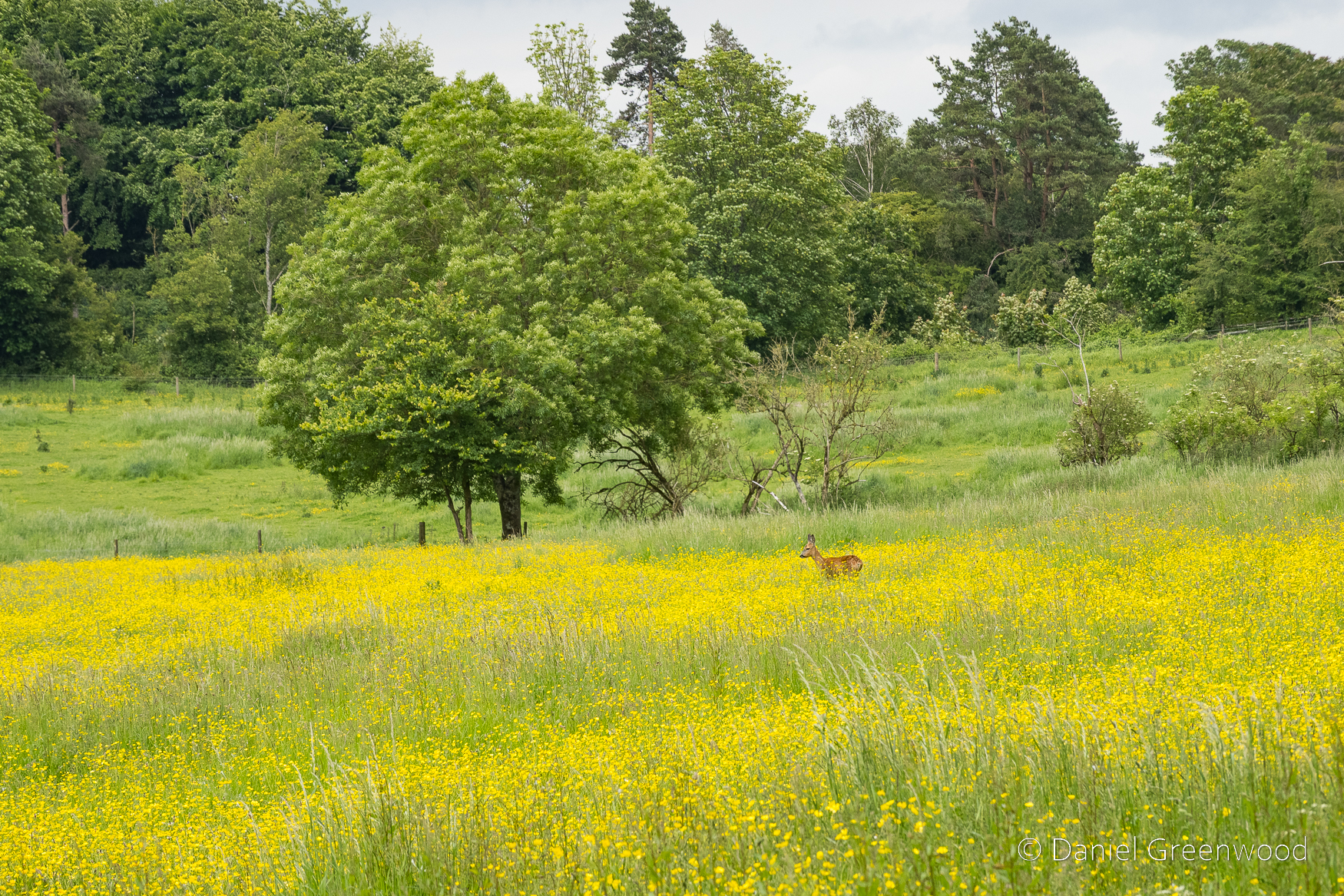
A roe deer grazing in a field of buttercups.
At this point it’s goodbye to the South Downs Way and hello to Washington.
Billingshurst and the Wey-and-Arun Canal, West Sussex, January 2024
Pre-ramble
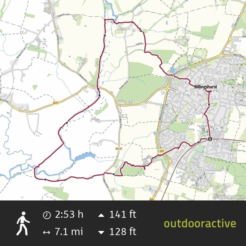
This long post (2500 words) is based on the Billingshurst walking route available in the Ordnance Survey guide to walks in West Sussex and the South Downs.
The difference in my route is that I went by train not by car. It’s always better by train if you can do that. I also took a longer route to the south via Parbrook.
Billingshurst is a growing ‘village’ on the from Victoria to Bognor Regis or Chichester.
The name Billingshurst means a wooded hill of the Billa’s people who were perhaps an extended family rather than a large tribe.
For this post I’ve relied on Geoffrey Lawes’ Billingshurst Heritage (2017) for historical references, which I borrowed from my local West Sussex library.
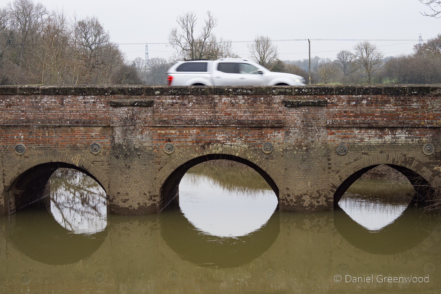
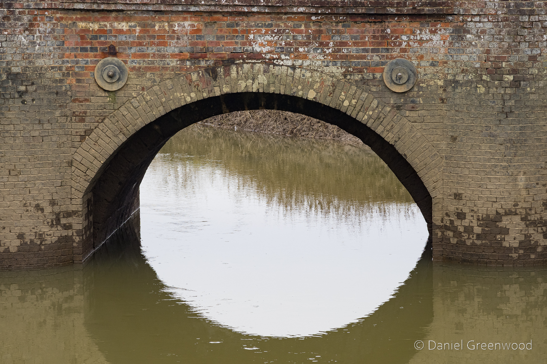
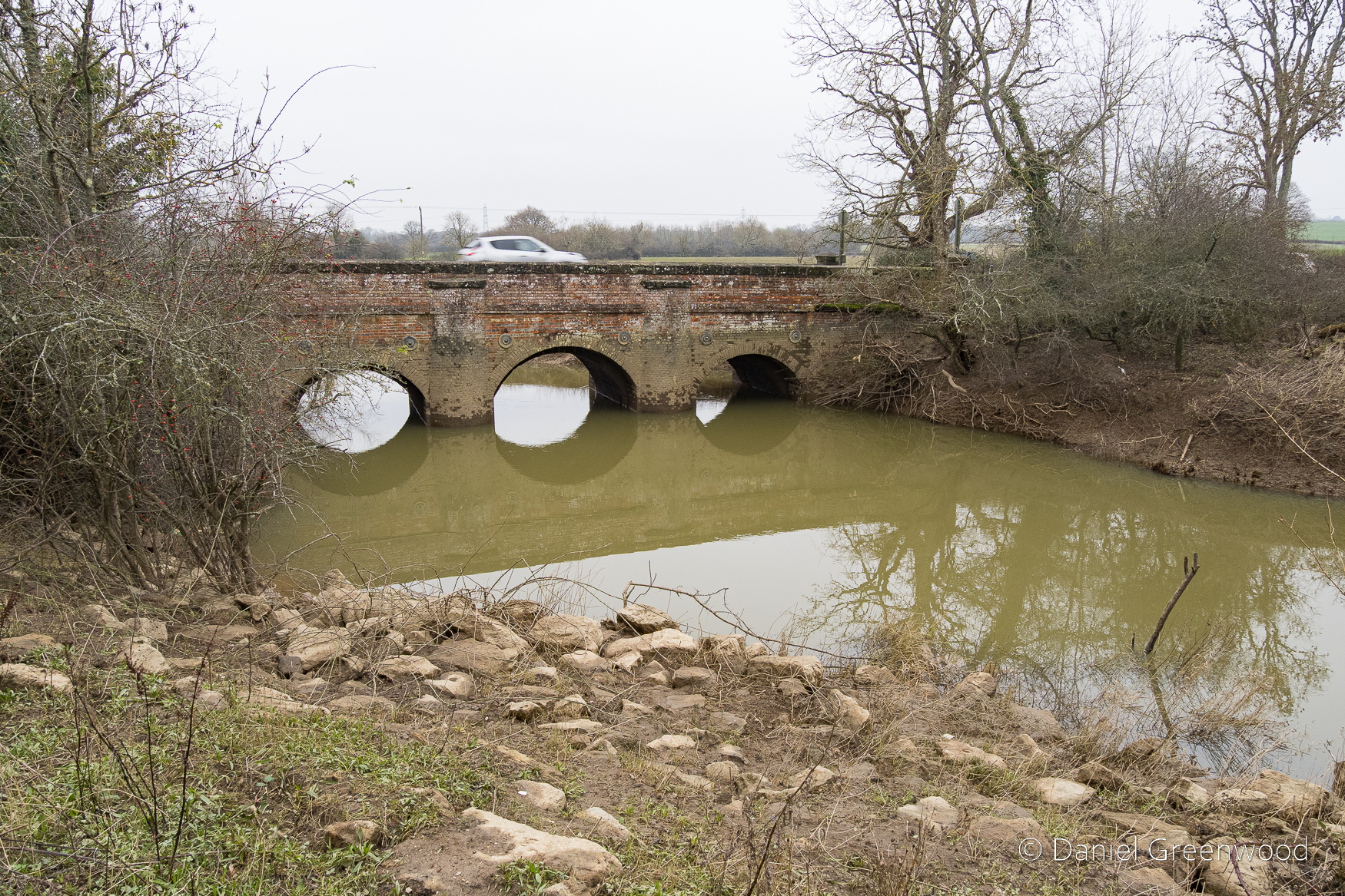
I wouldn’t do the walk after high levels of rain in winter because the Arun is prone to flooding in epic fashion and could make some of the walk impassable, particularly beyond the bridge.
This would be a good one to do in the spring when it’s a bit drier and the birds and woodland flowers are coming to life again.
There are some quite dangerous crossings here, so care needs to be taken when you meet the A29 twice, and another country lane that has poor visibility about a quarter of the way in.
Parbrook
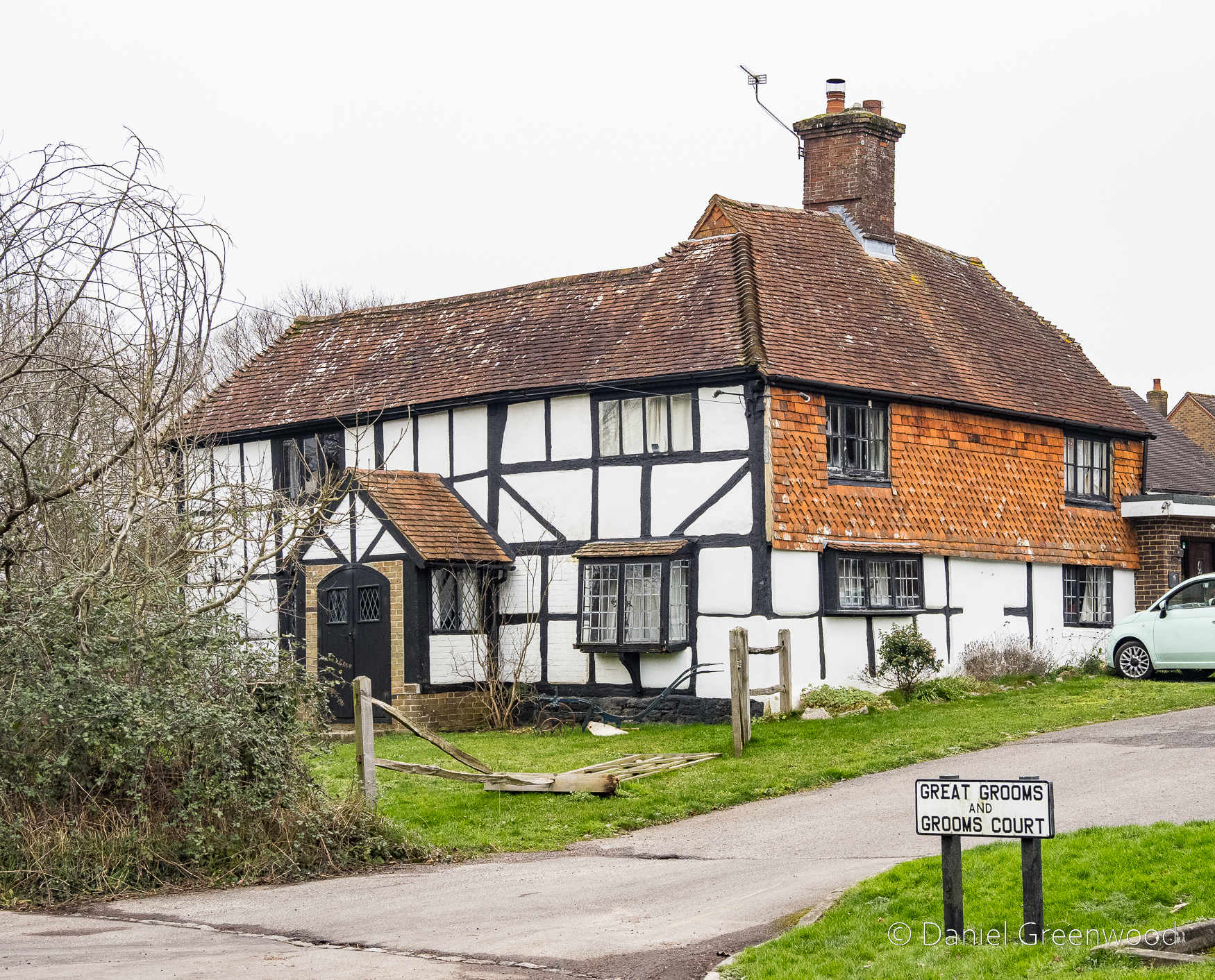
After leaving Billingshurst station you pass through a new housing development to the west of the village, and then the village of Parbrook, which was once separate. There’s an impressive timber-framed building here called Great Grooms, which dates to the 1500s. It’s on the Historic English register as the Jennie Wren Restaurant, as it was recently known.
In Billingshurst’s Heritage there’s an insight into the life of people here around the time of the First World War. Doris Garton describes her childhood in a ‘small, primitive cottage’ in Parbrook, and her father’s life after he returned from the war:
In the 1920s my father did contract to local farms at Parbrook. He would set off at 6:30am with his tools and hay knife strapped on his bicycle. According to the seasons he did hay cutting and tying, harvesting and threshing, thatching and land work, draining, ditching, ploughing with a horse, hedge-cutting and layering of hedges. He was also sometimes hired as a water diviner, using a hazel twig.
Billinghurst’s Heritage: Geoffrey Lawes, 2017: p. 255
The walk gets serious quite quickly as you cross the A29, which is a diversion from the straight line of Stane Street, a Roman Road that provided a route from London to Chichester. Crossing the A29 gives the immediate reward of this – the sort of place where Doris’s father would have plied his trades in the 1920s:
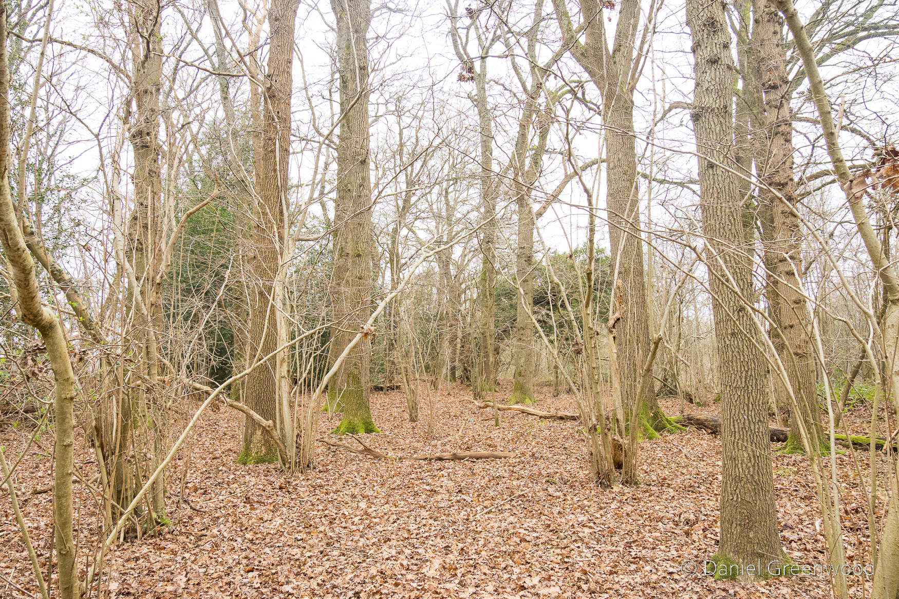
Ancient woodland
As you probably already know, ancient woodland is a sensitive habitat, so be careful not to trample wildflowers like bluebell and wood anemone in the spring (it’s hard!), and not to disturb ground-nesting birds (March-July). I noticed some bluebells were peeking from the leaf litter, which seems to be fairly normal for January in the last decade.
It was here that I spoke to a local woman about the walk I was doing and what the best route was. I’m always looking for tips.
The woods are surrounded by open farmland. The make-up here is typical managed ancient woodland of old – hazel understory with mature oak trees (otherwise known as ‘coppice with standards’). Mr. Garton’s bread and butter.
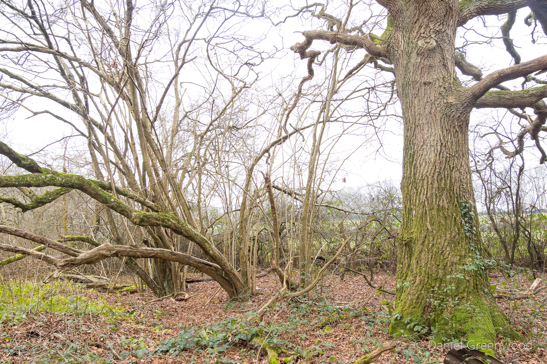
Holly is another element of this prehistoric mix. This isn’t meant to sound patronising but I think that sometimes too much holly can be removed from woodlands by well-meaning people who want to reduce shade for flowers to thrive. I understanding the motivation, but holly’s powers are subtle.
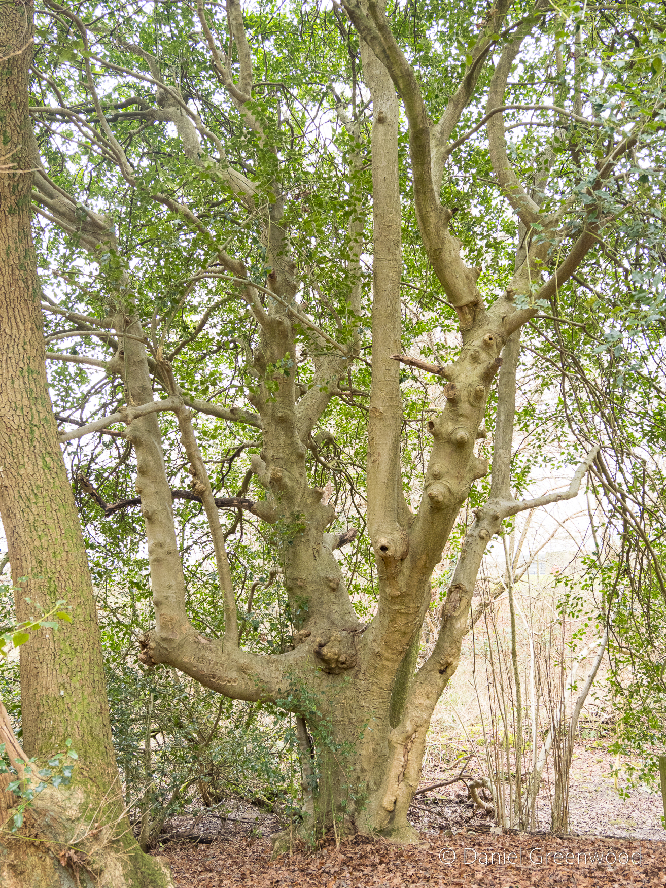
Speaking of which, this magnificent holly was growing on one of the wood banks. I think it’s one of the largest I’ve ever encountered, probably around 200-300 years old, but I’m not sure.
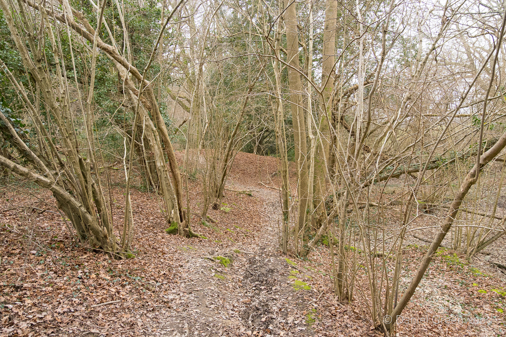
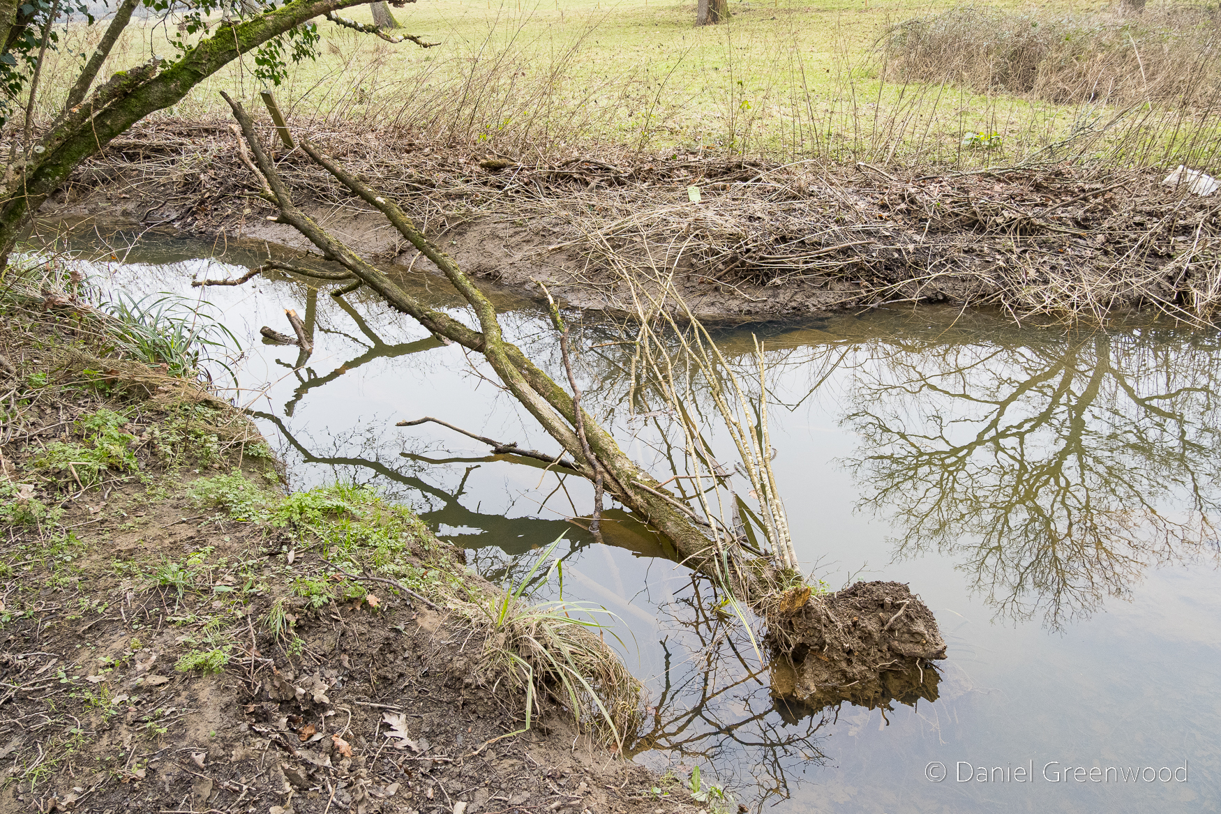
I got a bit lost here and ended up following a desire-line (an informal path) along the edge of this stream, as you can see on the map above. The erosion of the bank (possibly by people and pets entering it) may have contributed to this hazel losing its footing and falling in. It does look quite dead.
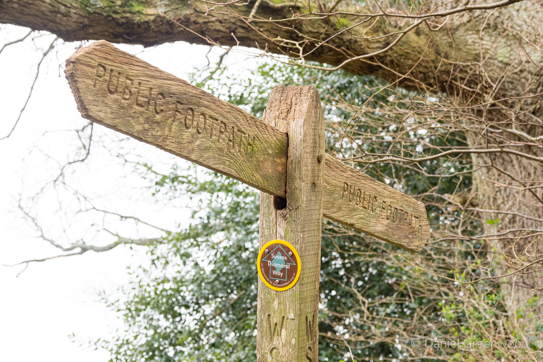
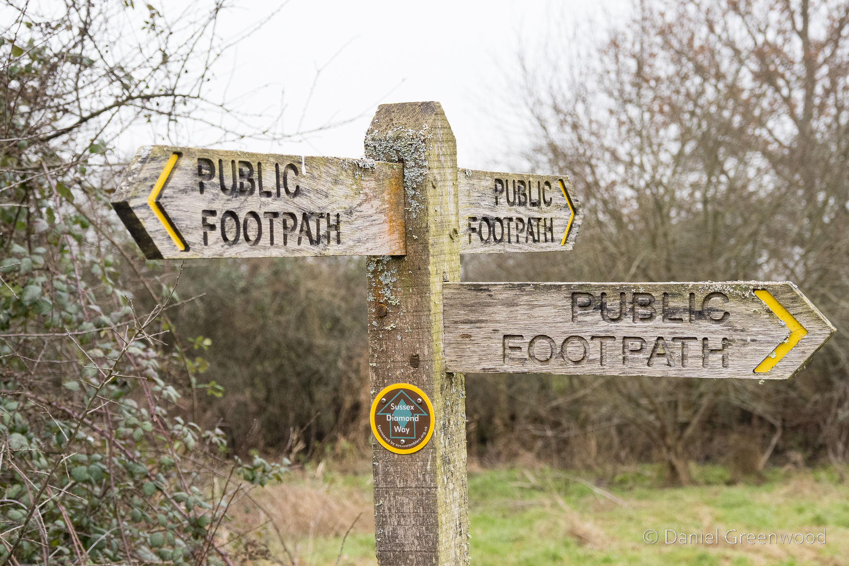
This was my first time on the Sussex Diamond Way!
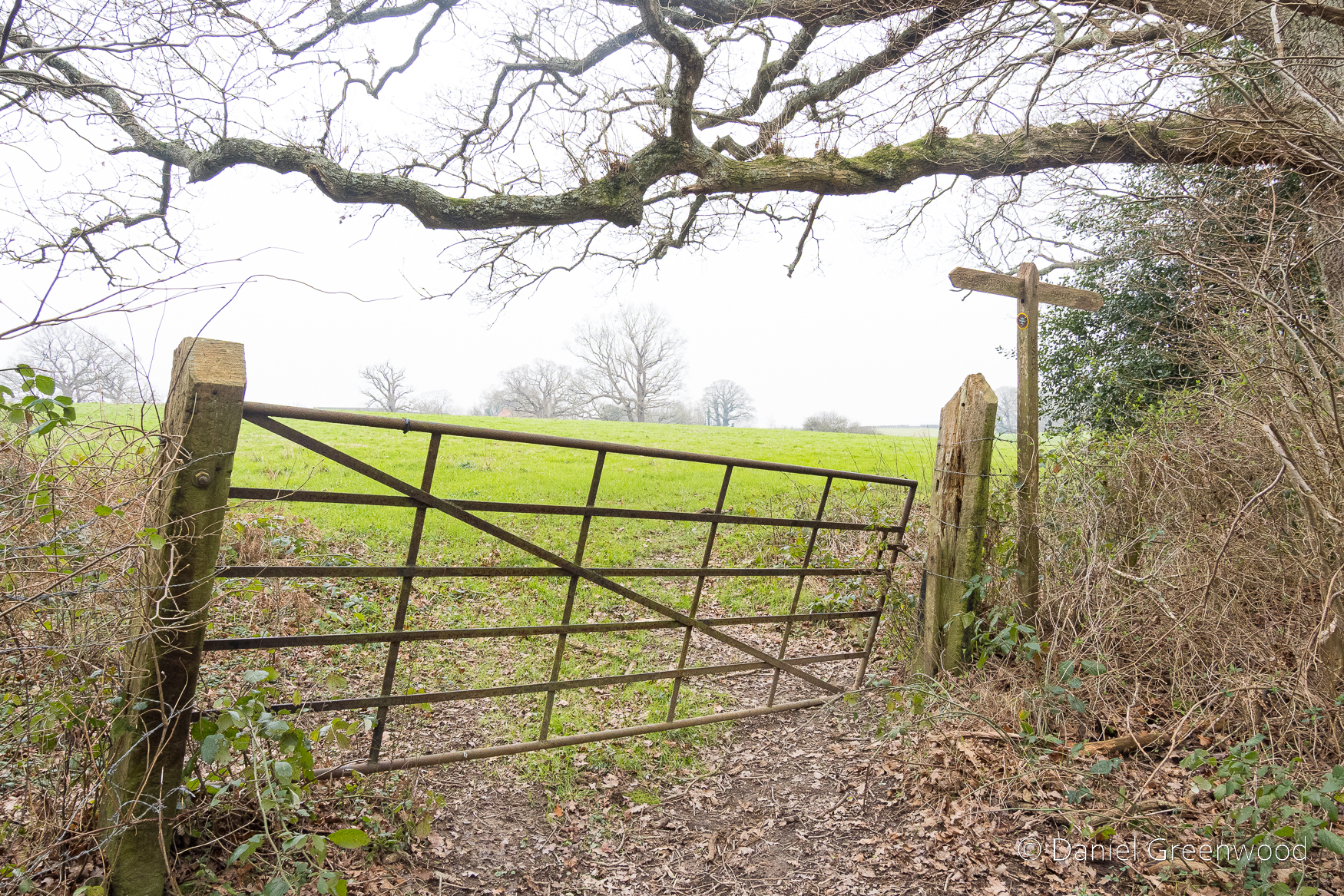
Having found the path again, I passed through this lopsided gate into the field.
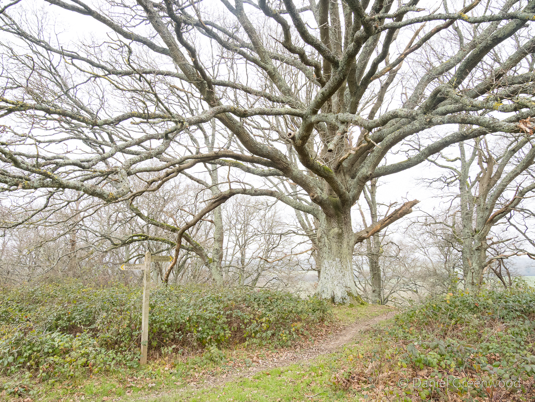
There were some lovely large oaks along the boundary of field and woodland.
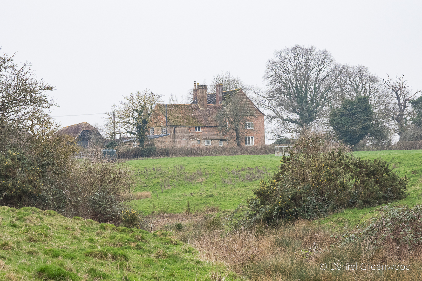
This is The Lordings, a Grade II-listed farmhouse dating to the 1600s (Historic England listing). With its uneven development and attached Sussex barn on the left-hand side, I had wondered how old it was. The windows of the house are in different places and rather small, which did suggest old age. The ditch in the image is part of a stream and pond. The landscape was lovely here, formed by the movement of water over time, which makes me think that’s a natural spring-fed watercourse. Little Lordings Wood sits nearby, and once upon a time woodland will have covered this entire area. ‘Lordings’ appears throughout this walk but I can’t find any more information about the significance of the name.
Now came one of the most dangerous crossings I’ve encountered during my 15 years of rambling (with my legs). The gate opens right out onto a road where the speed limit is 60mph, and you have no way of seeing what’s coming round the corner, or it seeing you. Having a hi-vis is useful in this kind of situation. Reader, I made it.
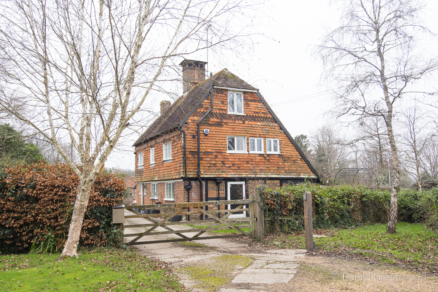
There are a number of old farm houses dotted around this walk. This is Tanners Farm, which ties in nicely with the oaks. Tanning is the job of removing moisture from animal hides in the process of producing leather. Soaking the hides in with oak bark releases the tannins from the bark and helps to waterproof the resulting leather.
It had the feel of an ancient agricultural landscape, with oak a core part of its progress over time.
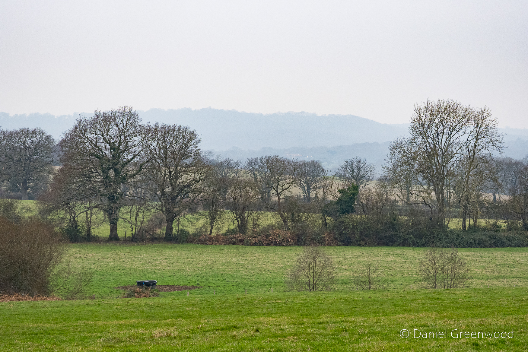
The Tanners Farm section, passing beyond two large oaks, provides the best views of the entire walk. It was misty when I was there, so the views of the Downs weren’t complete. The drama is still felt, and is a reminder that one of the nicest things about walking in the Low Weald are the views of that majestic chalk whaleback.
This enticing path into oak woodland was not to be taken on this occasion.
The misty view south, with the Downs not quite making it into the scene. Another one for a spring or summer day.
So much choice. It was time to leave the Sussex Diamond Way and join the Wey-South Path.
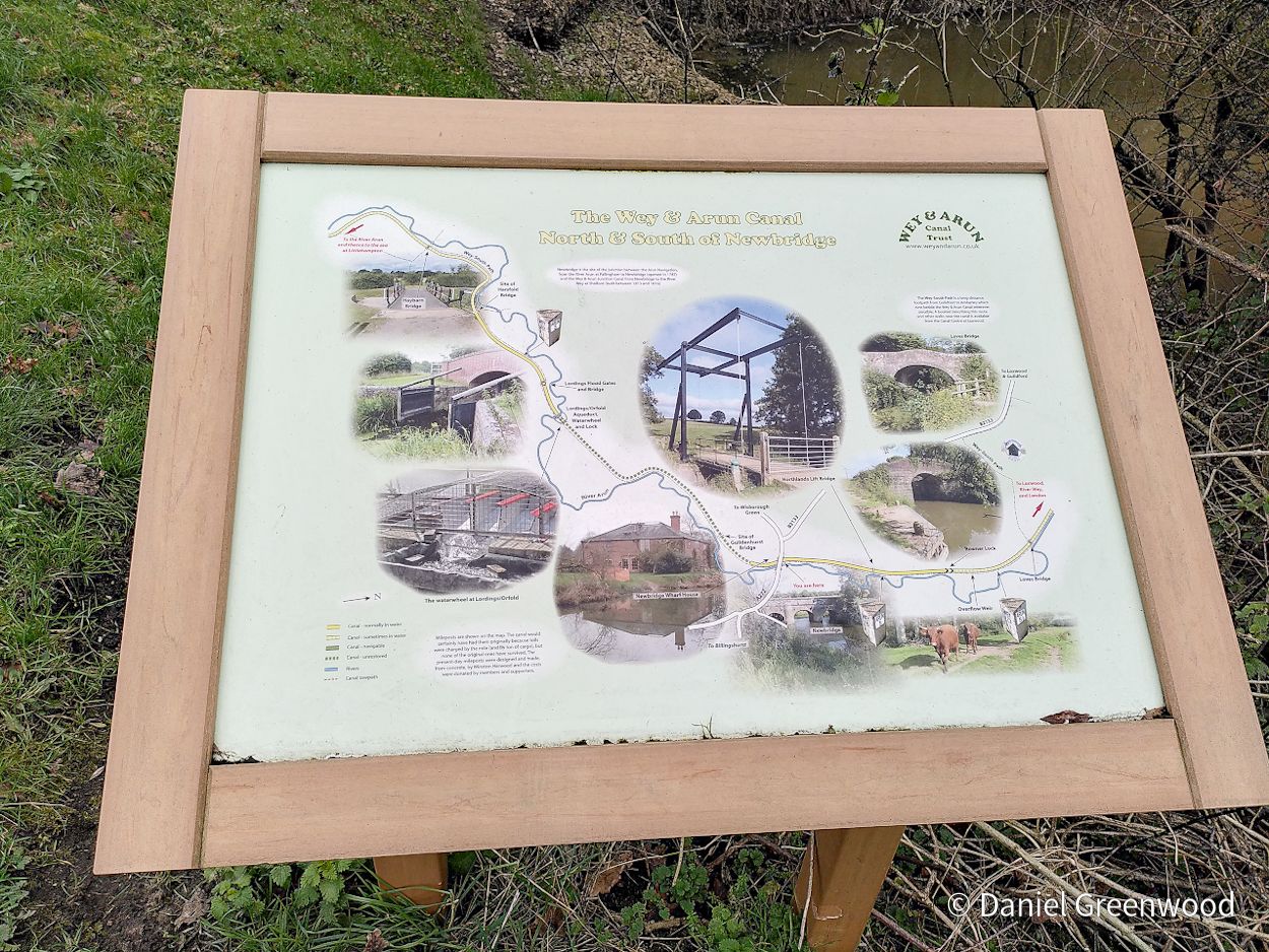
The Wey & Arun Canal
January is too early for blackthorn, though that is changing with the march of climate change. This froth of white is actually lichen hanging over the Wey & Arun Canal.
The canal was constructed after plans were brought to Parliament all the way back in 1641 to ‘link the upper reaches of the River Wey to those of the Arun by a canal between Cranleigh and Dunsfold’:
[I]n 1785 The Arun Navigation Act was passed and the section between Pallingham and Newbridge opened two years later.
The canal began to transfer goods in 1816 when the Wey & Arun Junction Canal opened. So it took the best part of 200 years for the canal to be built (sounds like HS2). The Industrial Revolution of the 1790s changed the world in that time, but the impacts only really began to be felt a couple of decades after the 1820s when the canal was in full operation. It closed in 1888 – two centuries of planning, sixty years of action.
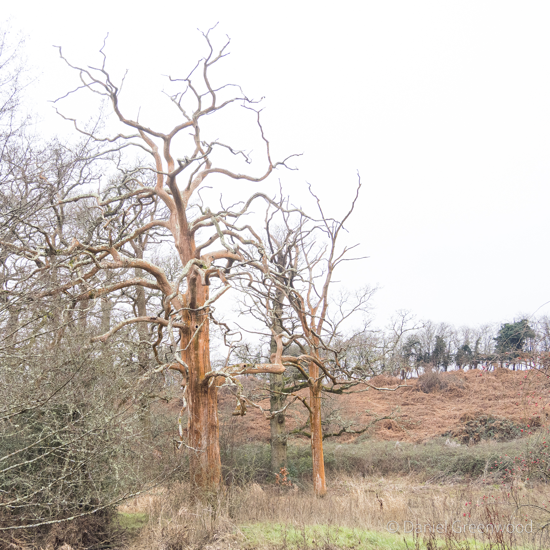
I passed these dead oak trees covered in an orange algae (I presume). I expect oak would have been one of the resources transported up and down the canal. The oak woodlands around Billingshurst, which covered a far greater area then, would have been felled, debarked and planked, their produce taken upstream to the Thames’ shipyards, or south to the Solent in Hampshire where international trade could have taken place. My understanding of the specifics is limited, so I’m generalising a bit, but Lawes States that most trade ‘was from London, mainly coal and groceries, porter beer and pottery’ (Lawes, p. 176). Lawes also confirms that the canal gave access to Littlehampton, Portsmouth, Chichester and Arundel via other water-links that could connect with the Wey & Arun Canal.
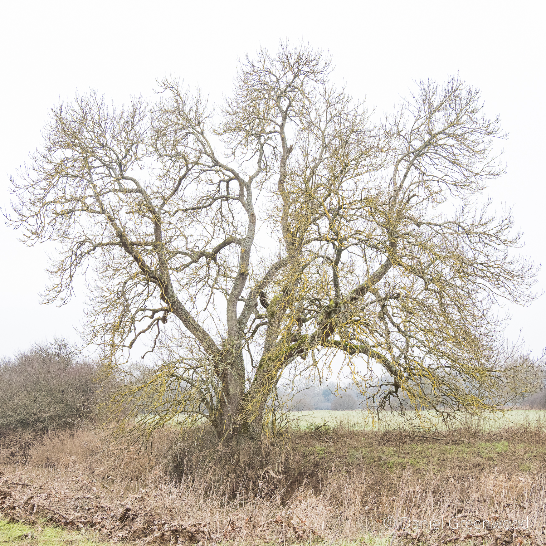
Ash trees would have been useful also, particularly for tool handles. One way to identify a distant ash tree in wet winter weather is the yellow glow on the outermost branches. These are xanthoria or sunburst lichens which of course thrive in wet weather. I would say this was a significant ash tree, and possibly had been pollarded, due to the branching taking place so low down on the trunk.
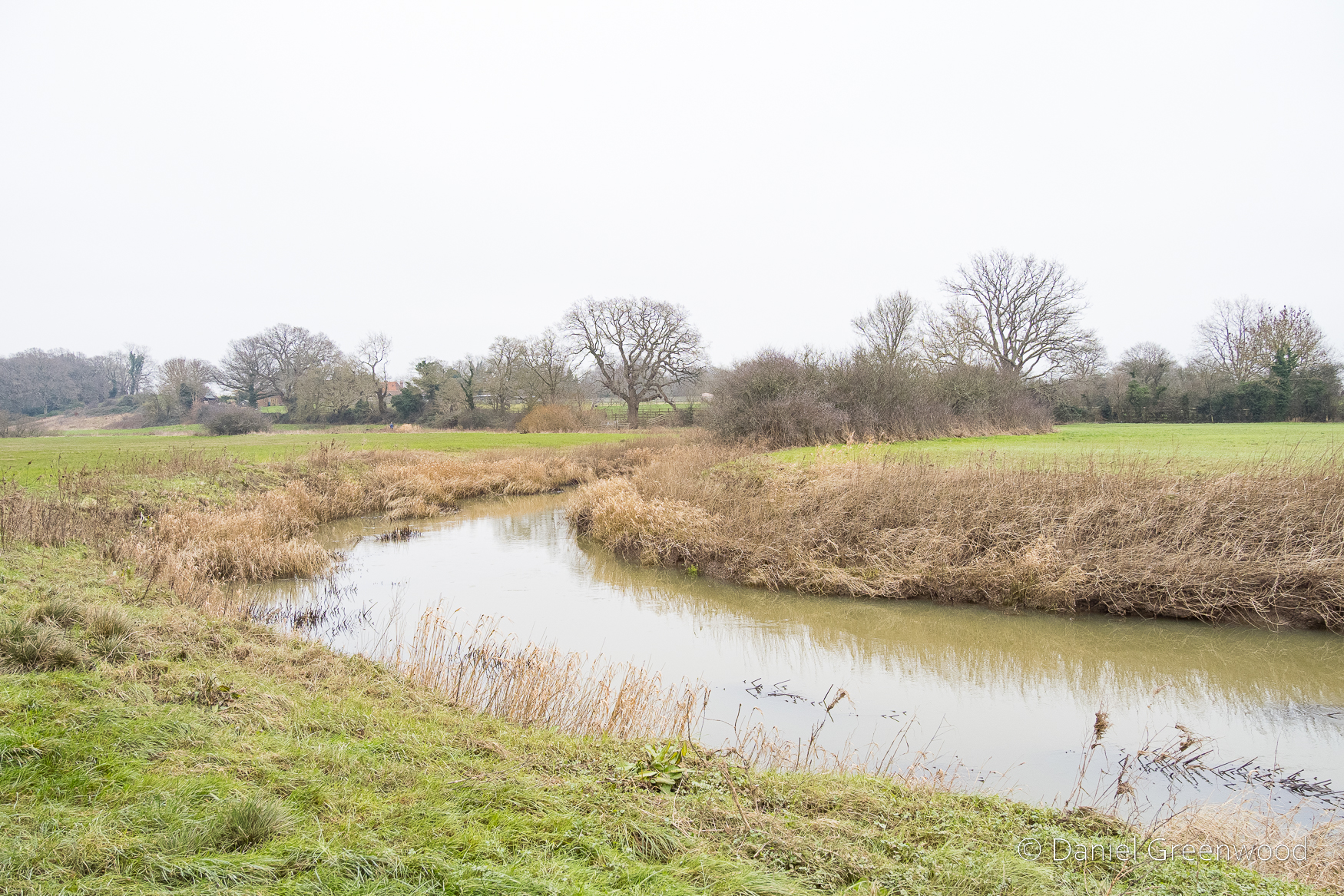
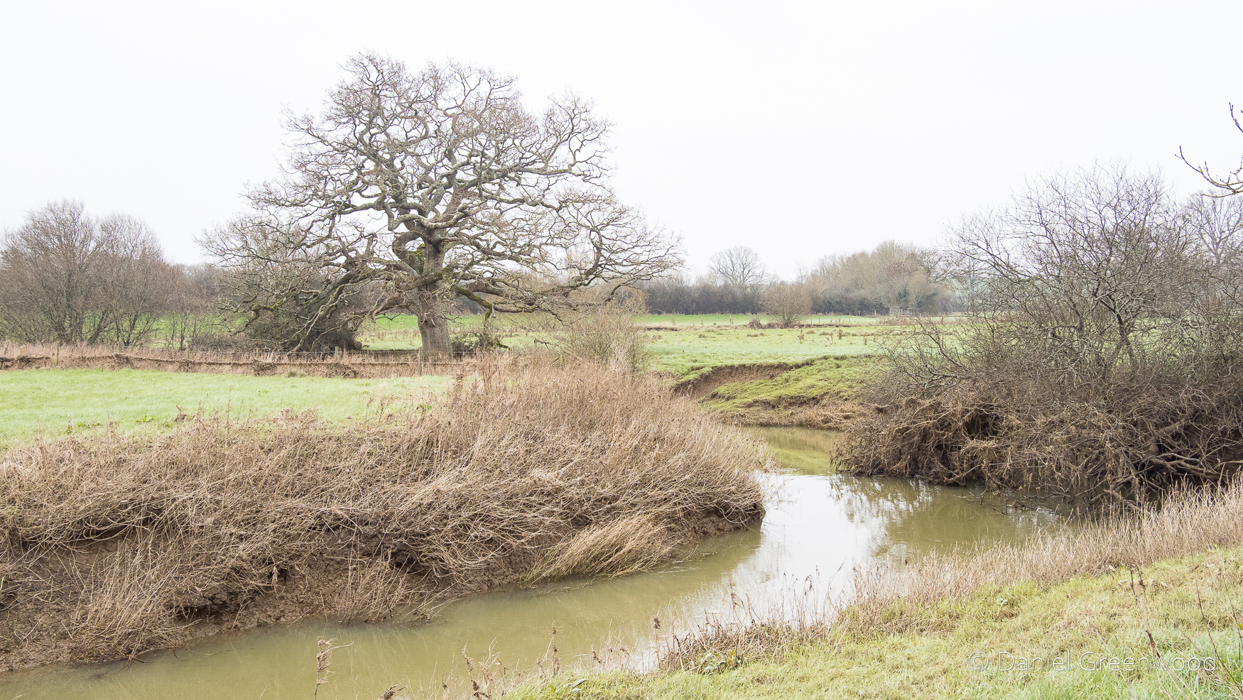
The Arun mocks the canal with its swooping bends as it takes its wild course through the outskirts of Billingshurst. The walk along this stretch was a sloshy trudge for a good while (wellies are advisable). It would be nicer in spring or summer, as all good walking guides will tell you.
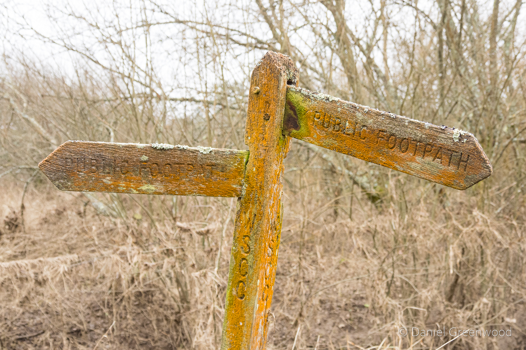
The damp atmosphere around the river and canal meant the fingerposts have become home to algae, moss and lichen.
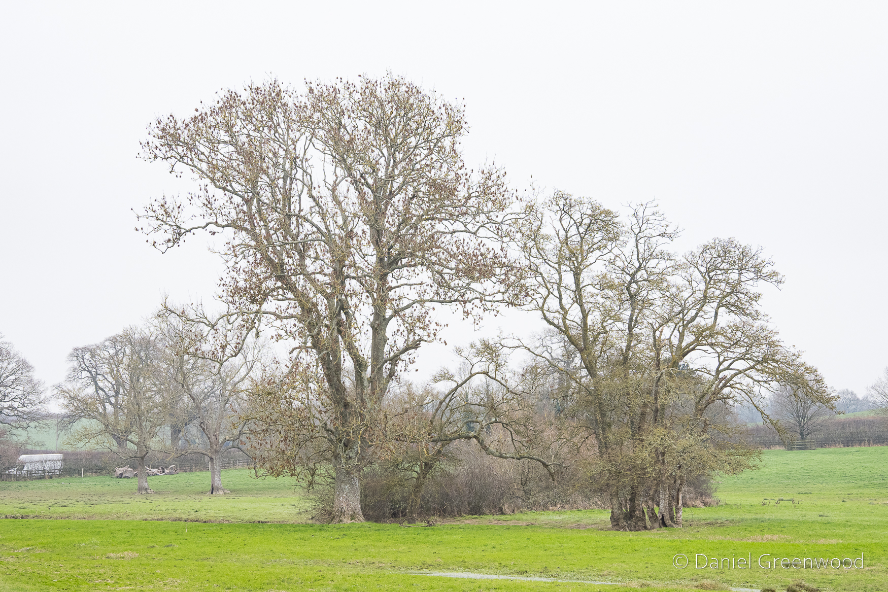
This is a large ash tree with what looks like an old hedgeline queueing behind it. To the right-hand side is what seems to be an alder, a tree that thrives in wet conditions. You can see a vehicle passing on the far left-hand side of the screen. The view of this field completely underwater during twilight is one of the more memorable scenes I can recall from travelling to Midhurst on the A272 over the years.
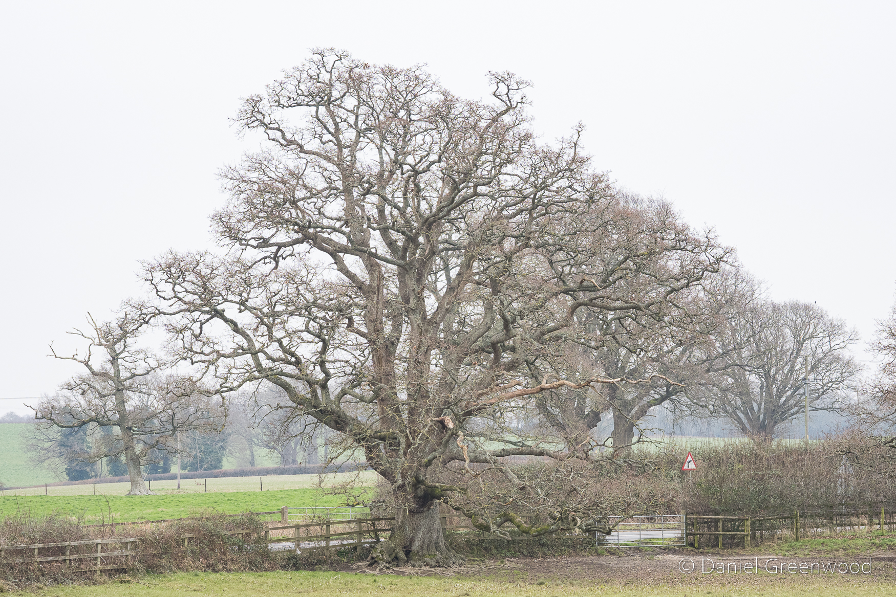
I passed this massive oak (it looks smaller in this image than it is in real life) several days a week between 2018 and 2022. The mud underneath is from the cattle standing there to shelter from the rain. The oak is probably around 400 years old, making this stretch of the Wey-South Path around Billingshurst a land of giants.
New Bridge only allows one car at a time, but I’d never seen the three frogs under the bridge until I did this walk.
This frog looked particularly surprised to see me.
In Billinghurst’s Heritage there’s a passage from a canal tourist in 1869 – J. B. Dashwood. He travelled along the Wey & Arun Canal one spring or summer from the Thames to the Solent. There’s a description of what our man J. B. saw with his travelling partner somewhere along this stretch. Quoted below.
At a little before 7 o’clock we reached Newbridge where our boat lay quietly at her moorings, wet with the morning bath of dew…[at the first lock] we watched the lock-keeper’s wife and two pretty daughters making butter in the early morning. Though flat the meadows on either side presented such a lovely English picture with cattle dotted about, …the larks sang aloft sending forth their melodious morning song and the banks of the Canal clothed with wild flowers of every hue and colour that we enjoyed this part of our journey almost as much as any.
Lawes, 2017, p.175
I wonder if these are the water meadows being described. While searching online for more information about New Bridge I discovered plans for housing affecting the area you can see in this image on the left-hand side (northern side) of the road. There’s a beautiful timber-framed house and barn called Hole Cottage (Historic England listing), dating to the 1500s. It wouldn’t be affected directly by the housing, the arable fields out of view towards the ‘village’ would be.
The proposal is called Newbridge Park (there’s a consultation online which closed in January). This area would become a country park, which is wise. Driving along the A272, the sight of the Arun flooding these meadows is a sight to behold. No one would seriously suggest building along this floodplain (would they?), particularly with the sort of winter deluges we’re getting now in this part of England. This is a rather old oak, perhaps 200 years, sitting at one of the bends in the Arun, which is just below the ground level.
This is that sumptuous bend in the Arun, a river which I have now learned was previously known as Tarrente or Trisanton which means ‘trespasser’ (Lawes, p.174). The river does trespass widely here, or is it the other way around? We have trespassed far into the floodplain of this great river. This is another view into the area which the developers propose would become a country park. But how long would that hold for, and who would fund the management of a park here?
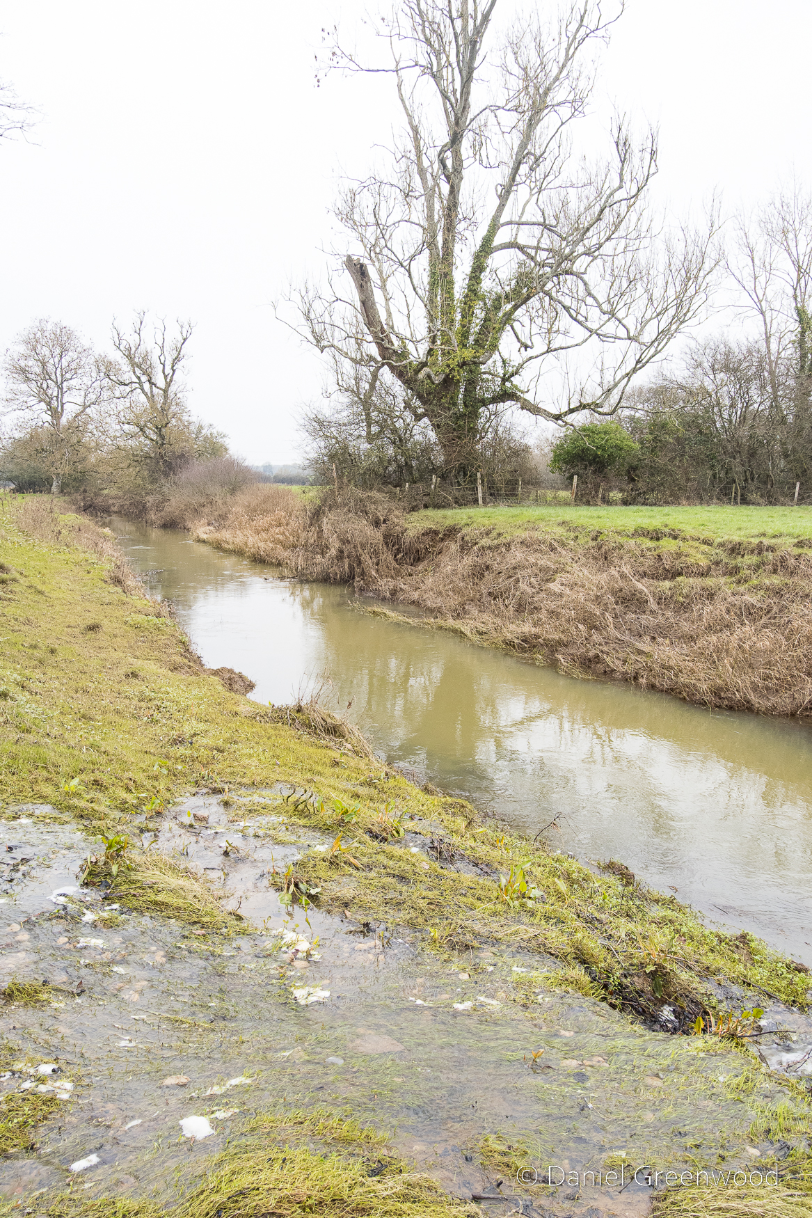
There was a winterbourne (I am guessing) flowing over the banks and into the canal. Growing up in Lewisham in south London, it’s so nice to see water moving of its own accord in the landscape (with respect to the work to restore the rivers in that particular borough.)
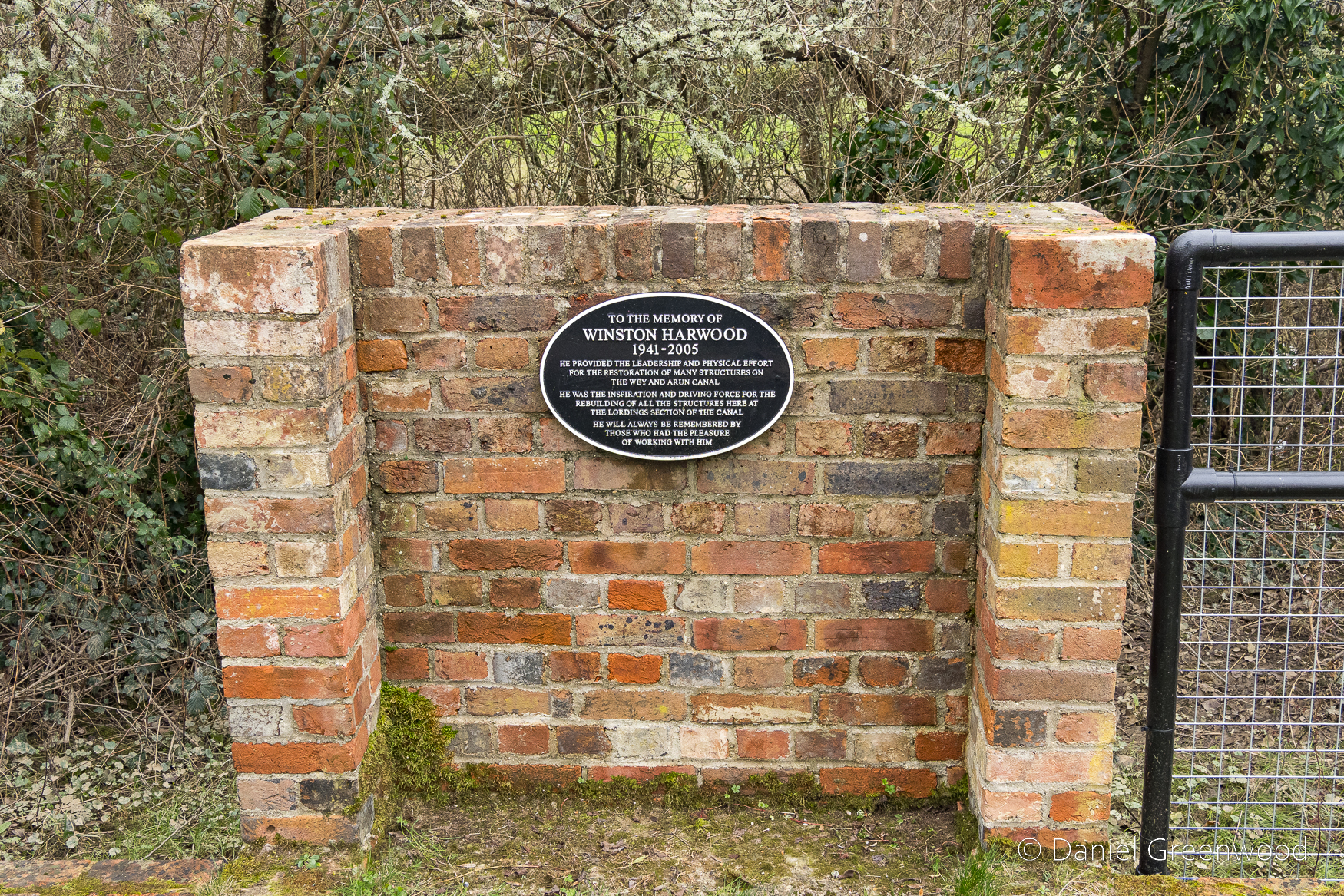
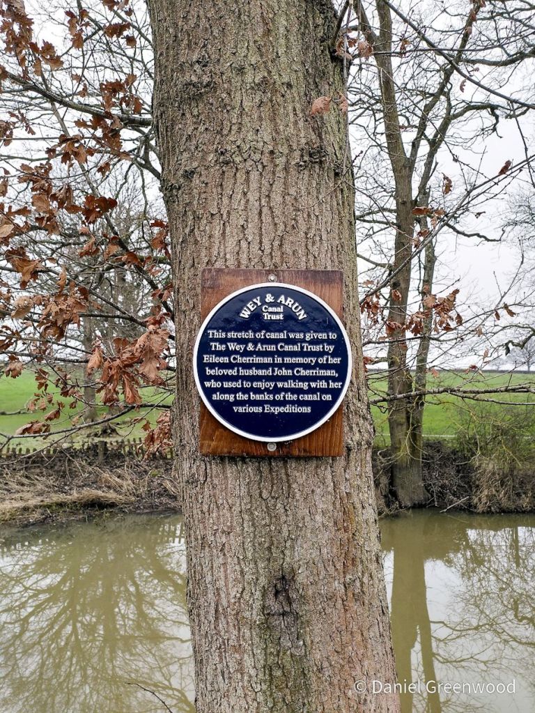
Let’s appreciate the generosity of Eileen Cherriman here, who donated a stretch of the canal in memory of her husband John.
I do enjoy bringing interpretation boards to a wider audience.
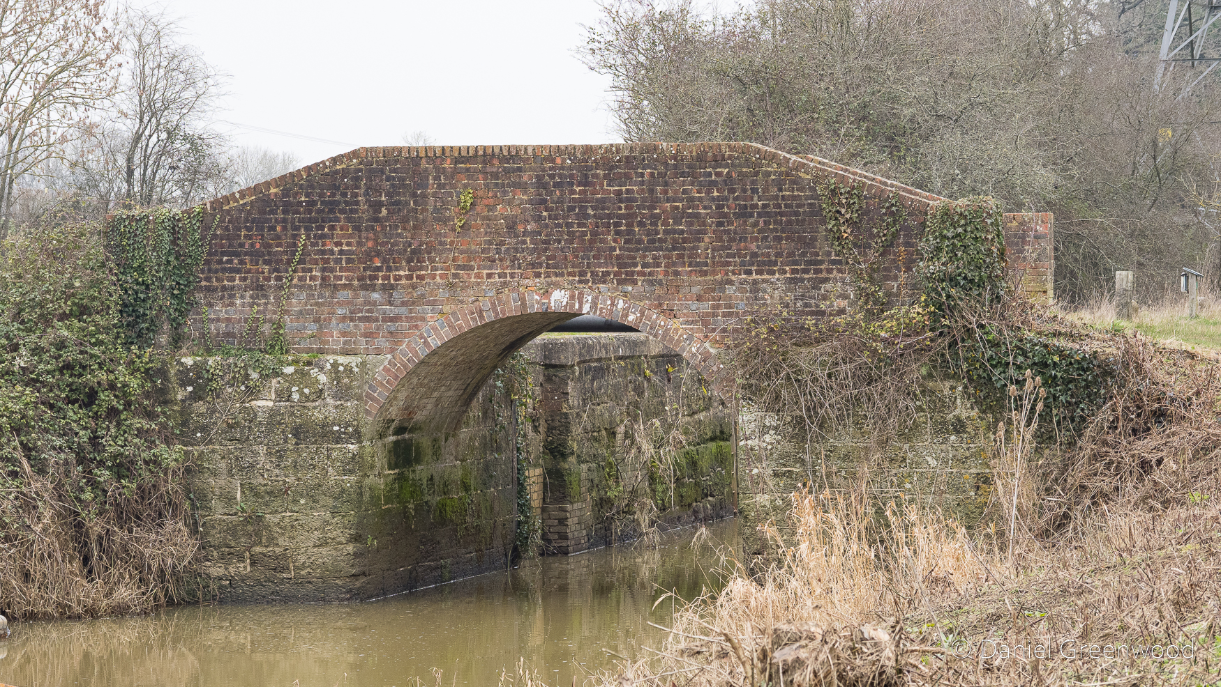
Further down the canal is another bridge at Rowner Lock.
This was restored by the Wey & Arun Canal Trust.
Returning to Billingshurst
It was time to turn away from the watercourses and back towards civilisation.
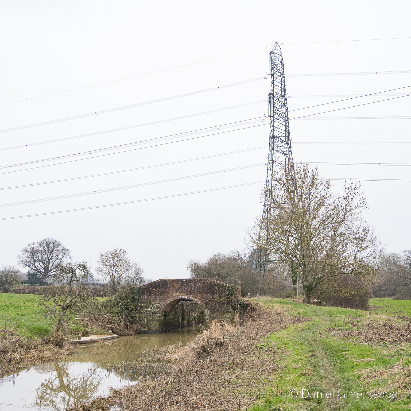
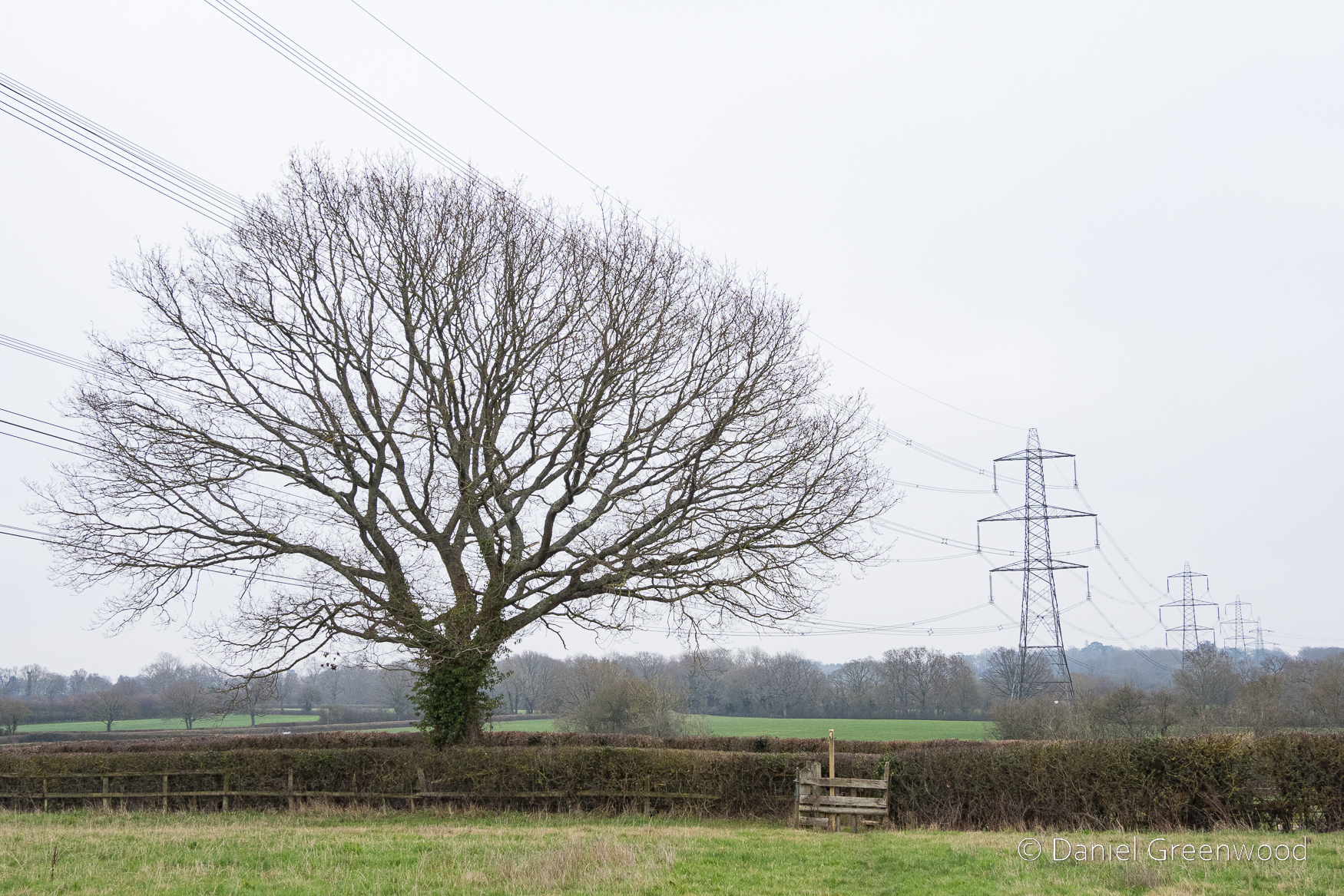
The walk turns east as it returns towards Billingshurst through farmland walked by electricity pylons.
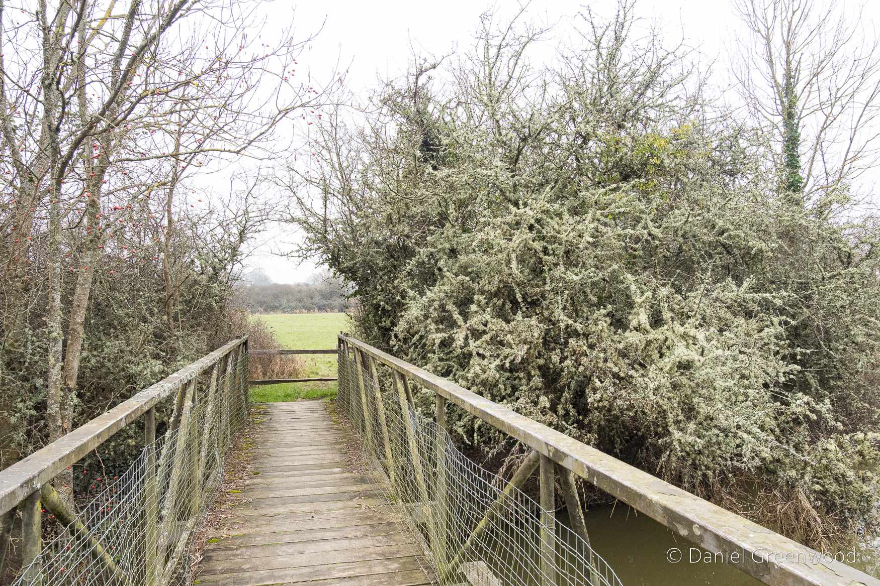
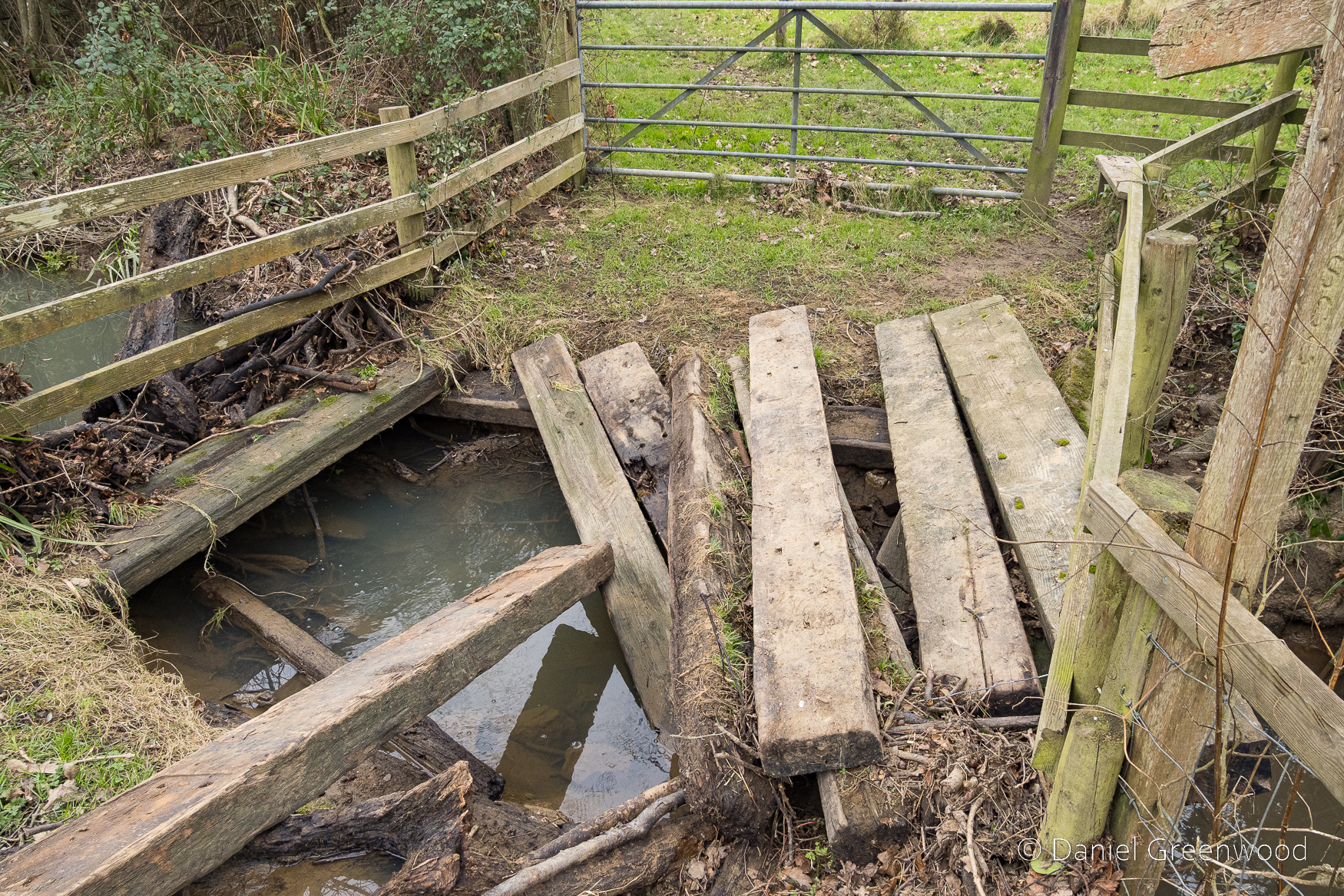
One of the footbridges on the way back was in a state of devastation, probably due to the impact of flooding. I presume this wasn’t vandalism, but from my experience you just can’t be sure sometimes.
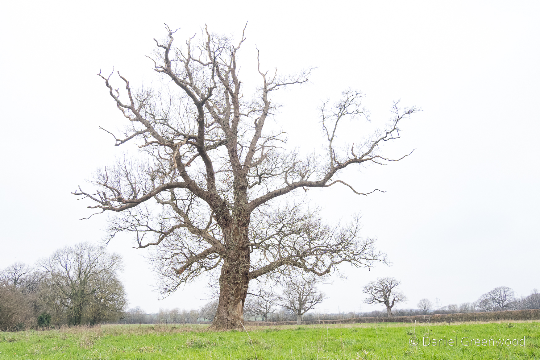
A rather sickly oak in a process of retrenchment as the upper branches die away. You can see more oaks dotted around beyond the hedgerow.
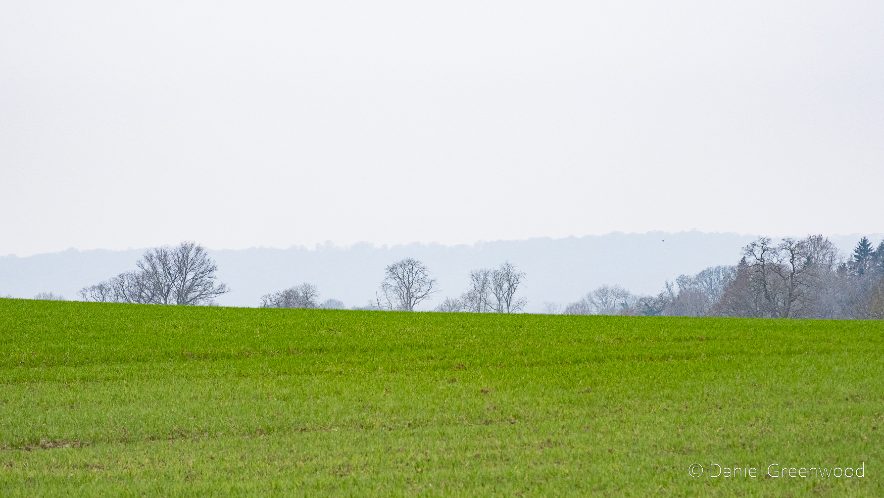
Looking north-east into the Weald, with the mist spoiling most of the fun.
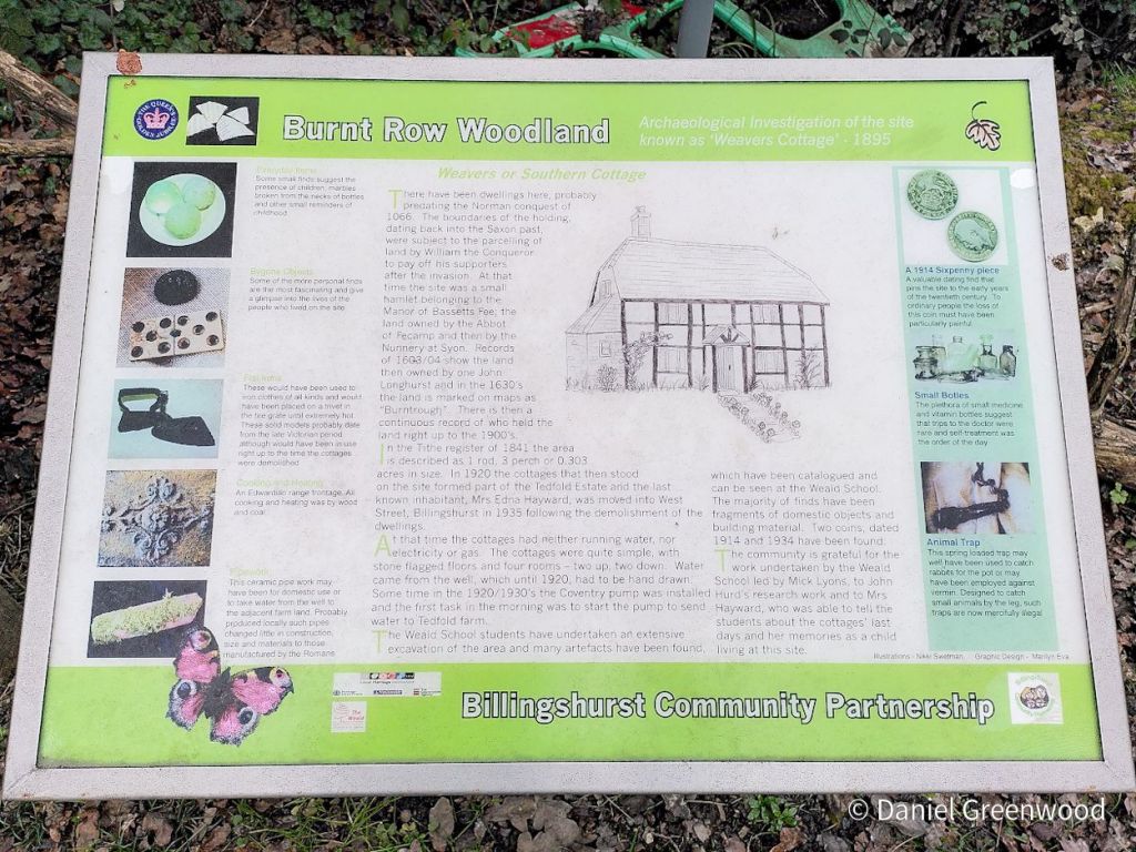
There are some interesting boards near the A29 crossing as you enter back into Billingshurst. I’m sorry that this timber-framer didn’t make it. This settlement seems to be very old, possibly prior to the Norman Conquest of 1066. Local school children have found lots of treasure at Burnt Row in their research into the site.
Entering back into Billingshurst I enjoyed the sight of this interesting timber-framer. A couple of local lads were causing a bit of bother here and couldn’t understand what I was doing.
I haven’t featured the church in this post though it is important and has a prominent position in the village. The Causeway is a row of houses, many of them old and timber-framed, with one potential dating back to the 1200s (Historic England listing). If you needed any evidence that Billingshurst and its surrounding countryside is an oaken land, this should be it.
Here’s the best image I captured while waiting for the sun to disappear over the Downs recently. To the right hand side of the image (north) you can see the Arun flooding the area known as Amberley Wildbrooks. It was surprisingly mild up there but as the sun slid away the cool air arrived with the moon. Red kites floated overhead and trains echoed through the valley on their way to Arundel. A beautiful evening in a special place.
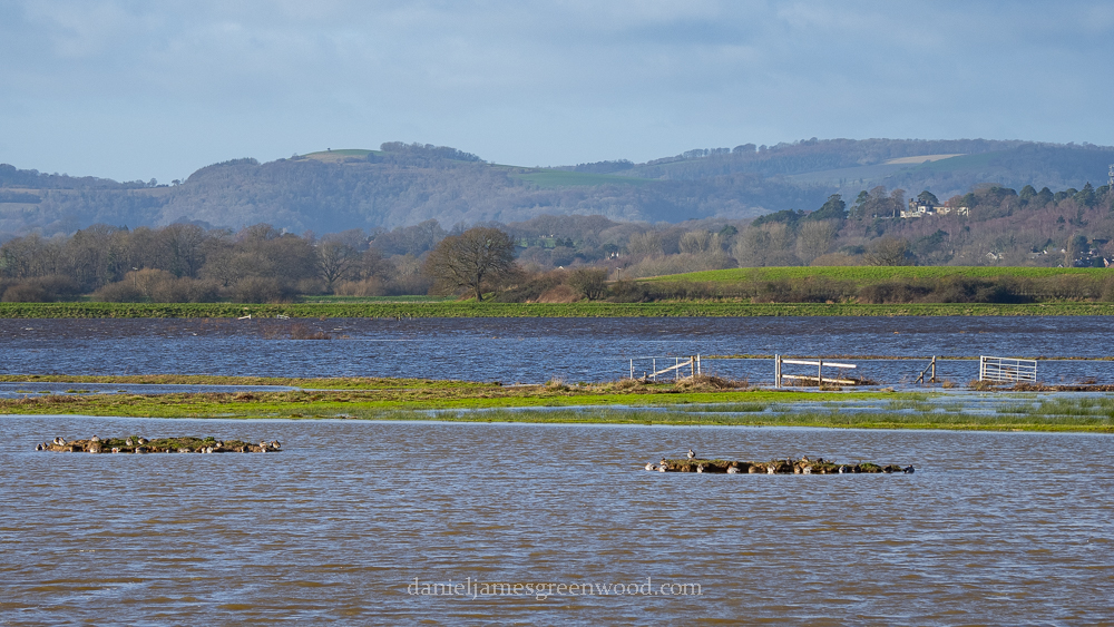
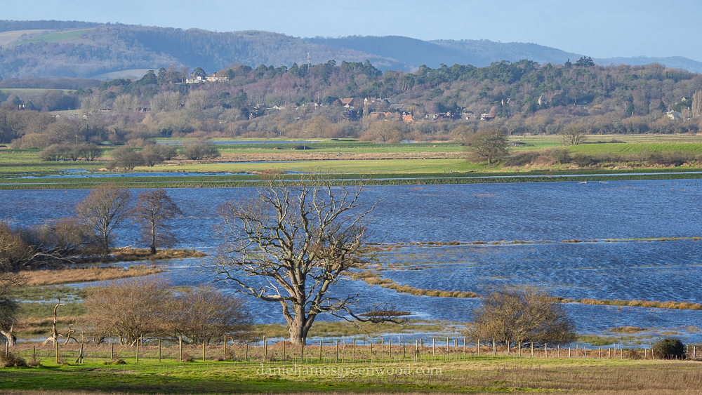
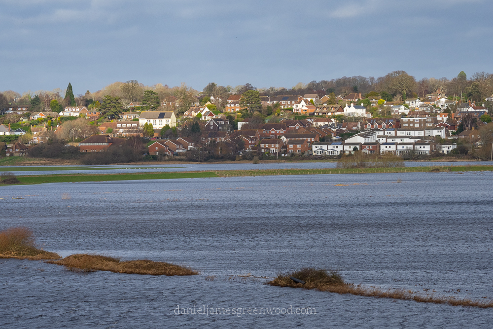
A lot of rain has fallen in Britain in January. One way I like to gauge just how much, is to visit the wetlands around Pulborough and Amberley in West Sussex.
In the winter months, roads are routinely closed as the Arun breaks its banks, doing what it used to without much issue. On the morning of Friday 13th January, the green fields of the Arun valley were a deep, oceanic blue.
It’s rare in England that you get to see nature’s raw, awesome power. When you do, it’s not always a good thing. Seeing water flooding the landscape as it should, where it won’t destroy homes, is easier to enjoy.
Towards Pulborough, the flooded fields were speckled with hundreds of ducks: mallard, shoveler, widgeon. The buildings of Pulborough town looked ready to slip down into the deep blue sea.
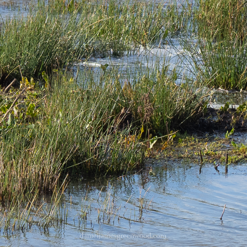
On the human-made islands lapwings contended with ducks for a spot on the bank. Elsewhere I overheard a man point out a snipe tucked away between rushes – ‘you can see it with the naked eye,’ he said.
Sure enough, there it was but 25ft away inside the fenced wetland. I wonder what it must have made of its small, safe spot, out there among the winter floodwaters.
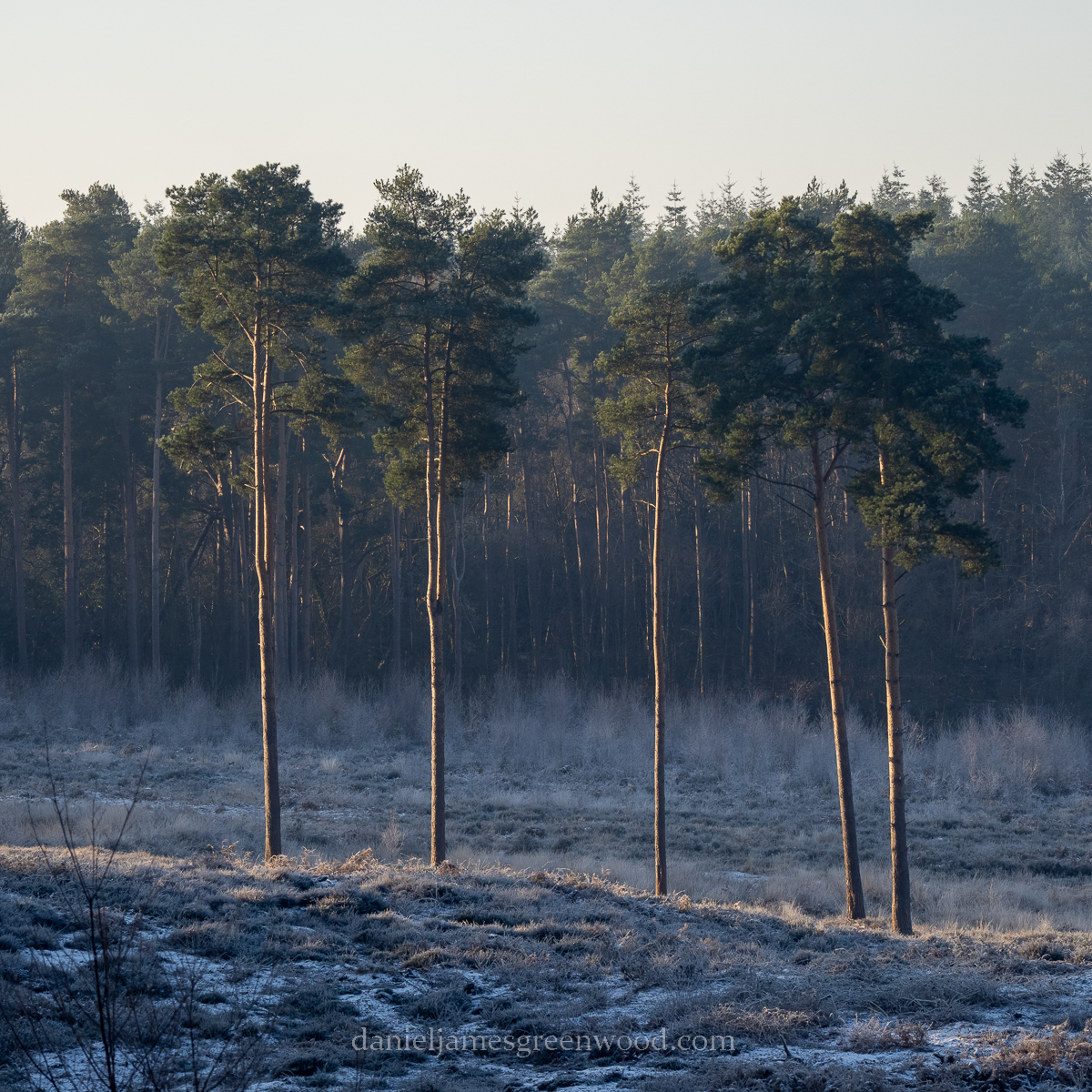
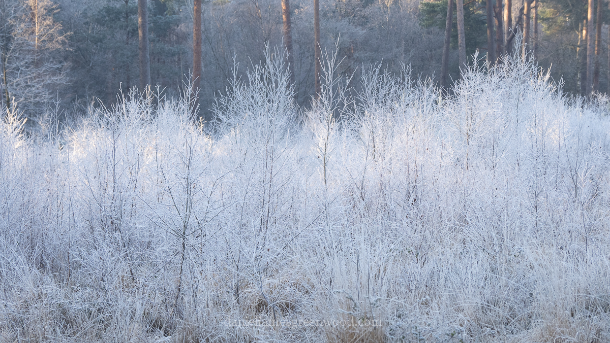
Pulborough Brooks, West Sussex, Friday 16th December 2022
I arrived at Pulborough Brooks as the sun began to rise over Wiggonholt, the heath on the hill.
There are five pine trees that stand together in the open heath, I always seek them out in this light.
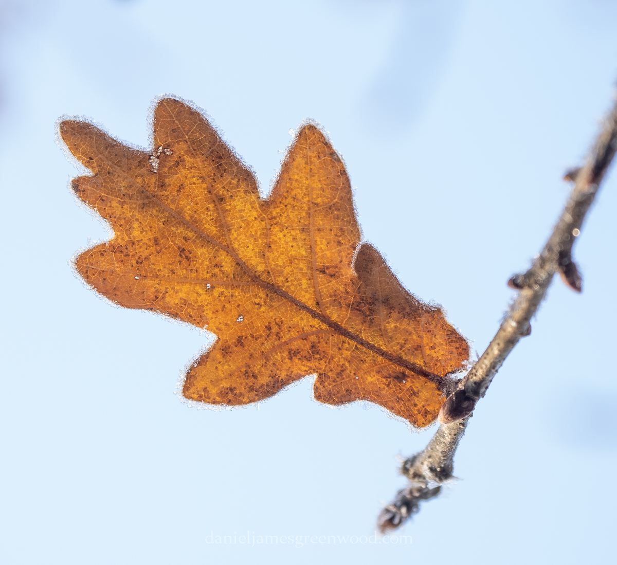
Frost encrusted everything where the sun was yet to reach. Young birches were thick with hoar frost, the yellow leaves of oaks held an edge of ice flakes.
There was little to hear, so much so that even a goldcrest moving through brambles made a sound.
Further round the hill the Highland Cattle were grazing among the frozen bracken. They looked so at home in their Viking get-up, heavy coats whitened by the temperatures. At 8am it was -5.
Out onto the reserve a winter landscape opened out: rock-hard fields with a herd of deer making a break for it; frozen ponds and lakes without ducks and wading birds; and in the distance the South Downs almost hidden by a rising mist.
Rathcroghan, Roscommon, Ireland, September 2024 This short post shows some of the images I snaffled from a pit stop at the ancient Celtic landscape of Rathcroghan, while travelling from Mayo to Dublin. Apologies if I mangle any of the Irish mythology, it is not a subject I’m at all familiar with. Rathcroghan is one of…
A couple of weeks ago I spent some time in the Arun valley, my local access point to the South Downs. At last some rain came and we watched it shift across the Downs, all the way over to the Greensand Hills in Surrey.
I remember looking at this view in April 2021 after a year of lockdowns and computer screens. I honestly did not believe it was real. Perhaps it was the veil of mist, or perhaps I had developed some mental or neurological disorder from so much time stuck at home.
The Arun valley around Amberley is a crossing point (or perhaps washing point) of the Weald and Downs – where the river that rises in the High Weald’s most westerly point cuts a course through the chalk hills. It has wetlands of international significance in Amberley Wildbrooks and nearby Pulborough Brooks.
Arun at North Stoke, page 71 Book about the Highways and Byways of Co. Sussex, England
Like the nearby Adur, probably better known to people because it passes through the very fashionable Knepp Estate, it used to be a much wilder and freer river.
Along the Arun is the village of Bury, likely to originally have been a defensive point preventing easy Viking access from the coast, up the Arun and towards London, a key trading point (obviously). I recently read a book about Anglo-Saxon England that included some information about King Alfred’s development of ‘boroughs’. These were defensive outposts alongside rivers designed to protect from Viking invasion, which happened so regularly and to great effect in Alfred’s time.
The churchspire of Buryvillage can be seen among the trees on the banks of the Arun (2020)
The boroughs were an effective means of defence, for a time at least. I can think of so many placenames that include a borough of somekind: Pulborough, Bury (Lancashire, too), Borough (on the banks of the Thames) and Middlesbrough being the first that come to mind.
The Arun valley at Amberley is a place I first visited through working in the South Downs National Park. My relationship to it is about to change as my time with the National Park comes to an end, but that mixture of professional connection and personal fondness has always been an uneasy one.
It’s the place you can get a train to, which is rare in the South Downs, and enjoy some of the most accessible downland walking. There are views to the North Downs and then south to the coast. The Amberley Downs have glow worms, junipers, barn owls, ravens and rare butterflies like the duke of bergundy. It’s also home to vast monocultures of ‘improved’ grassland that were once rich in communities of now rare plants.
A lone hawthorn on the Downs with the Arun snaking away in the background (2019). Much of its floodplain has become grazing land
The South Downs was first floated as a National Park contender in 1929 but the devastation to its chalk grasslands from the need to plough it up for crops in the Second World War left it a poor relation to the seemingly untouchable Lake District, Yorkshire Dales and Peak District. It only got full ratification as one of the final acts of the outgoing Labour Government in 2010. The Conservatives who followed have begun to cut National Park budgets through flat cash settlements, despite the effect this might have on such a strongly conservative social make-up (‘the shires’ or ‘blue wall’).
The pre-war Downs were sold as one reason to fight for Britain’s sovereignty from Nazi Invasion in the Second World War. How ironic that they ended up being denuded by the very same need to survive. Once the Downs would have been roamed by shepherds grazing large expanses of chalk downland. Today the South Downs feels in some places like an outdoor factory of intensive agriculture, with miles and miles of fences. It is not a wild place in the way that people imagine American National Parks, which in themselves were not necessarily ‘wildernesses’ either due to prior Native American presence. But it is still an incredible place to witness England’s wildlife and geology,
Your Britain – fight for it now (Imperial War Museum/Frank Newbould 1942) – this is not geographically accurate, with the landscape being a splicing together of different parts of the Downs for artistic effect
In Rebirding, a sort of bird conservation polemic, Benedict Macdonald questions the designation of the South Downs as a National Park because of its rolling hills and chalk grasslands, having read this on the website. Ironically the South Downs is one of the most wooded in its tracts of the ancient Low Weald, and home to internationally significant wetlands like those along the Arun at Pulborough. Chalk grassland is also one of the rarest habitats in Europe. It is an astonishing range of habitats, with the dry lowland heath now very rare after the Victorian and 20th-century devastation of the ‘wastes’.
The whole 100 miles of the South Downs, from Eastbourne in East Sussex, to Winchester in Hampshire, has been in my thoughts most days for the past 4 years. The Arun valley now becomes for me that gateway that exists for so many people who don’t have to consider a National Park in its entirety, a psychological doorway into somewhere freer, better and more ‘wild’.
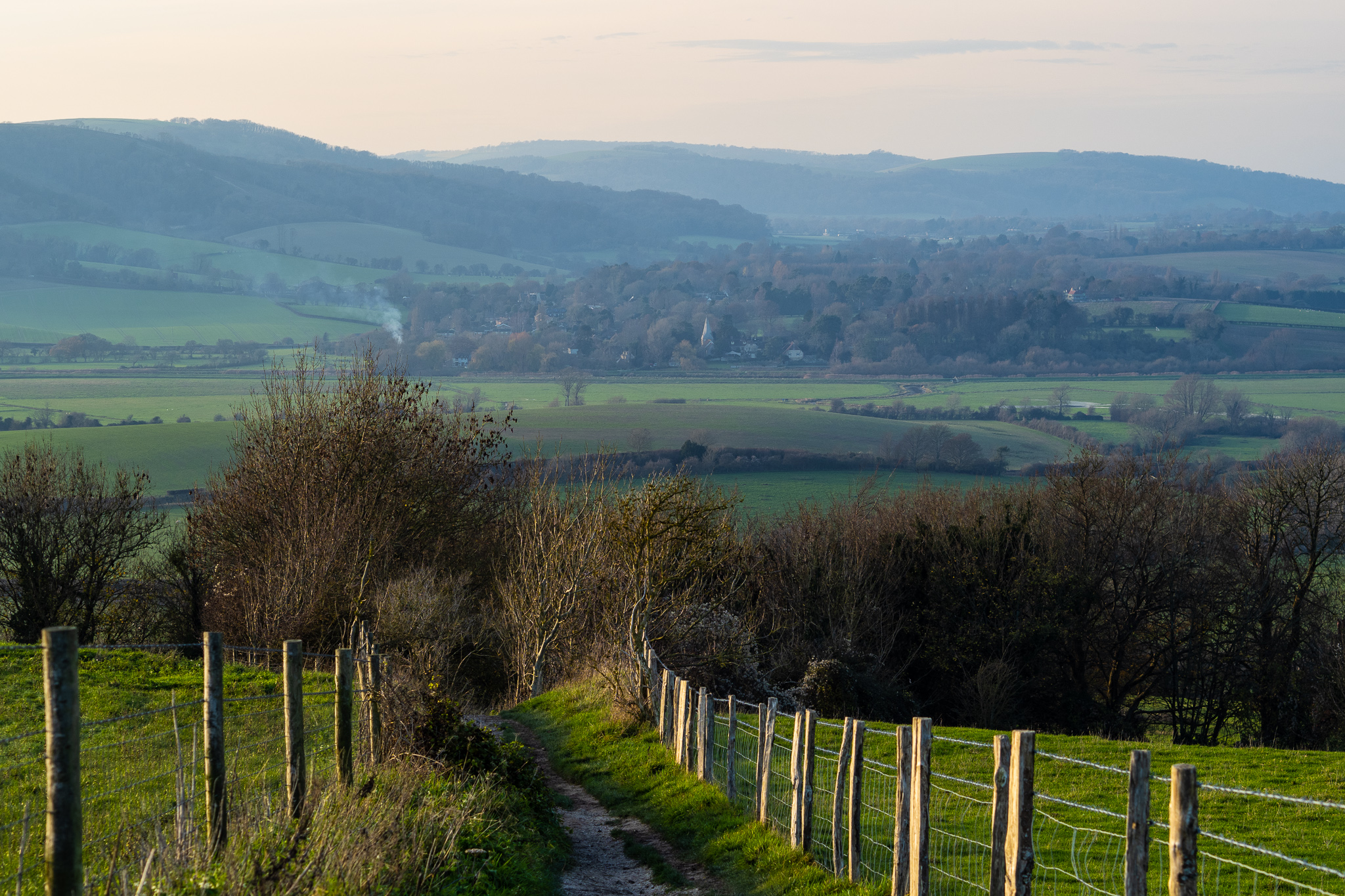
Looking east along the Downs from Chantry Hill, June 2020