Midhurst to Singleton on the New Lipchis Way, West Sussex, August 2019
Midhurst is a market town in rural West Sussex, right in the geographical heart of the South Downs National Park. A friend and I spent the evening walking a section of the New Lipchis Way that connects Midhurst and Singleton. It was a walk of 8 miles through several different habitats, undulating over varied geology. The New Lipchis Way sounds like something from Pagan Britain, but really it’s just that the walk begins in Liphook in Hampshire and ends in Chichester.

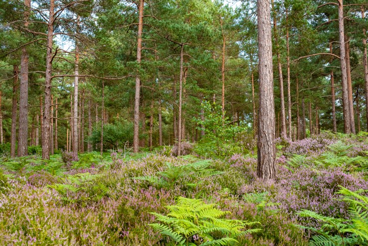
We began at Midhurst via the Cowdray Ruins, along the river Rother at the bottom of St. Ann’s Hill which once held a castle on its top. Remnants of the castle are still printed onto the hilltop. The way carries on through fields where ginormous sweet chestnuts are set in an avenue at the bottom of farmland. Soon the agricultural world is left behind for plantations imprinted on heathland around Heyshott and Ambersham Commons. Here the heather was beginning to bloom. The way crosses the old railway line that once served Midhurst.

Soon the South Downs break into view and the heathlands of the Greensand are left behind for Heyshott village. The use of the word ‘shot’ at the end of a placename usually refers to an extra piece of land extending from a settlement. Hence Aldershot and the variable Oakeshot. The church is a combination of chalk flint from the South Downs, oak timbers, sandstone blocks and clay tiles from the Weald and wooden panels and slats, presumably also from the Weald. The church probably dates from the 13th century.

I love the feeling of moving between settlements and countryside when walking and that drop-off in noise and activity for the stillness of an open or natural landscape. Here we passed through fields of wheat to reach the ridge of the South Downs at Heyshott. In the image above you can see the gradual dying back of ash trees on the ridge as the disease takes effect.

Looking back from the wheatfields you can see the ridge of Greensand Hills in the background, the woody heathlands in the middle and then the churchspire of Heyshott one layer closer.

Rising with the chalk, in the distance you can see Bexleyhill where the mast pokes out. These hills are part of the same Greensand ridge as Woolbeding Common, to the west or left hand side in this image. The river Rother runs from left to right (west-east) in this image, cutting between the distant hills and those of Heyshott and Ambersham Commons. Note the arrival of ash and whitebeam trees on either side on this rural chalky lane.

The light began to fade as the clouds came in and we made our ascent up onto the ridge of the South Downs. It was a dark, horsefly-occupied stretch which was so steep it shut any conversation down. Yew woods covered the northern slopes, such is their want on chalk. They give off an eerie vibe, light rarely breaks their cover. They are rare as woodlands.
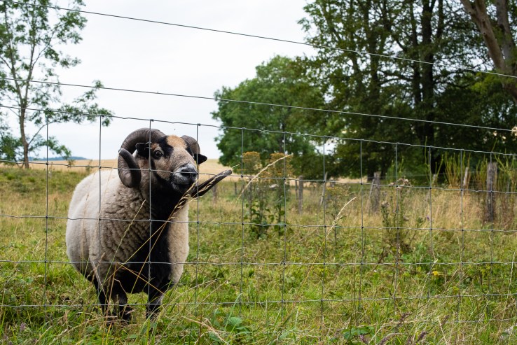
Up on Heyshott Down we were met by some badger-faced sheep, evidently they get fed by passersby or people who, like us, get to this point and hit the deck. Heyshott Down is rich in chalk grassland flowers but also in burial mounds. I heard someone say once that the South Downs ridge, all 100 miles of it, was the equivalent of a really long, ancient graveyard.

The Lipchis Way then slips down through the non-stop beech plantation of Charlton Forest. Rain came in and the light was so low I took few pictures. We found this vast clearing where new conifers had been planted. You may be able to spot the hunting seats. This is the kind of heavily industrialised landscape that is found across Europe. It could be the Czech Republic, France or Scotland. It is a controlled landscape. Hunting and shooting are common past times in this part of West Sussex.

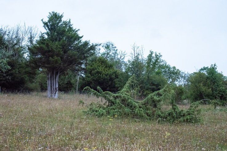
Leaving Charlton Forest behind after a good 20 minutes, you arrive at Levin Down, a Sussex Wildlife Trust nature reserve. On the edge of the reserve sits this twisted ash tree, recoiling from the woods and reaching out into the open landscape. This is another eerily open landscape, set against the wonderful diversity of Levin Down. The name derives from ‘Leave Alone’ because it was too steep to plough, thank God.
The light was so dull here that my camera’s excellent low-light skills came into action. Levin Down is chalk grassland with some stunning veteran juniper trees. Juniper would once have been much more common in areas of chalk downland. I have only ever seen it at Box Hill in the wild in the UK. In the White Carpathians of the Czech Republic, a landscape similar to the South Downs, they replant them to try and resurrect their populations.


You may know juniper from their berries because it is used to produce gin. The junipers on Levin Down are works of art. Like grim reapers their limbs look to be covered by overhanging sleeves, reaching out across the ground, rearing up like the pointed tips of hats. It feels like they’re pointing at you as they reach out to you from their place in the meadows.

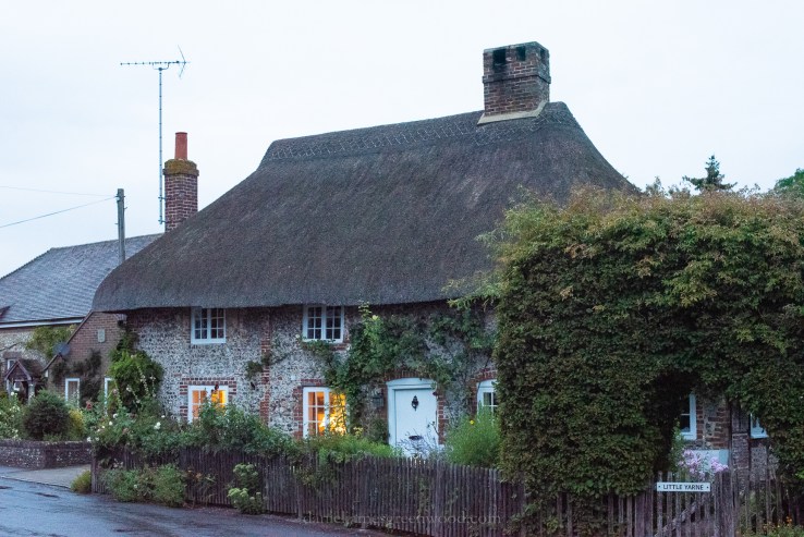
Leaving Levin Down behind, we dropped down through chalk heath (a super rare habitat), one of the most pungent meadows I’ve ever smelt due to the wild marjoram or oregano. The way drops into the old part of Singleton, a village known for the Weald and Downland Museum. Thatched cottages with chalk flints sit with windows showing a cosy inner glow. A lovely place to end the walk.

[…] a friend and I took an evening hike on a section of the New Lipchis Way. This was in addition to a previous walk from Midhurst to Singleton. The 7 mile walk began at Older Hill with astonishing views across the heathlands of the Sussex […]