The Peak District: struggling through the mist on Kinder Scout

Peak District - 2019 blog-16

Edale, The Peak District National Park, September 2019

View my route for this walk on View Ranger

In September I visited the Peak District for the first time. I was heading up north to visit family and wanted to check whether an old friend’s claim to being a ‘northerner’ was accurate. He’s from Chesterfield and has accompanied me on several walks shown on this blog. Turns out that as a native of Chesterfield he might actually be a Midlander, anyway, nevermind that and apologies for any offence caused.

Edale blog-2

The walk was 12 miles in length and a circular from the YHA in Edale. It’s a fantastic place to stay with really nice staff. The YHA straddles the slopes of the Edale valley. I said to the man working at the YHA that the valley took me completely by surprise when arriving, it comes out of nowhere. He said that despite visiting it every day it did the same to him each time.

Edale blog-3

My aim was to get up onto the Kinder Scout plateau, a place famed for the mass trespass that took place 1932. Our public access to the countryside is a precious thing. It’s under attack from some landowners who don’t want members of the public walking across their land, by footpaths being forgotten and going un-walked, but it would have been even worse were it not for the interventions of a group of ‘young communists from Sheffield’ in the 20th century. It is said that their intervention led to the National Parks Act of 1949.

Edale blog-5

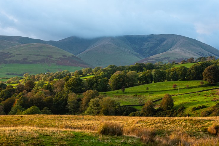
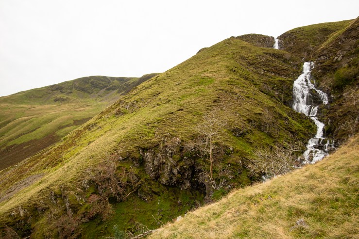
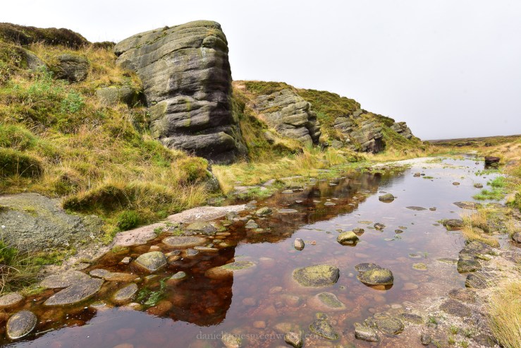
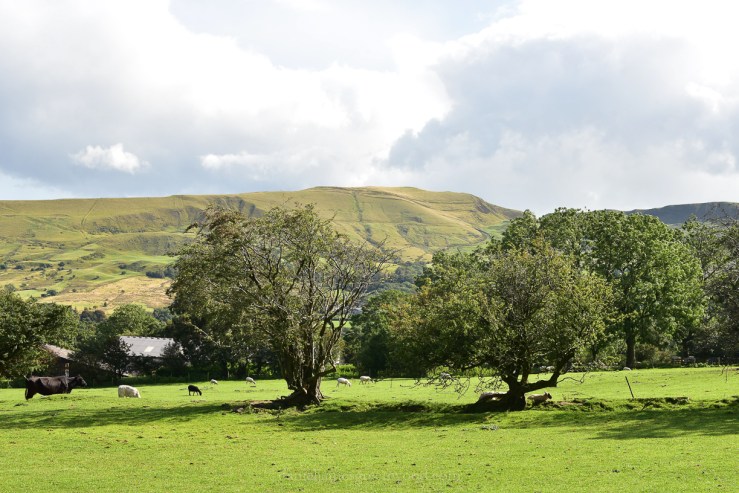
Edale is nestled in amongst the woody riverine margins of Grinds Brook that runs down into the River Noe.

Edale blog-6

The Peak District is a rural landscape of grazing land and heather moorland. I’m not defending grouse shooting here, but National Parks in the UK are designated as cultural landscapes. Our ‘wildernesses’ are not devoid of people. It was the Industrial Revolution that made the Peak District what it is today above its bedrock. In the UK people have to be part of the landscape for its protection to be ensured.

Peak District - 2019 blog-1

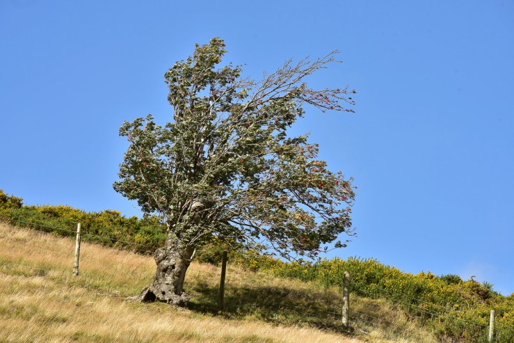
Like many areas of hilly heather moorland, rowans are a common occurrence and point to its other common name of mountain ash. In September they are possibly at their most alluring with their masses of bright red berries earmarked for the tummies of redwings and blackbirds.

Edale blog-11

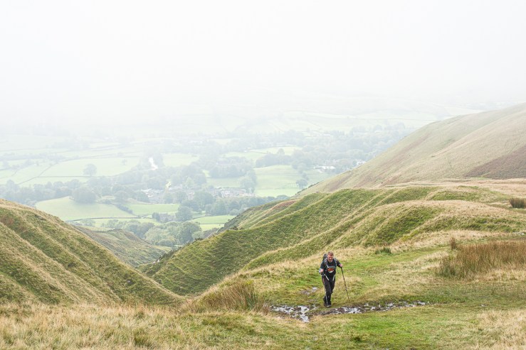
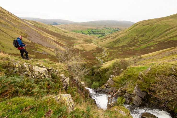
This is a view up Grindsbrook. I have to admit, being out of (proper) hillwalking fitness this was a challenge. The track becomes bouldery, not helped by the heavy rain that arrived as I began. It being a Sunday morning, it created a bottleneck of walkers struggling up onto the top of Kinder Scout. After this photo I put my camera away and focused on the ascent.

Edale blog-12

The rain was so bad up on Kinder Scout that I only took photos of the trackway heading north-west rather than the views into the Edale valley, and I have a waterproof camera! The rain and cloud had swallowed the views anyway.

Edale blog-13

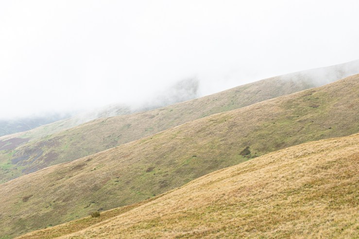
When the mist began to blow away, it created mysterious ranges of exposed gritstone and Sunday ramblers.

Edale blog-14

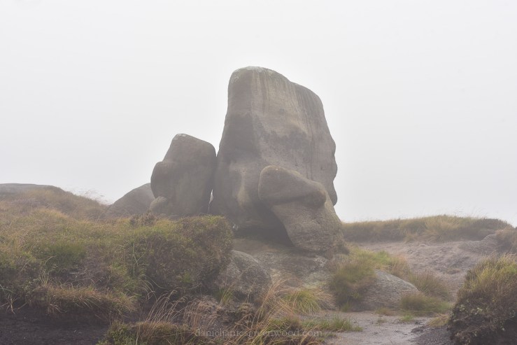
Some of the rock formations were like ancient stone sculptures.

Peak District - 2019 blog-4

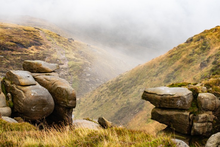
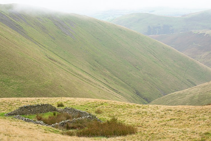
The clearing mist gave stunning views into the gulleys and passes of the Peaks.

Edale blog-16

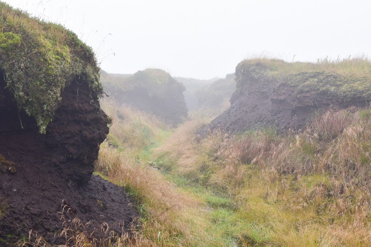
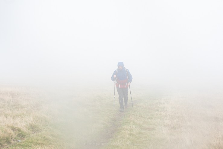
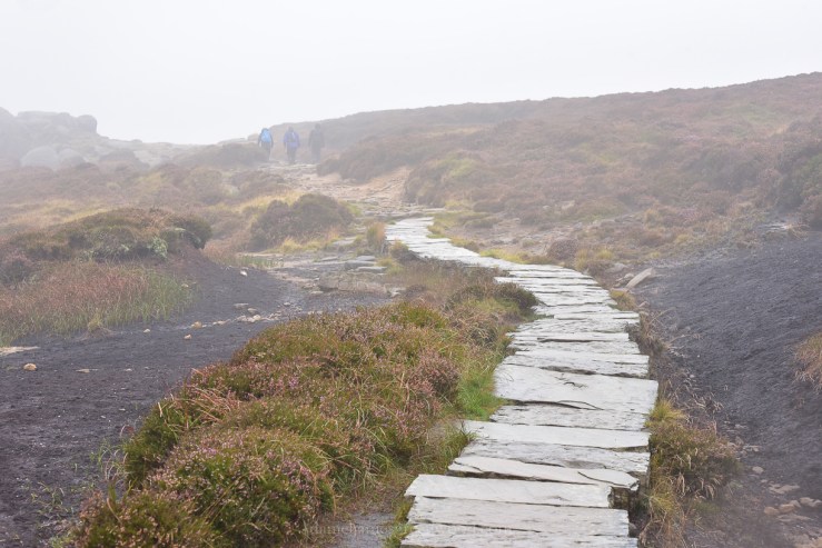
The walking atop Kinder Scout is tough. It’s a labyrinth of peatlands and bog. The mist closed everything in and gave the sense of moving through endless corridors of black soil. Fun is not quite the word to describe it.

Edale blog-17

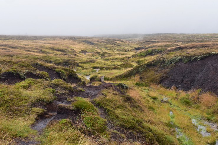
As you can see, the path was difficult to keep. You need a compass and a map to be up here, View Ranger was very helpful in give a sense of my proximity to the general route. But mobile phone GPS is not reliable in these places and you need to know where you’re going.

Edale blog-18

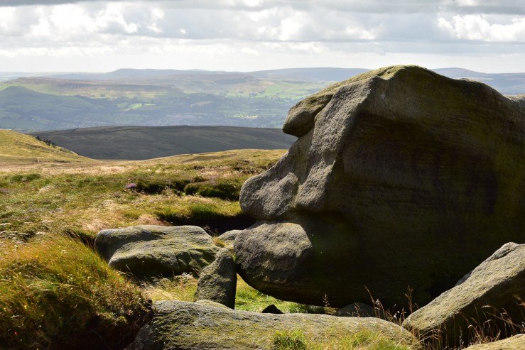
The sun slipped through for a minute and lit these totemic outcrops.

Peak District - 2019 blog-7

Reaching Kinder Downfall was a relief. The sun broke through and blue sky appeared. The wind was so strong that it blew the water back up the fall. Kinder Scout is a Norse name, likely named by the Viking settlers present in Britain between the late 700-900s. I love this fact about Britain. When you look back at British history you fail to find a mono-ethnic, English culture.

Peak District - 2019 blog-12

The warm sun here helped to dry out my coat and trousers (which I was still wearing of course) and lit the rock formations. As if clouds eventually grow heavy like stone and fall to the earth to rest like this in the hills.

Peak District - 2019 blog-10

Kinder Reservoir was constructed in 1911 and can be seen in the centre of the image here.

Edale blog-25

Can we talk about how much this boulder looks like a person in deep thought ๐Ÿค”

Peak District - 2019 blog-14

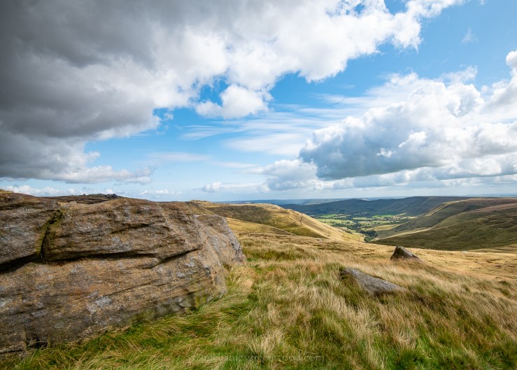
The light spread across the moors, the wind blew through the grasses and clouds broke across the sky.

Edale blog-30

Edale blog-31

There were lots of people of all ages and backgrounds rambling on this Sunday afternoon. This is the approach to Jacob’s Ladder. The deeply worn hills show the impact of many thousands of years of water running from their summits.

Peak District - 2019 blog-19

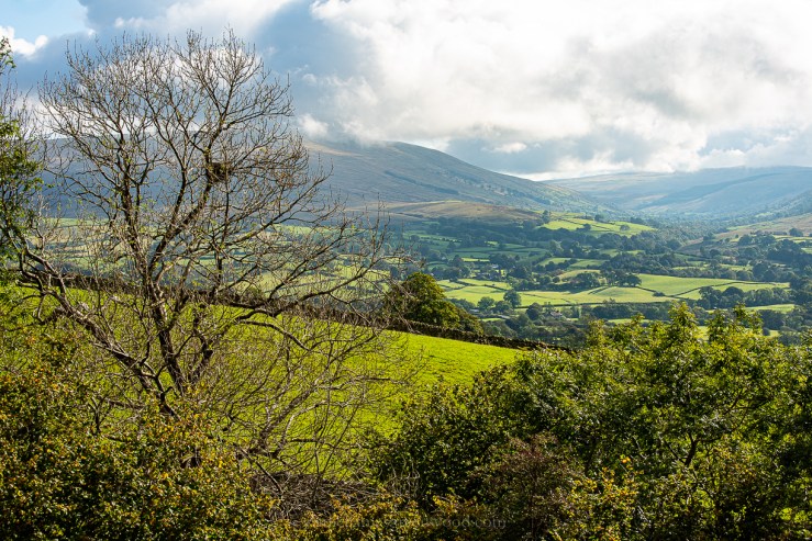
A monochrome view into the Edale Valley from Jacob’s Ladder.

Edale blog-37

I was drawn to the sight of hawthorns against the hills. They look like people. It’s a wood pasture of sorts that is found in the Yorkshire Dales below the moorland level as well. I love hawthorns.

Edale blog-38

At Lee Farm this wooden Pooh bear was greeting walkers from its home in the wood shed.

Edale blog-39

The rain came and passed away again on my return back to the YHA.

Edale blog-41

What was probably the line of an old hedgerow can be seen here with two beautiful veteran trees, hawthorns sheltering sheep.

Edale blog-45

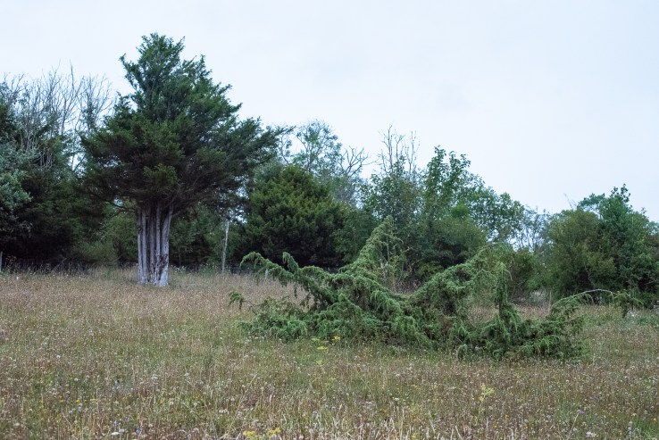
Sadness lingers in the countryside in the shapes of our dying ash trees. In the Yorkshire Dales, in Scotland, on Dartmoor and the South Downs our ash trees are succumbing to ash dieback disease. So, too, in the Peak District. I have to photograph them as a record for what our landscapes used to look like. Hopefully more resistant genetic strains will emerge from the mist like boulders in the Peaks and rock on for millennia to come.

Edale blog-47

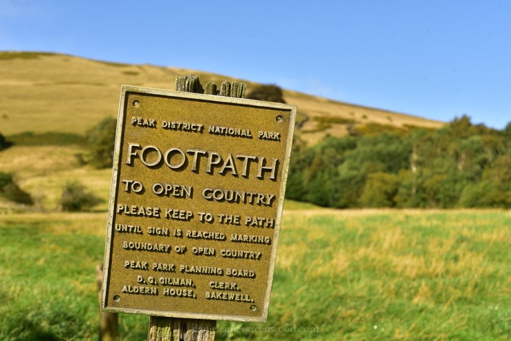
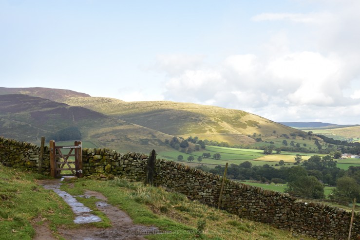
What a beautiful phrase: footpath to open country. Take me there (no, really, please I’m dying it’s been 12 miles).

Edale blog-48

Holly is another of the veteran trees you find in moorland landscapes along with hawthorn. This was a stunning tree blown east by the wind rushing through the valley.

Edale blog-50

This is special. I noticed a massive rowan tree at the margin of field and gorseland. It is the largest rowan I have ever seen in the UK. I tweeted about it and the brilliant writer Mark Cocker asked me where it was. Mark Cocker is a ‘hero’ of mine having been inspired by his assiduous observation of rooks in Crow Country when I first became interested in the genre of ‘nature writing’. Mark said I should write something about this tree but really I only passed it. I was so tired I didn’t have the energy to pull myself up the hill (off the path!) and get a nicer photo of it with my wide angle lens. Instead, hopefully Mark will write something about it?

Edale blog-51

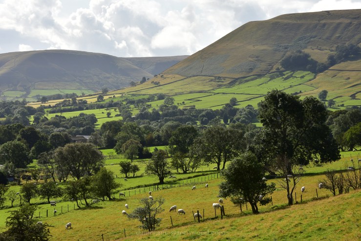
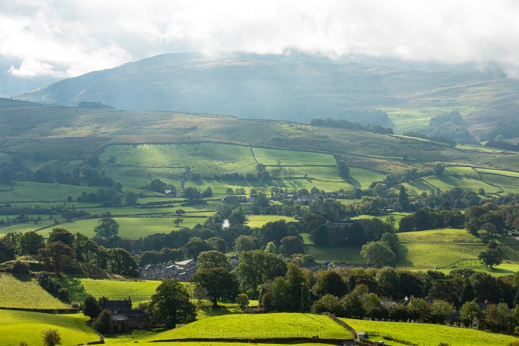
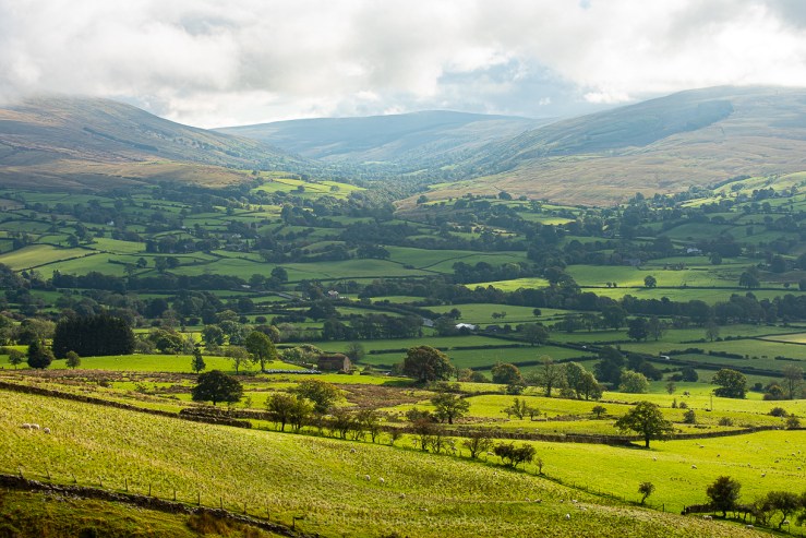
The sun shone in the valley and the Peak District in all its glory was on show.

Peak District - 2019 blog-23

Views across to the other side of the valley showed the various stages of the landscape. The screen and exposed geology, the rampant woodland and scrub, held off the by the farmer’s drystone walls and sheep.

Edale blog-53

To end, the summit of Mam Tor where once an Iron Age hill fort stood. Can you imagine what it must have looked like, high up there overlooking the landscape with its wooden walls and torches burning at each corner. Next time I visit I intend to get my butt up there and see how it might have felt for our ancient ancestors, within the Countryside Code, of course.

Thanks for reading.

The Howgills: walking the folds of the Cumbria fells

Yorkshire Dales - October 2019 blog-6-2

Howgill Fells, Yorkshire Dales National Park, October 2019

At the beginning of October, my friend Eddie Chapman and I walked ten miles into the Howgill Fells in the Cumbrian reaches of the Yorkshire Dales National Park. You can view and download the walk on ViewRanger here.

The evening before the walk we passed the Howgills during the golden hour. A day of heavy rain dried up and the sun cast its glaze across the folds of the fells.

Yorkshire Dales - October 2019 blog-10-2

Cloud hung over the Calf, the highest peak in the area and was to remain for the next day.

Yorkshire Dales - October 2019 blog-4-2

The stone barns are one of the Yorkshire Dale’s most iconic features. Swaledale seems to have the greatest compliment of these beautiful structures.

Yorkshire Dales - October 2019 blog-11-2

The walk began from Sedbergh, the largest settlement in the Yorkshire Dales National Park. The day was sunny and surprisingly warm.

Yorkshire Dales - October 2019 blog-12-2

The cloud still lingered over the highest points but the fields glowed in the morning sun.

Yorkshire Dales - October 2019 blog-13-2

Looking east towards Garsdale, the Yorkshire Dales are always more wooded than I remember.

Yorkshire Dales - October 2019 blog-4

As we made our way up into the hills through a steady ascent, the clouds settled in overhead.

Yorkshire Dales - October 2019 blog-3

Here Eddie could still make out a small family group of stonechat in some bracken.

Yorkshire Dales - October 2019 blog-6

Climbing higher onto Arant Haw the mist locked down, a strange and claustrophobic experience.

Yorkshire Dales - October 2019 blog-10

Up and over our first peak, the mist began to clear only when we headed towards the Calf, the highest point of the Howgills.

Yorkshire Dales - October 2019 blog-14

It was a great relief to have the folds of the fells reappearing from the cloud.

Yorkshire Dales - October 2019 blog-12

Anyone who has travelled between Glasgow and Manchester will have passed the Howgills. At this junction in the fells the motorway can be heard in the distance and the small specks of vehicles passing. Above you can see what looks like the remains of an old sheep pen.

Yorkshire Dales - October 2019 blog-22

The clouds lifted and the fells appeared. The creases speak of millenia-old waterways.

Yorkshire Dales - October 2019 blog-16

Greater views began to appear, with Ribblesdale appearing in the distance in the shape of Whernside, one of the three peaks famed for the 30-mile day hike challenge.

Yorkshire Dales - October 2019 blog-24

Atop the Calf, Eddie is happy to be out of the clouds for once.

Yorkshire Dales - October 2019 blog-30

This sheep felt like it was being watched.

Yorkshire Dales - October 2019 blog-26

The light began to dip as we headed deeper into the folding Howgills.

Yorkshire Dales - October 2019 blog-33

Our target was Cautley Spout, the waterfall that would lead us down into the valley for a return to Sedbergh along the river Rawthey.

Yorkshire Dales - October 2019 blog-47

The waterfall thunders down into the valley from Cautley Crag.

Yorkshire Dales - October 2019 blog-55

The waterfall is a safehaven for trees, unlike the wider hillsides which are either unsuitable due to the boggy nature of the moorland or because of sheep grazing. Rowan, ash, holly and elm were all growing in the gully.

Yorkshire Dales - October 2019 blog-50

The limestone surrounding the falls is covered by map lichens glowing neon.

Yorkshire Dales - October 2019 blog-49

Yorkshire Dales - October 2019 blog-58

This area holds evidence of an Iron Age settlement. It isn’t surprising. There is protection, the river provides food and once woodland will have been more prevalent providing fuel. This landscape was potentially a site of spiritual significance. The allure is undeniable.

More photography

ViewRanger route

The Sussex Weald: Seven miles of sunset hills in the Wealden Downs

Midhurst to Singleton on the New Lipchis Way, West Sussex, August 2019

Midhurst is a market town in rural West Sussex, right in the geographical heart of the South Downs National Park. A friend and I spent the evening walking a section of the New Lipchis Way that connects Midhurst and Singleton. It was a walk of 8 miles through several different habitats, undulating over varied geology. The New Lipchis Way sounds like something from Pagan Britain, but really it’s just that the walk begins in Liphook in Hampshire and ends in Chichester.

Mids-Singleton - 8-8-2019 djg-6

We began at Midhurst via the Cowdray Ruins, along the river Rother at the bottom of St. Ann’s Hill which once held a castle on its top. Remnants of the castle are still printed onto the hilltop. The way carries on through fields where ginormous sweet chestnuts are set in an avenue at the bottom of farmland. Soon the agricultural world is left behind for plantations imprinted on heathland around Heyshott and Ambersham Commons. Here the heather was beginning to bloom. The way crosses the old railway line that once served Midhurst.

Mids-Singleton - 8-8-2019 djg-13

Soon the South Downs break into view and the heathlands of the Greensand are left behind for Heyshott village. The use of the word ‘shot’ at the end of a placename usually refers to an extra piece of land extending from a settlement. Hence Aldershot and the variable Oakeshot. The church is a combination of chalk flint from the South Downs, oak timbers, sandstone blocks and clay tiles from the Weald and wooden panels and slats, presumably also from the Weald. The church probably dates from the 13th century.

Mids-Singleton - 8-8-2019 djg-14

I love the feeling of moving between settlements and countryside when walking and that drop-off in noise and activity for the stillness of an open or natural landscape. Here we passed through fields of wheat to reach the ridge of the South Downs at Heyshott. In the image above you can see the gradual dying back of ash trees on the ridge as the disease takes effect.

Mids-Singleton - 8-8-2019 djg-15

Looking back from the wheatfields you can see the ridge of Greensand Hills in the background, the woody heathlands in the middle and then the churchspire of Heyshott one layer closer.

Mids-Singleton - 8-8-2019 djg-16

Rising with the chalk, in the distance you can see Bexleyhill where the mast pokes out. These hills are part of the same Greensand ridge as Woolbeding Common, to the west or left hand side in this image. The river Rother runs from left to right (west-east) in this image, cutting between the distant hills and those of Heyshott and Ambersham Commons. Note the arrival of ash and whitebeam trees on either side on this rural chalky lane.

Midhurst-Singleton D750 - 8-8-2019 (99)

The light began to fade as the clouds came in and we made our ascent up onto the ridge of the South Downs. It was a dark, horsefly-occupied stretch which was so steep it shut any conversation down. Yew woods covered the northern slopes, such is their want on chalk. They give off an eerie vibe, light rarely breaks their cover. They are rare as woodlands.

Mids-Singleton - 8-8-2019 djg-17

Up on Heyshott Down we were met by some badger-faced sheep, evidently they get fed by passersby or people who, like us, get to this point and hit the deck. Heyshott Down is rich in chalk grassland flowers but also in burial mounds. I heard someone say once that the South Downs ridge, all 100 miles of it, was the equivalent of a really long, ancient graveyard.

Mids-Singleton - 8-8-2019 djg-18

The Lipchis Way then slips down through the non-stop beech plantation of Charlton Forest. Rain came in and the light was so low I took few pictures. We found this vast clearing where new conifers had been planted. You may be able to spot the hunting seats. This is the kind of heavily industrialised landscape that is found across Europe. It could be the Czech Republic, France or Scotland. It is a controlled landscape. Hunting and shooting are common past times in this part of West Sussex.

Mids-Singleton - 8-8-2019 djg-19

Leaving Charlton Forest behind after a good 20 minutes, you arrive at Levin Down, a Sussex Wildlife Trust nature reserve. On the edge of the reserve sits this twisted ash tree, recoiling from the woods and reaching out into the open landscape. This is another eerily open landscape, set against the wonderful diversity of Levin Down. The name derives from ‘Leave Alone’ because it was too steep to plough, thank God.

Mids-Singleton - 8-8-2019 djg-27

The light was so dull here that my camera’s excellent low-light skills came into action. Levin Down is chalk grassland with some stunning veteran juniper trees. Juniper would once have been much more common in areas of chalk downland. I have only ever seen it at Box Hill in the wild in the UK. In the White Carpathians of the Czech Republic, a landscape similar to the South Downs, they replant them to try and resurrect their populations.

Mids-Singleton - 8-8-2019 djg-25

Mids-Singleton - 8-8-2019 djg-24

Mids-Singleton - 8-8-2019 djg-23

You may know juniper from their berries because it is used to produce gin. The junipers on Levin Down are works of art. Like grim reapers their limbs look to be covered by overhanging sleeves, reaching out across the ground, rearing up like the pointed tips of hats. It feels like they’re pointing at you as they reach out to you from their place in the meadows.

Mids-Singleton - 8-8-2019 djg-30

Leaving Levin Down behind, we dropped down through chalk heath (a super rare habitat), one of the most pungent meadows I’ve ever smelt due to the wild marjoram or oregano. The way drops into the old part of Singleton, a village known for the Weald and Downland Museum. Thatched cottages with chalk flints sit with windows showing a cosy inner glow. A lovely place to end the walk.

Mids-Singleton - 8-8-2019 djg-29

Explore my Wealden archive