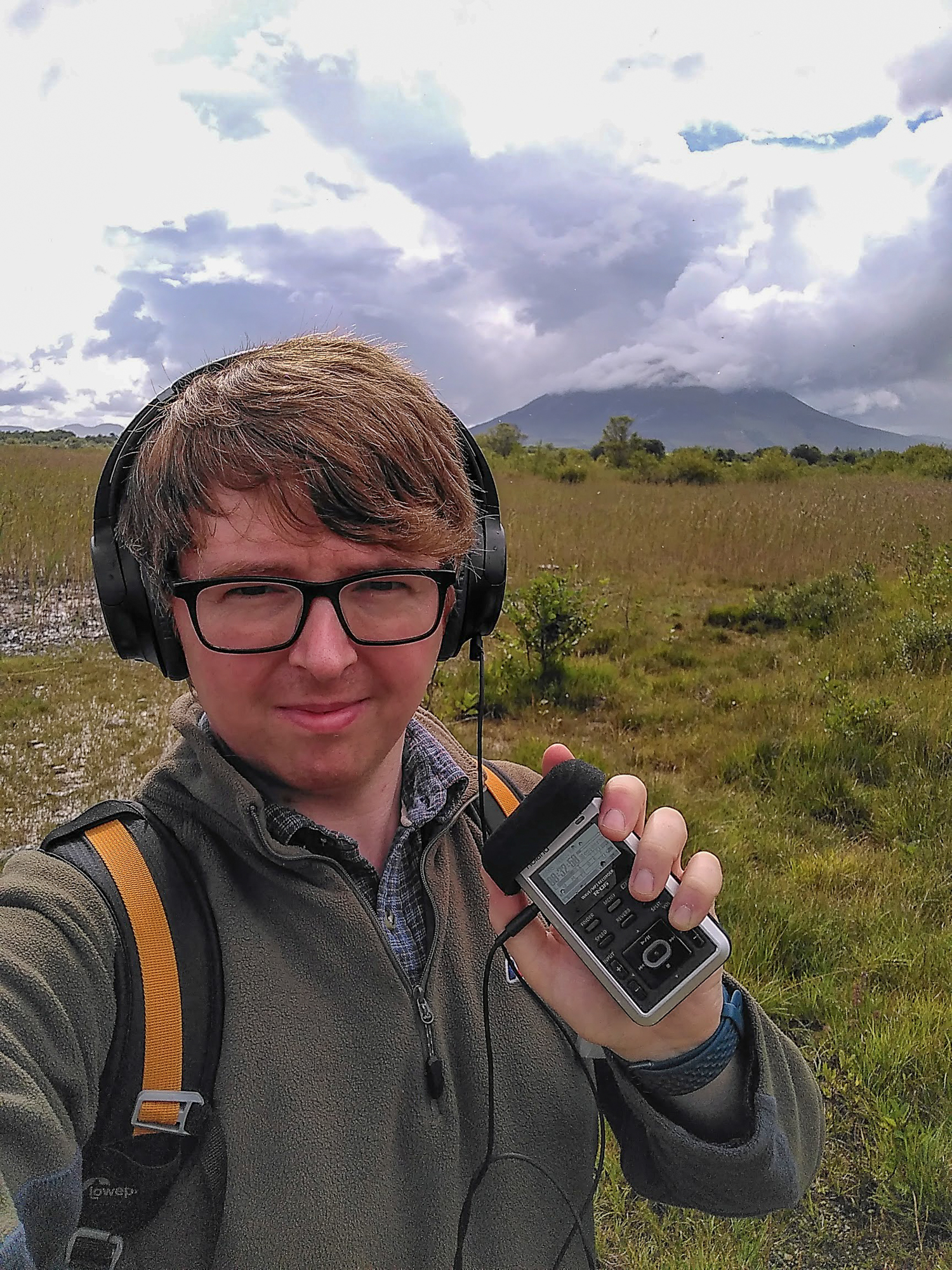
Regular readers (both of you) may be aware that my blog has become slower in posting, but the posts I am putting out are longer and reaching new depths. Not of depravity, but with more research and history included.
It’s something I spend a fair amount of time thinking about – what is the point of taking all these photos and writing all these words – what is it all for?
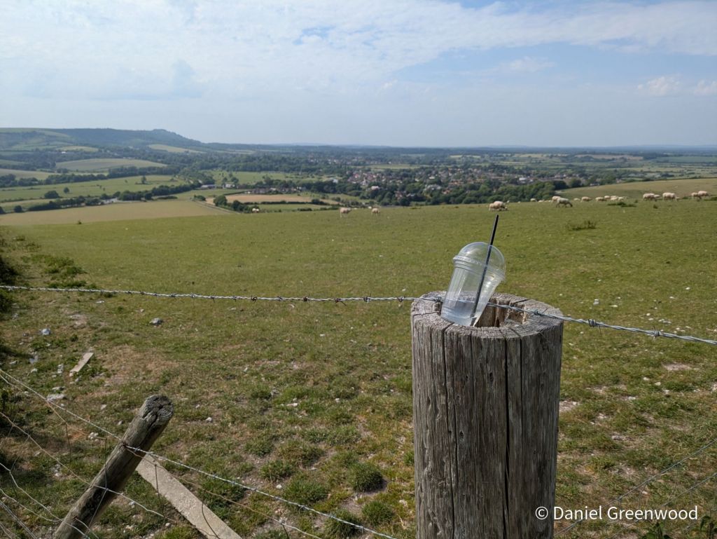
I’ve spliced in photos from a phone camera project I have called ‘rogue vessels’, to make what I’m about to write sound less pretentious.
Photoblogs help me in the act of unlocking a landscape™️, peeling back the layers of history, culture and industry, whatever the scale, however far I get with it.
Photography is extremely effective in capturing a seemingly innocuous scene which, in fact, contains multitudes. This is not a boast of what I am putting together but the richness of the world around us. Photography is not just an artform but scientific, too.
The still image can be a pushback against the overwhelming barrage of video, AI-guff, and all-out nonsense that Facebook, whatever Twitter has become, and TikTok churn out. Stills can engage your brain and allow you to think for yourself in ways short video doesn’t.
So will photoblogs save the world? Mine won’t, but they can provide a deeper understanding for both the writer and the reader, which surely is somewhere we all need to be going in this age of political entrenchment, outrage, and mainstreaming of extreme ideology.
Below are some recent photoblogs, many of them from Ireland. I have so many interesting blogs to come in the next year, I hope they provide you with a glimmer of light (as they do for me).
What I’m writing – recent blogs
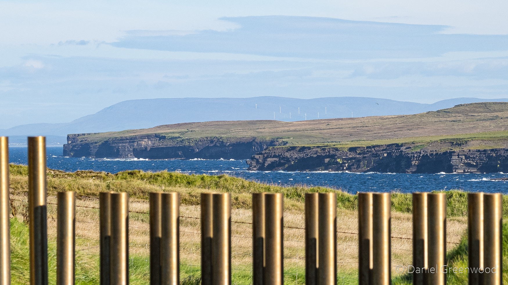
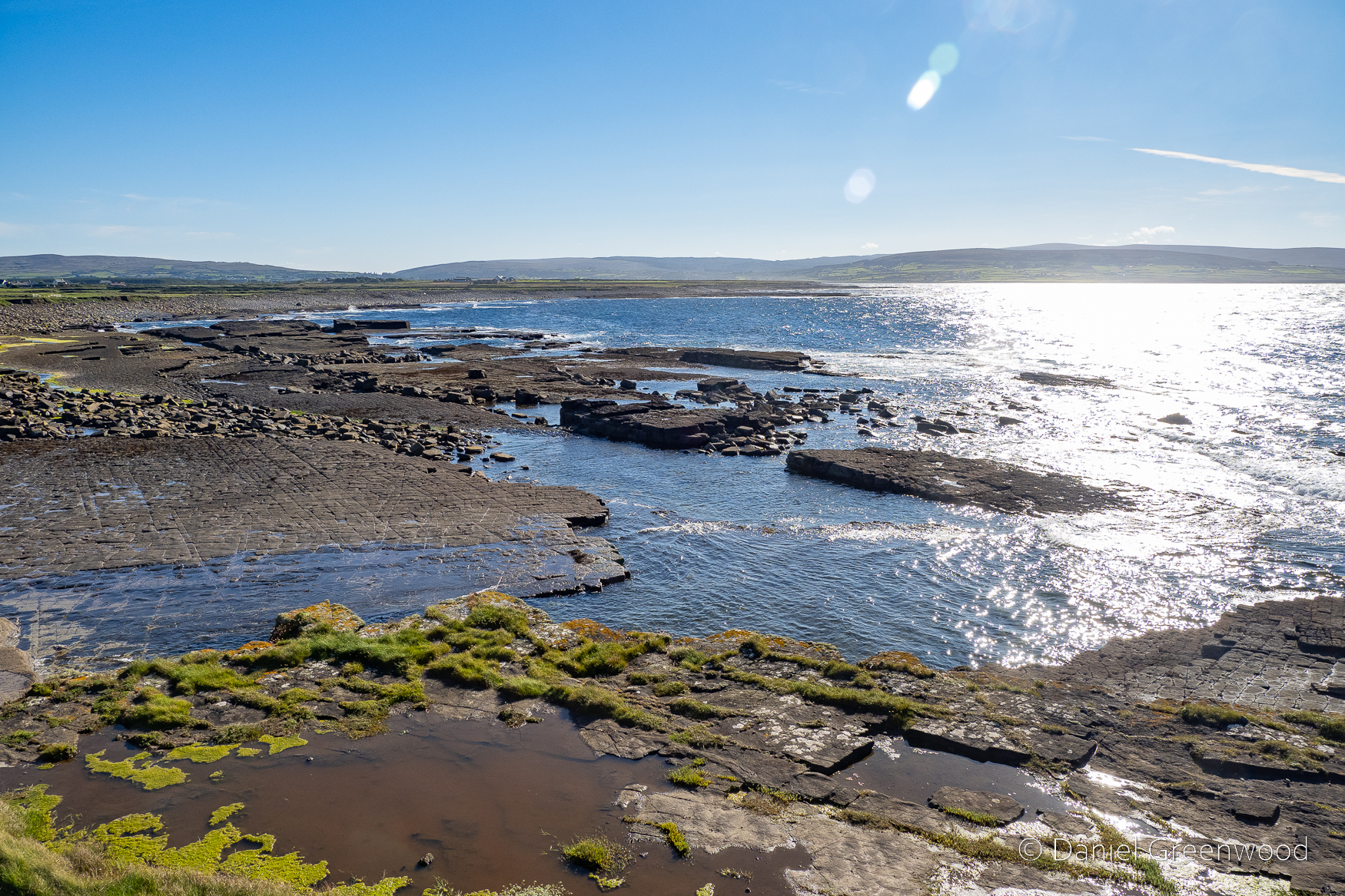
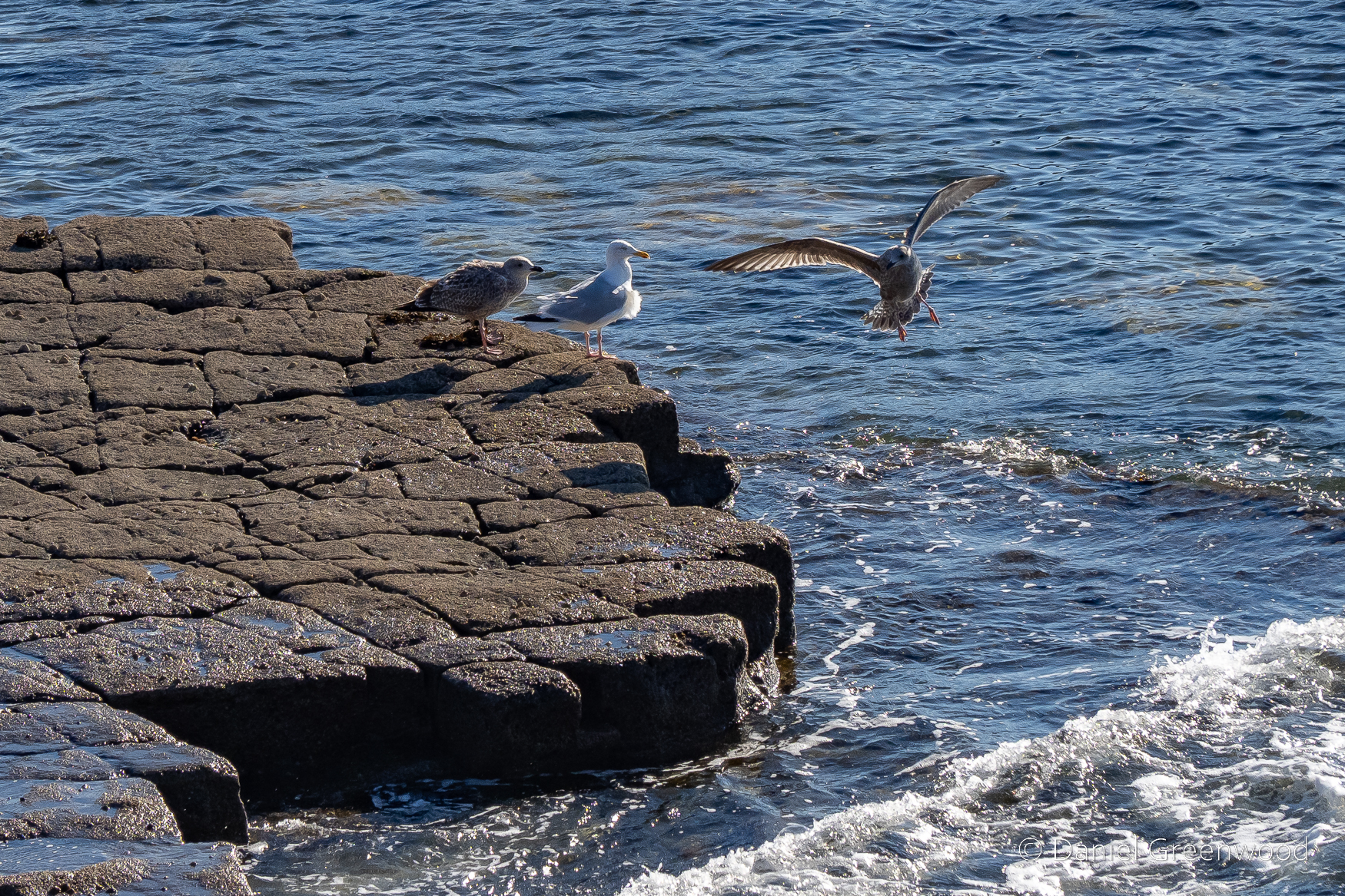
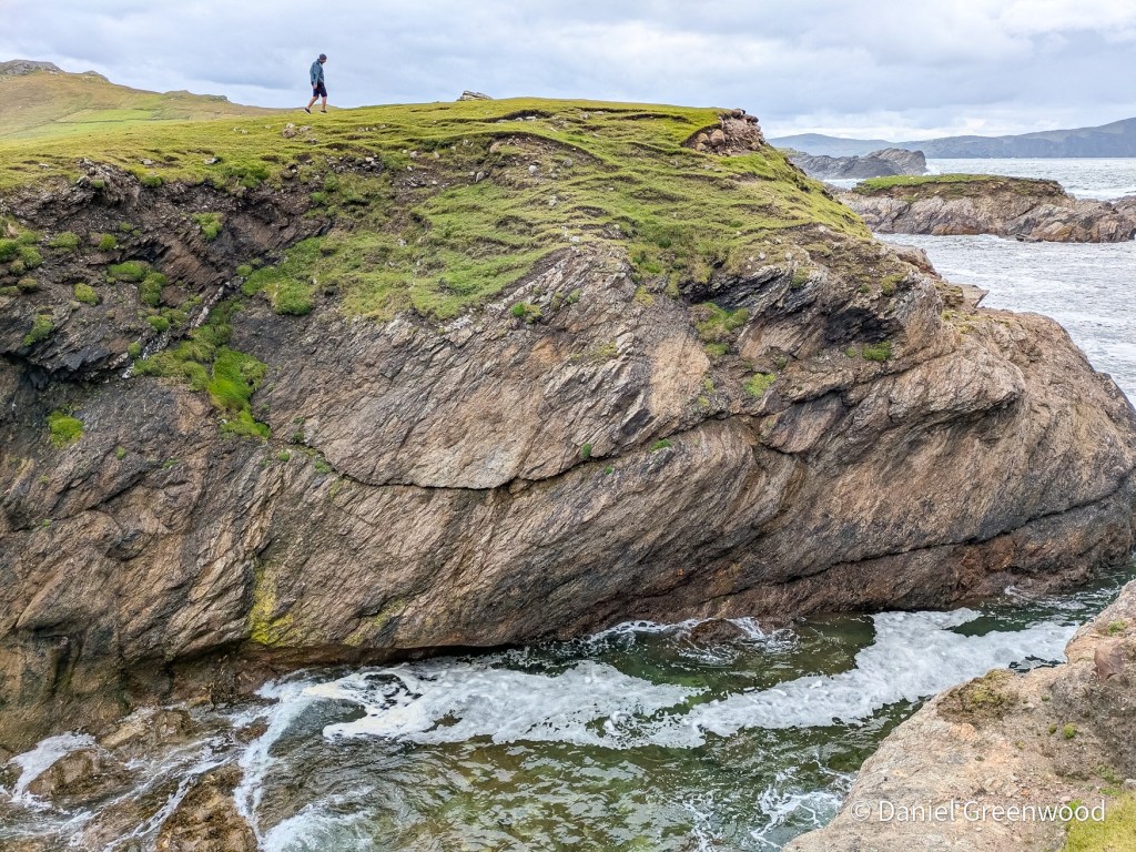
I’ve been posting my photos from my 2024 visit to Ireland which has proved surprisingly fruitful. I’ve posted several blogs about the trip and there are more to come!
I’ve learned a lot about Dublin Bay from writing this post, and have even started reading James Joyce’s Ulysses to keep the bay in my life. Yes, I have found the novel very hard going, and it’s on pause at the moment while I try and understand what is actually going on in it.
This is a post I’ve been thinking about for quite a while. I needed more time at Rathcroghan, rather than a pit stop, to capture more of the landscape and to learn more about the dynamic Celtic and pagan history of the place.
Closer to home I delved into 2024 again to share some images from a lovely summer’s day in the South Downs.
What I’m reading
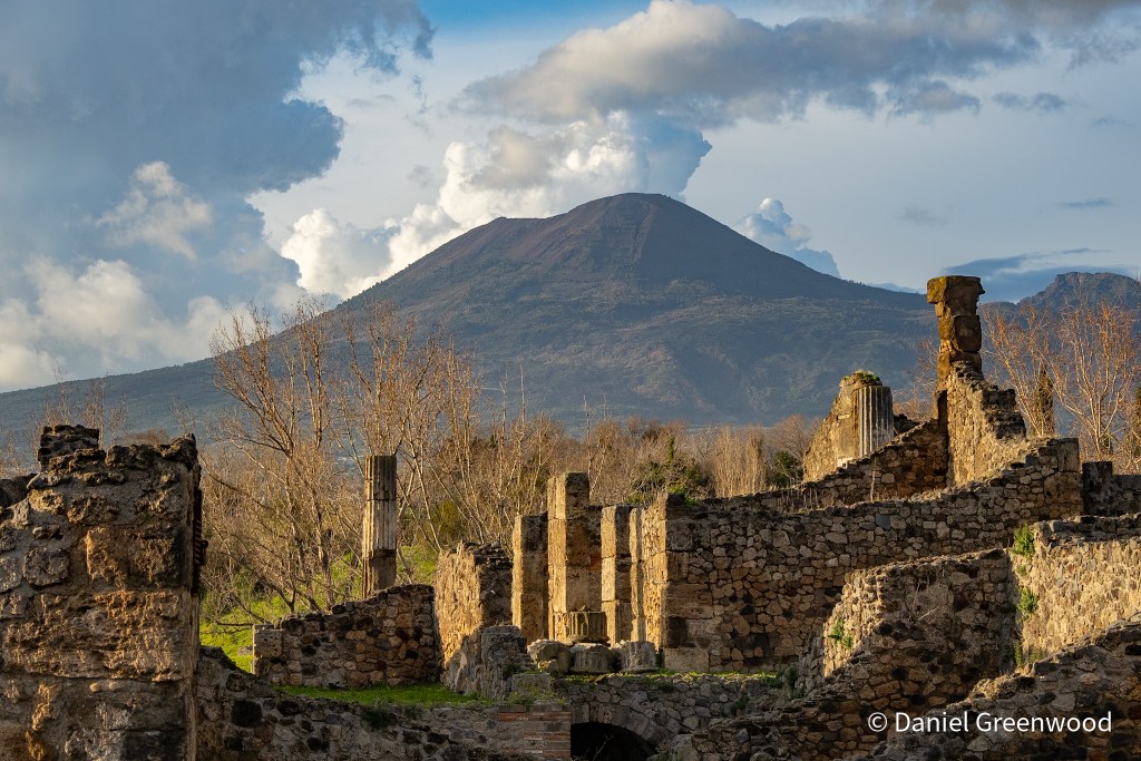
Mount Vesuvius as seen from Pompeii
Below is a selection of what I’ve managed to read cover to cover in recent months:
Pompeii – Mary Beard (above, February 2026). I visited Pompeii for the first time in February and have a post or two in mind for this wonderful place. Mary Beard’s interpretation of Pompeii’s history is essential reading.
Pax – Tom Holland. I was in total Roman mode when I got back from Italy (as in reading, not militarily), and finally got round to reading one of the more famous books from Tom Holland. I once met and photographed Tom at Sydenham Hill Wood when he was supporting London Wildlife Trust. Lovely man. I’ll be reading more of his work in future. Congratulations, Tom.
The Great Irish Famine: A History in Four Lives – Enda Delaney. I borrowed this book from my local library and tore through it with my eyes. The Great Famine of 1845-52 directly impacted my ancestors in Mayo so it’s something I am keen to educate myself about, and it’s an area of Britain’s colonial past we should know more about. It’s a complex subject, but there is plenty of evidence here to argue that English politicians saw the Famine as divine punishment for a people deemed beneath them. I learned that many more people died because ideology and prejudice deterred people in power from taking action. In some places, people even profited from it.
What I’m hearing
I actually went to a gig in June! Ye Vagabonds are a family band from Co. Carlow. The band were fantastic live, the final leg of their tour promoting their new album All Tied Together (January 2026). The songs are lovely.
What I’m watching
Thanks to a wonderful Blindboy podcast episode I learned about the work of David Keohan, who is now famous for reigniting the interest in Irish stone lifting. This short film nicely encapsulates how David goes about his work to rediscover old stones in Ireland, and to lift them again after several decades of mostly being stuck to the ground. David also has a book out called The Wind Beneath the Stone.
What began as me non-chalantly taking some photos from the deck of the ferry leaving Dublin Port emerged as a deep-dive (not literally) into the ecology and history of Dublin Bay. It has taken me weeks to complete this, I hope you enjoy it as much as I have learning about Dublin Bay.
Through the process of writing this post, I have also somehow ended up watching livestreams of ferries leaving the port! Also, I’ve taken the plunge (lol) and borrowed my late father’s copy of James Joyce’s Ulysses because some of it is set in Dublin Bay (thanks Mum). This blog can’t wait for me to read those 900+ pages, however, but I’ve included a few snapshots of the Bay from the first chapter.
This ferry journey is deeply ingrained in my childhood memories, from summers spent visiting my grandparents in Dublin and then usually down south to Cork. I have one memory of leaving on a summer evening in the 1990s, with the golden evening sunlight draped across Howth to the north as we began our journey to Holyhead. How many other people must have similar memories.
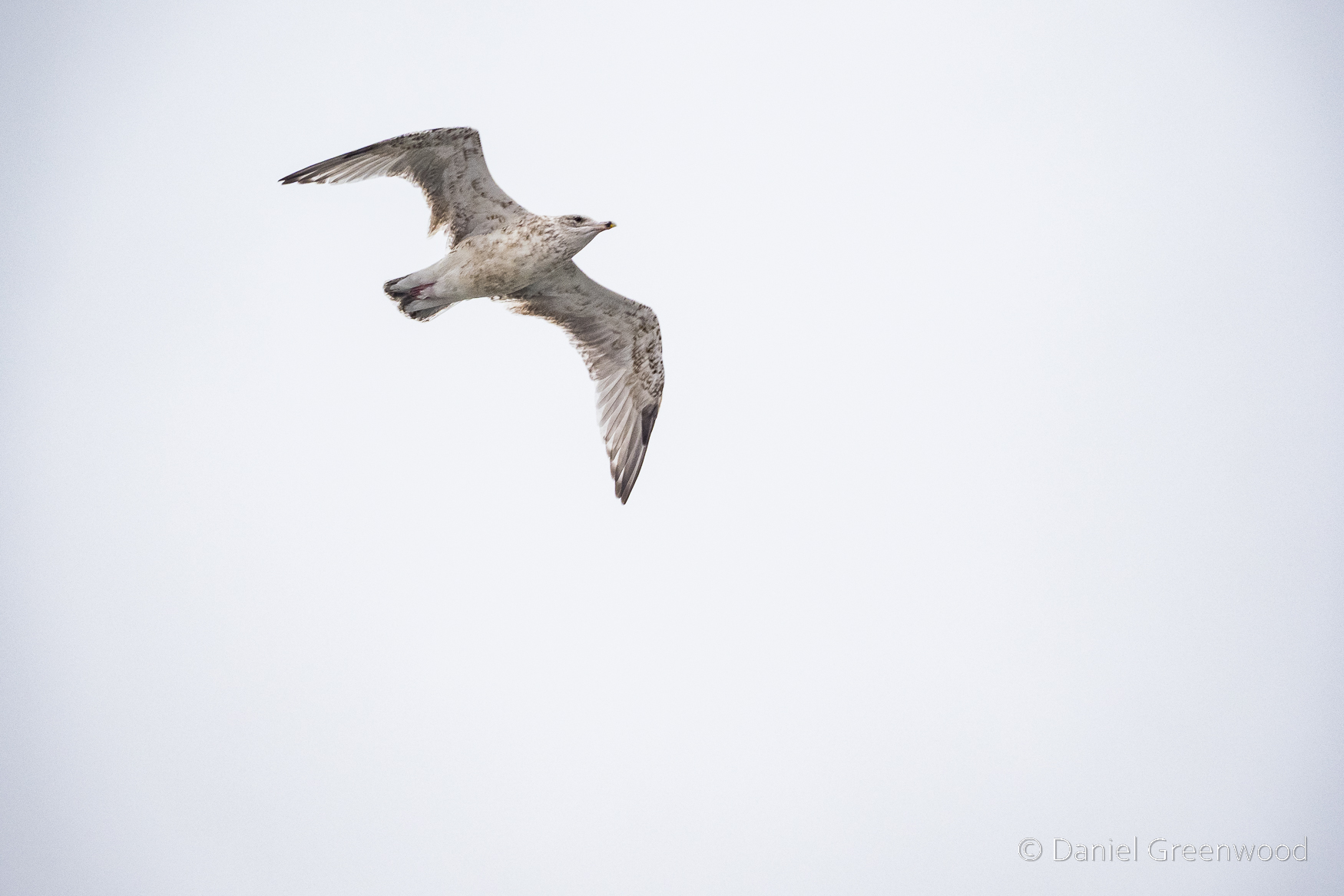
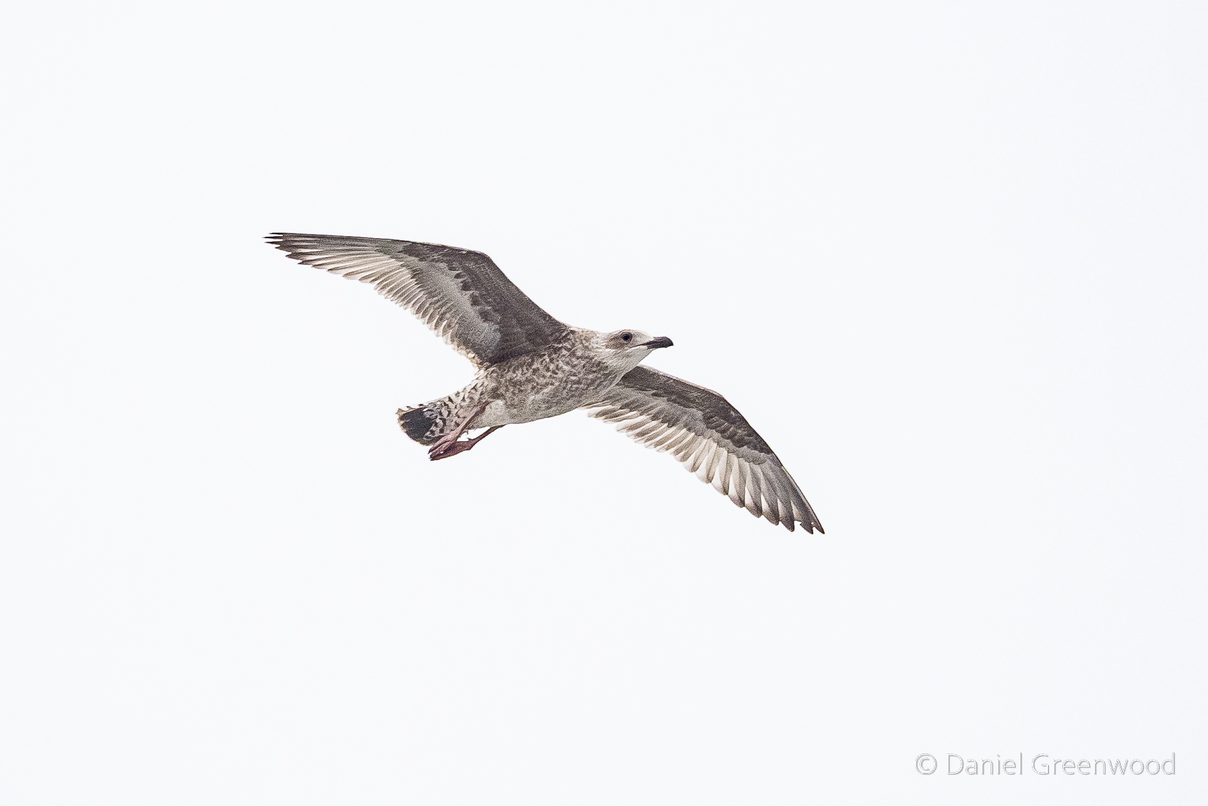
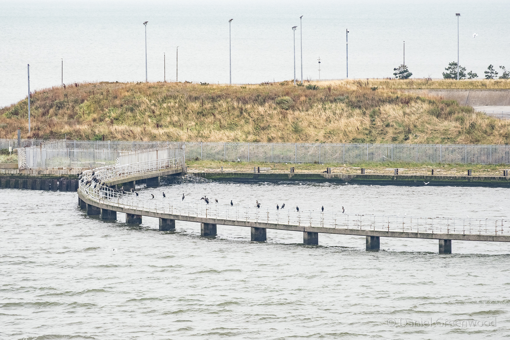
From the deck of the boat you have great views of gulls flying by. Gulls don’t just follow trawlers, they also swoop alongside ferries. The vantage point of the ferry deck is a great spot for gull photography, which is something that most people don’t really spend time doing. Those people are missing out.
Identifying gulls is not easy, especially with the pre-adult phase plumages. This looks like it could be a herring gull due to the black tips to the wings, but it may also be a juvenile like the one in the previous image.
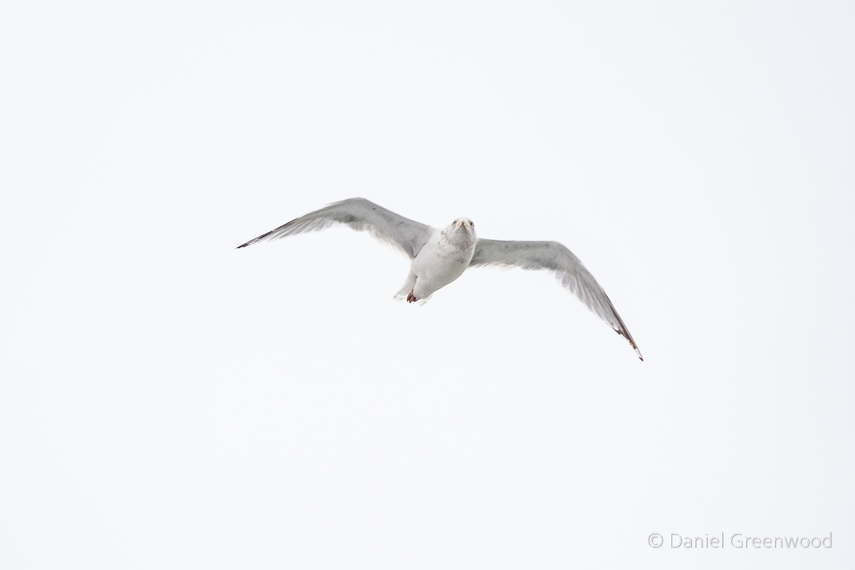
This is another juvenile gull. Dublin Port must be a fun place for a gull to grow up.
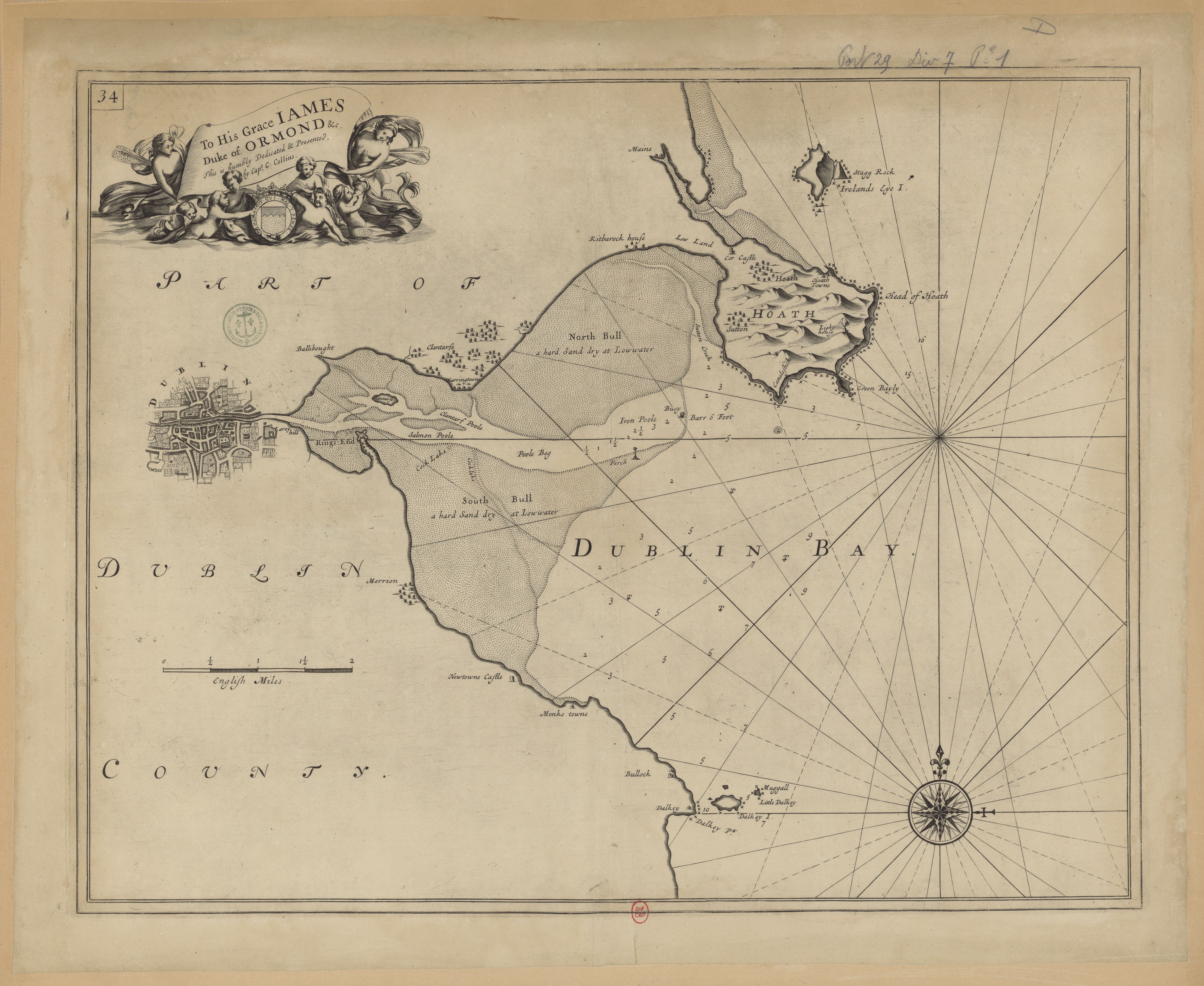
It would have been more fun before the port developed, when it was more of a natural estuary with mudflats and saltmarsh that have over the centuries been lost to a booming shipping industry. That era is captured in this 17th-18th century map.
The gulls really are rather mesmerising among the ferry churn as it departs.
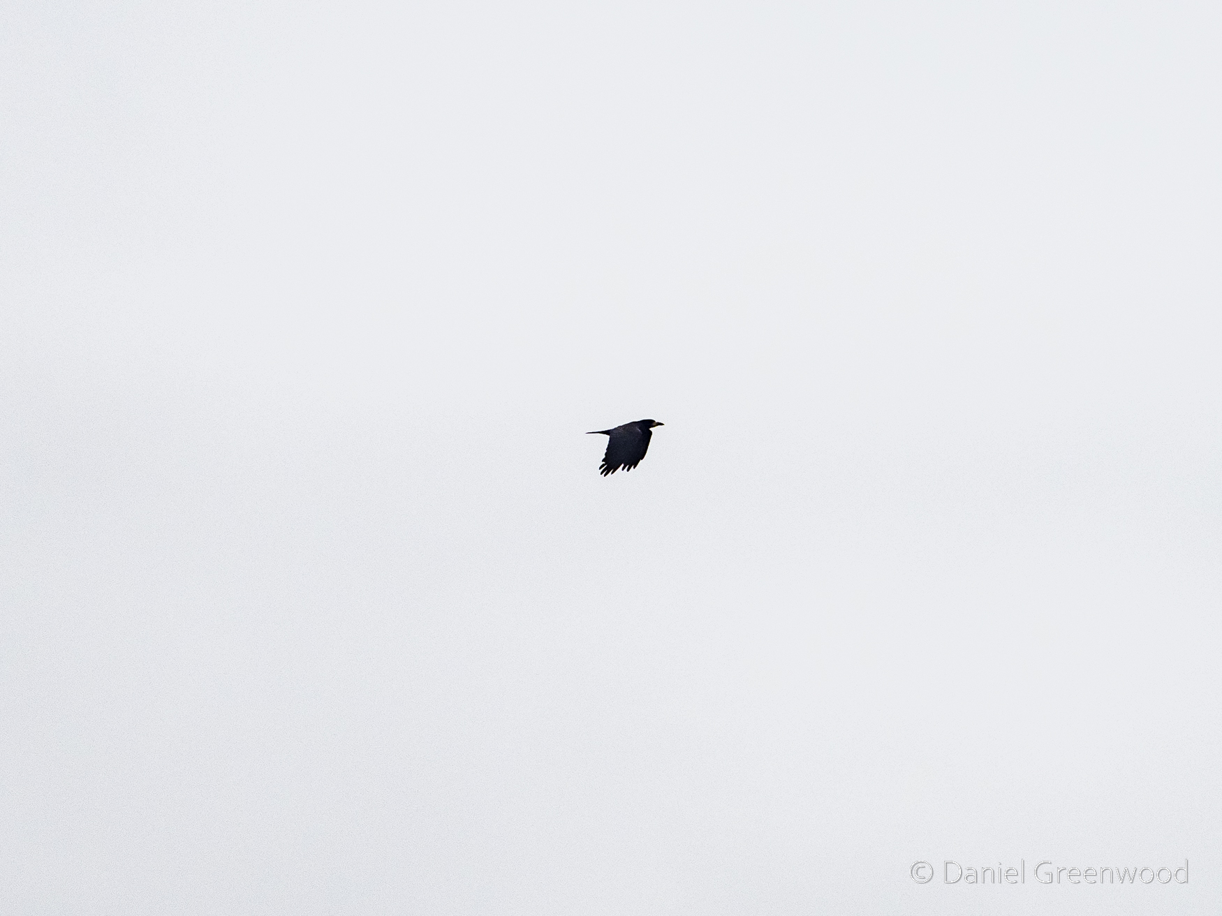
Who knew rooks were seabirds, too (they’re not). They’re very intelligent though, my aunt Sally is a particular fan of these communal roosters.
Though industry has gulped down much of the natural landscape of Dublin Bay, there’s ongoing conservation work with Birdwatch Ireland supporting Dublin Port to understand the birds of the Bay.
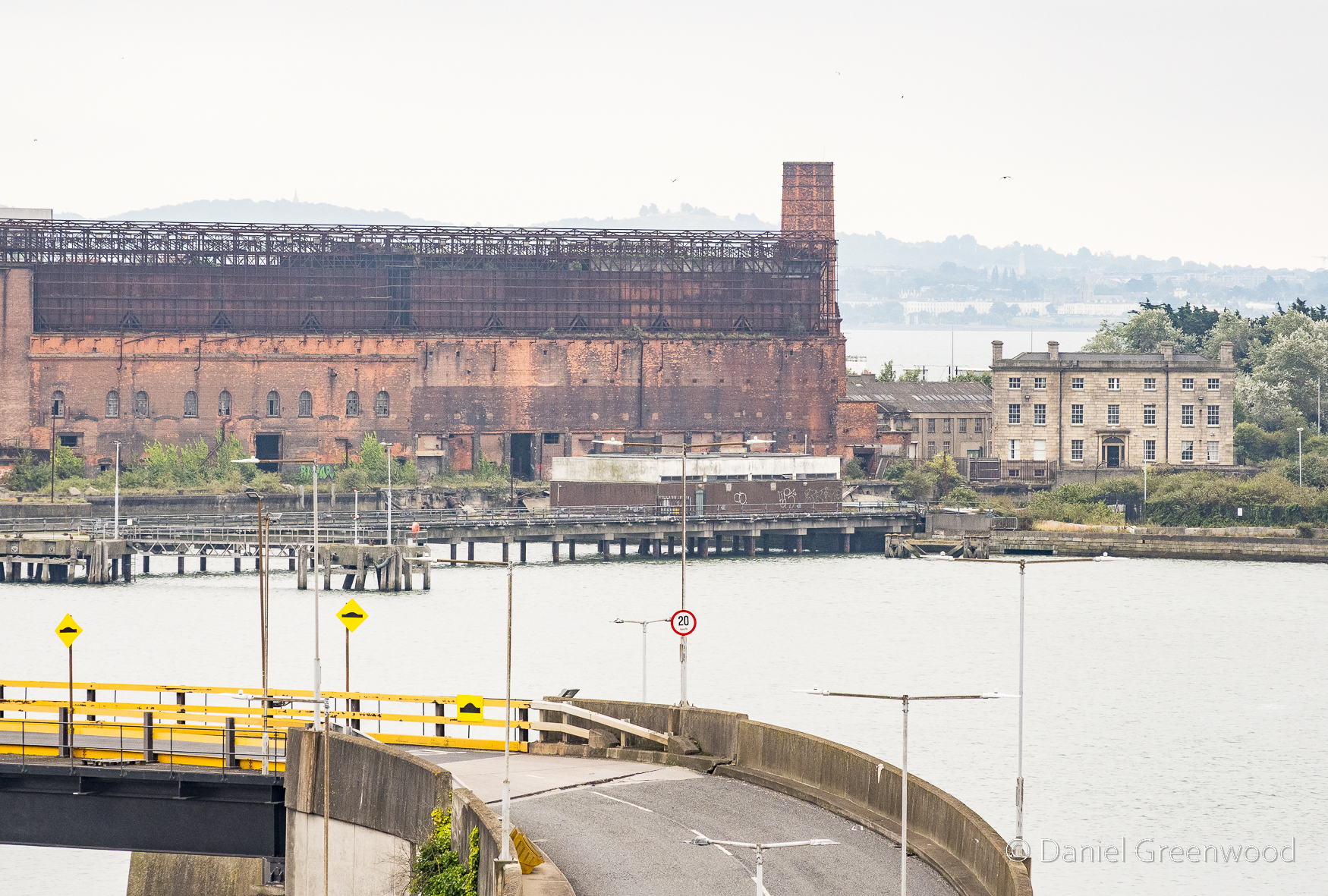
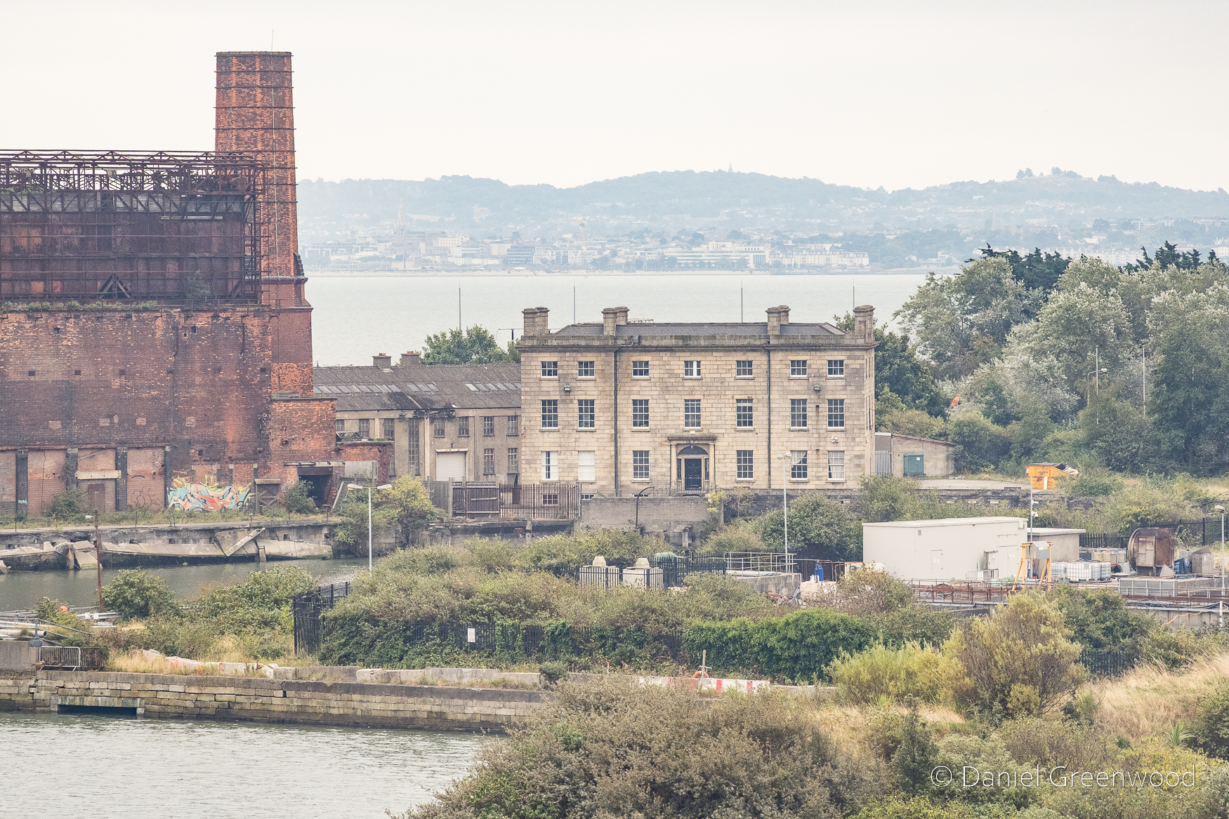
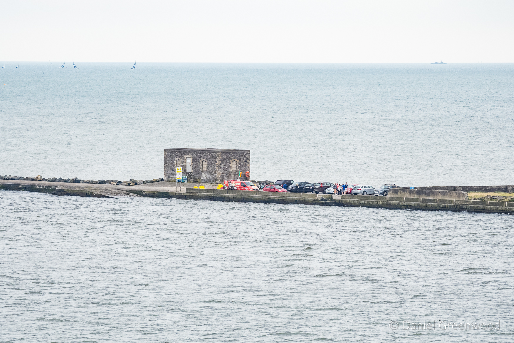
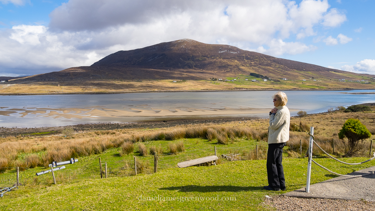
One of the views before embarkation, which I will come back to when the ferry pulls up alongside this view. The Georgian-looking house on the right is Pigeon House, named after the couple who once managed it.
This scene reminds me of The Wire series two, though I’m not suggesting the same is going on down there.
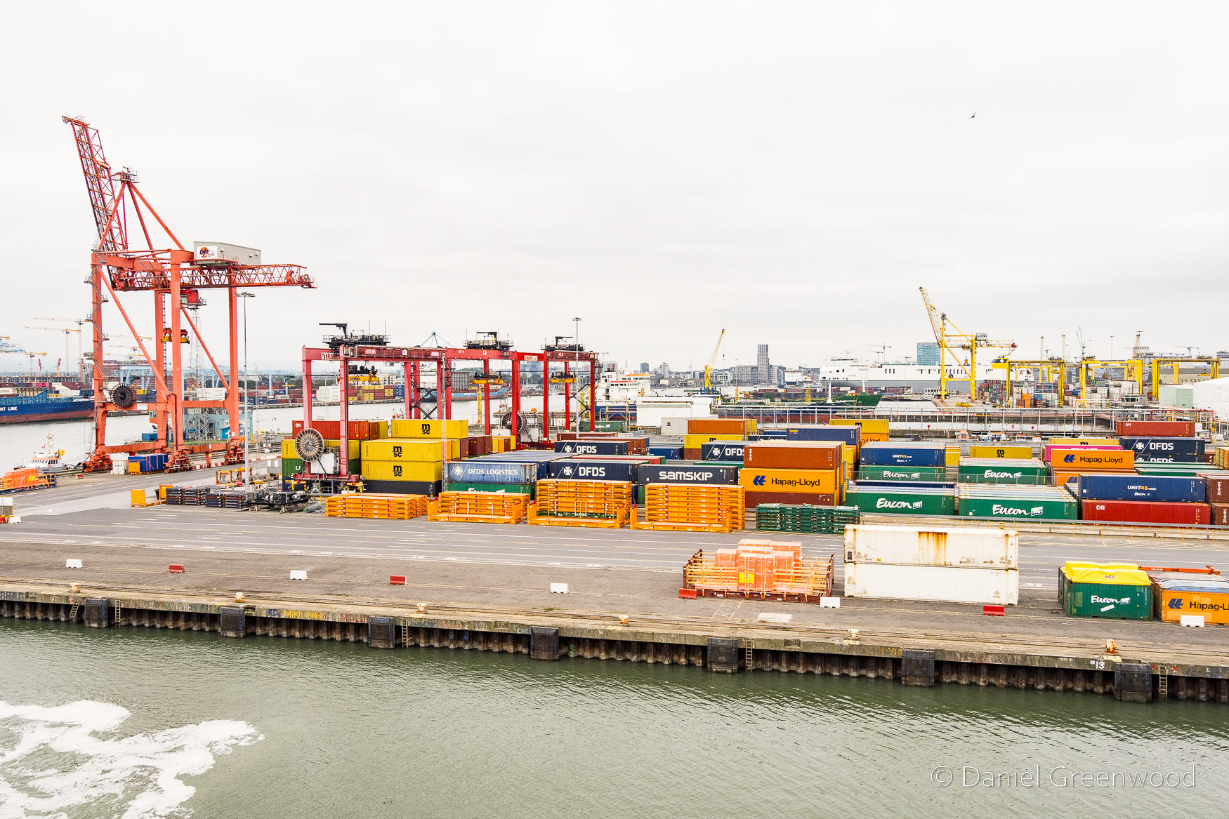
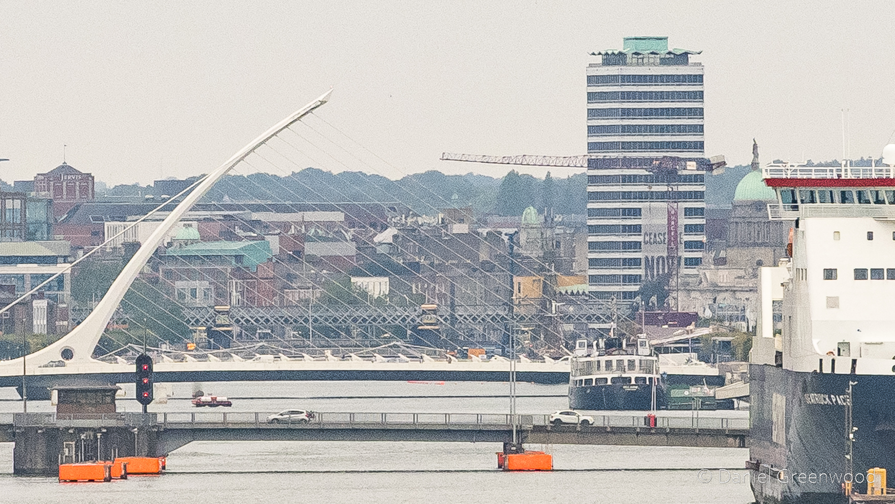
As the ferry exits the dock the Liffey comes into view among a cluster of ships, cranes and containers.
This seascape is a mystery to me. Something that helped me to understand the complexity of the area was this perfectly-timed episode from the Irish History Podcast: Dublin Port has seen it all: 1200 years of history
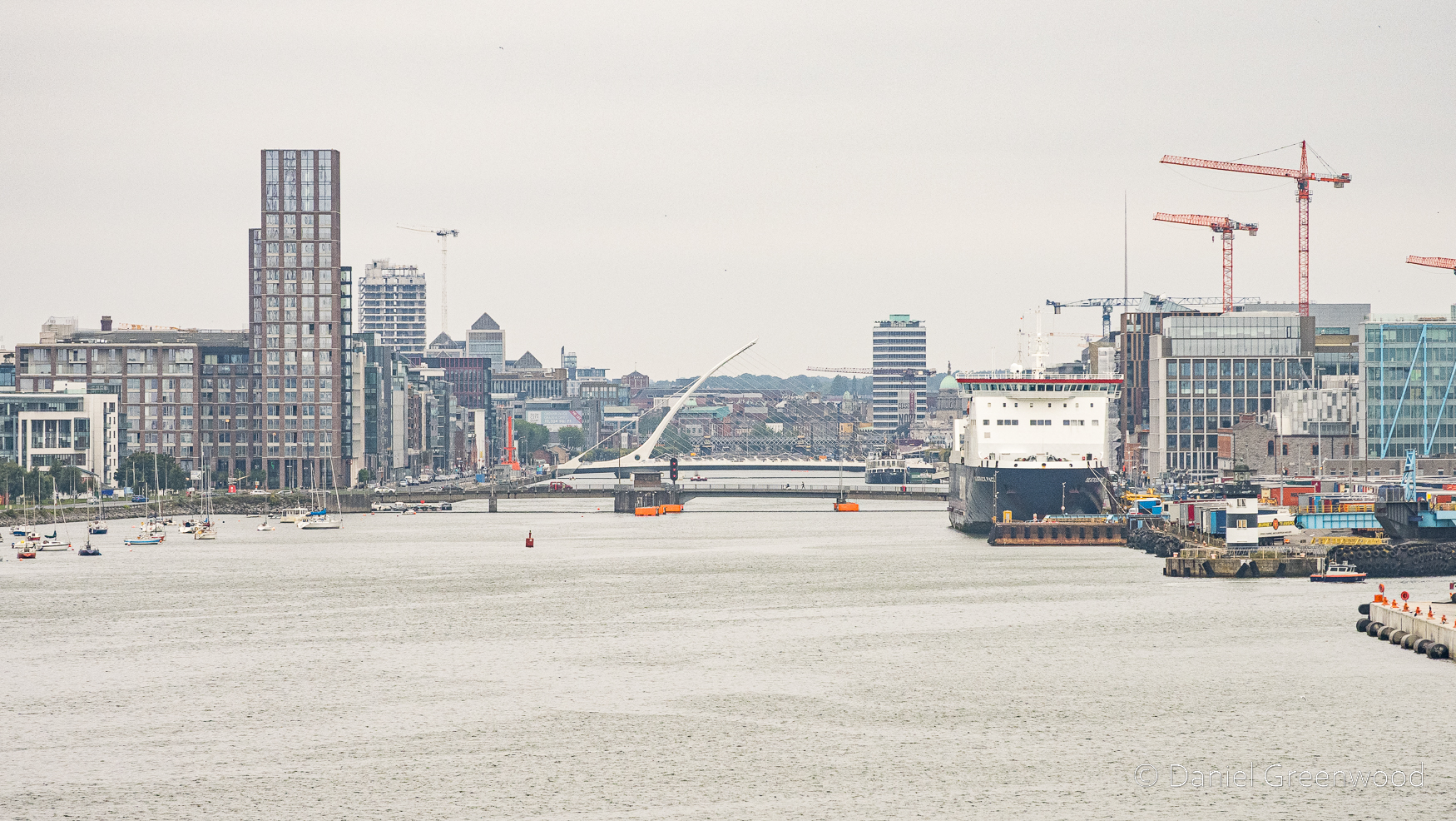
The famous Harp bridge becomes visible as the Liffey opens up. Imagine the Vikings travelling up here long ago as they first set foot in Ireland. They founded the Kingdom of Dublin.
I cropped this photo to show the ‘Ceasefire Now’ banner that covers the tower block alongside the river (mid-right). It of course refers to the Israeli military’s military campaign in Gaza, which has killed 70,000 Palestinians as of 2026.
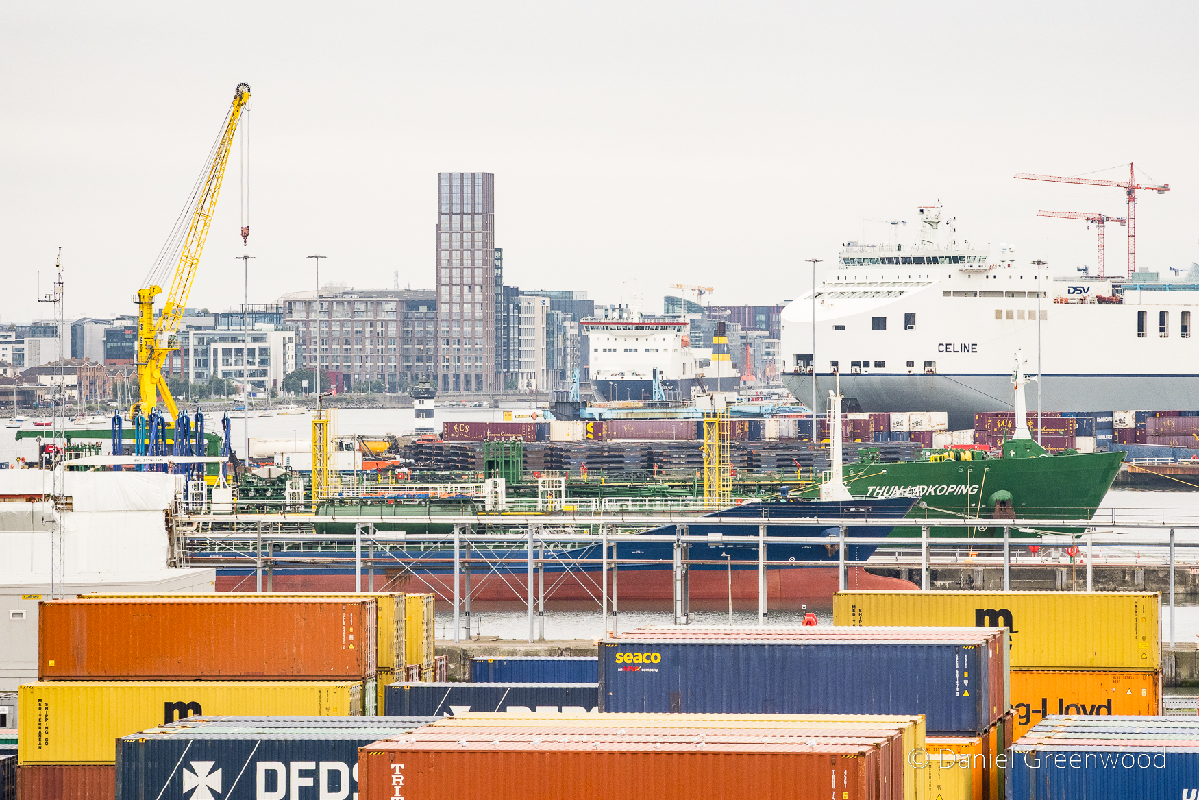
I think this ship goes to either Rotterdam or Antwerp. Rotterdam is one of the most important ports in Europe, especially for British and Irish shipping (more about that in the Irish History Podcast episode about the port).
My London-Irish uncle Jimmy (and reader of this blog, I think) shared a memory about these cranes:
‘One Halloween we were arriving at the port on a Stena boat and the crane was very busy at the dock picking up containers, but the crane driver had time, as we passed, to switch on his microphone and do a very creepy Vincent Price type of accent, and announced: “welcome to Dublin”. It was very funny’.
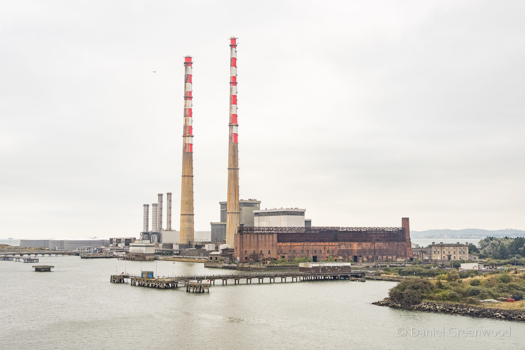
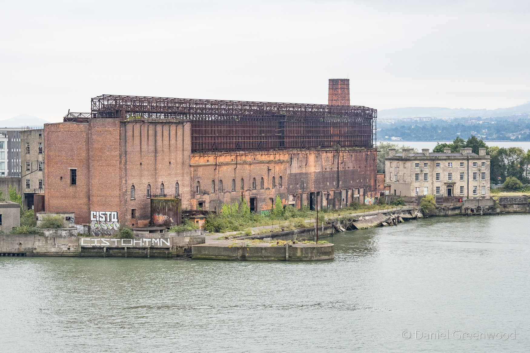
These iconic towers are known as the Poolbeg Stacks. You can see Pigeon House on the right.
Pigeon House was a hotel and today is available for use from the Dublin Film Office. It dates to the late 18th century:
The hotel did not last long for after the 1798 Rebellion, the area was transformed into a military fort, the Pigeon House Fort. The hotel building was converted into the officers’ accommodation within the fort, which then grew over the next hundred years to include an armory, a hospital, and trenches crossed by drawbridges.
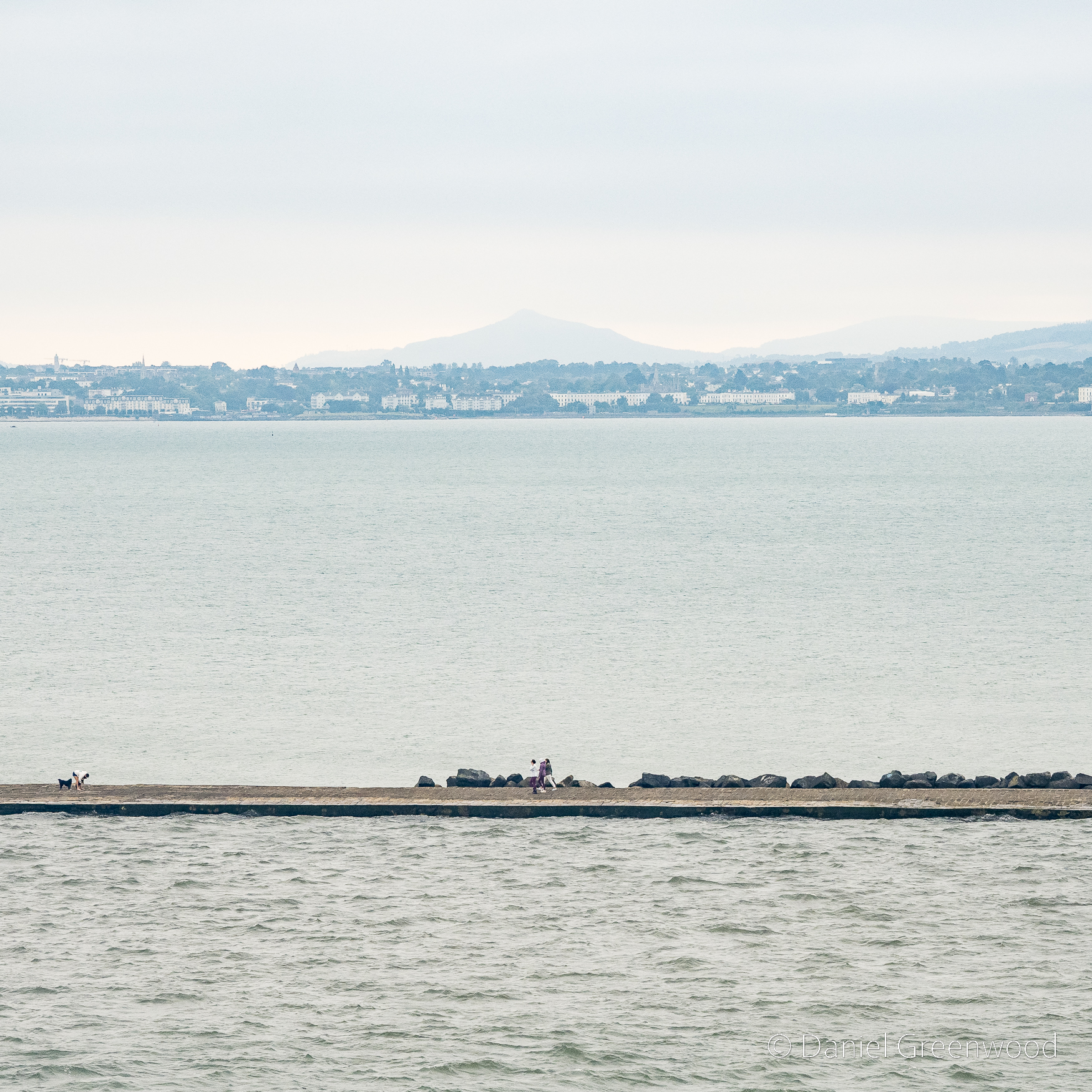
The Great South Wall’s construction began in 1717 to make the mouth of the Liffey suitable for shipping. Dublin Bay is sandy and the Liffey had problems with silting up, which didn’t allow for larger ships to move close enough inland to easily remove cargo and people.
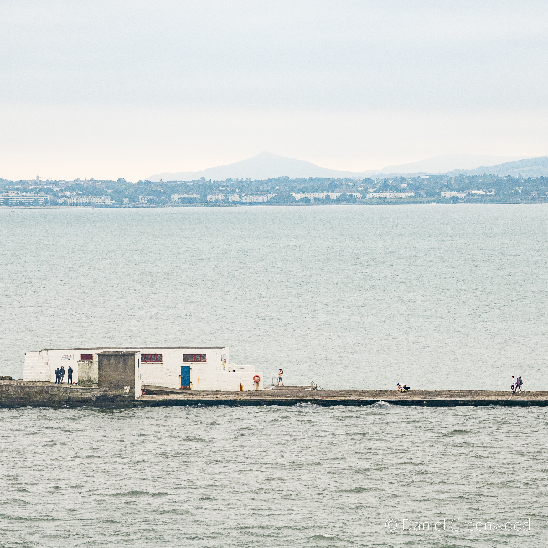
The visibility wasn’t good on the day, but the Great Sugarloaf mountain was visible over in Wicklow. I asked a friend from Bray, south of Dublin, if he had any info to share about the mountains there. His reply:
‘We used to climb it every New Year holidays when we were young. It has a sister mountain called the Little Sugarloaf. But I’ve never been up that one, cause Dad accidentally took us up the bigger one when we were little and never bothered to go up the smaller one’.
There’s quite a lot happening here. From the left three people huddle behind the wall, someone in swimming trunks on the other side, and someone crouching down to their dog.
I found this 18th century picture of the Wicklow mountains and Dublin Bay, and possibly even the site of Dublin Harbour (as stated in the caption of the painting) before its modernisation.
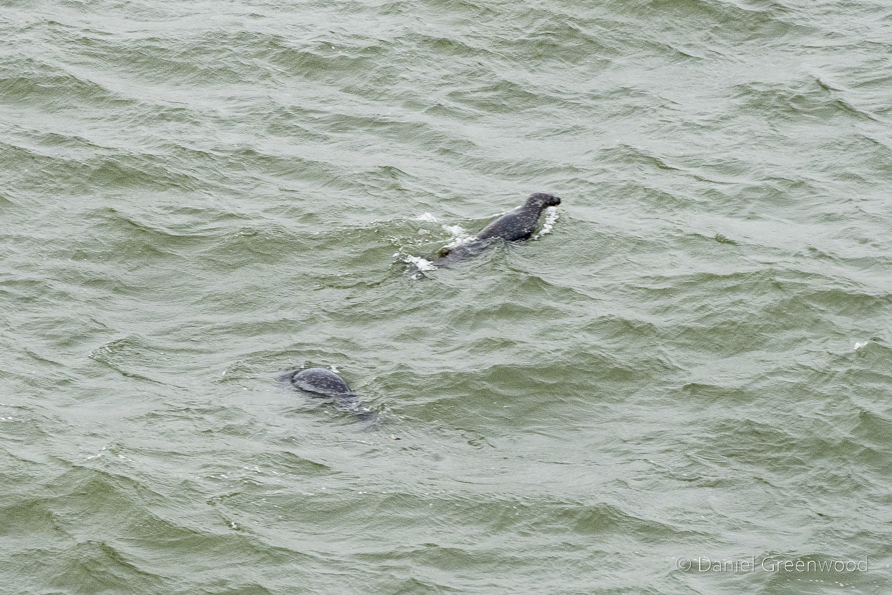
Inside the South Wall still I got this somewhat blurry shot of two Atlantic grey seals. They are supposed to be coping well despite the major upgrades to the port. Seals appear in Ulysses:
A voice, sweettoned and sustained, called to him from the sea. Turning the curve he waved his hand. It called again. A sleek brown head, a seal’s, far out on the water, round.
James Joyce, Ulysses, p. 29 (1960)
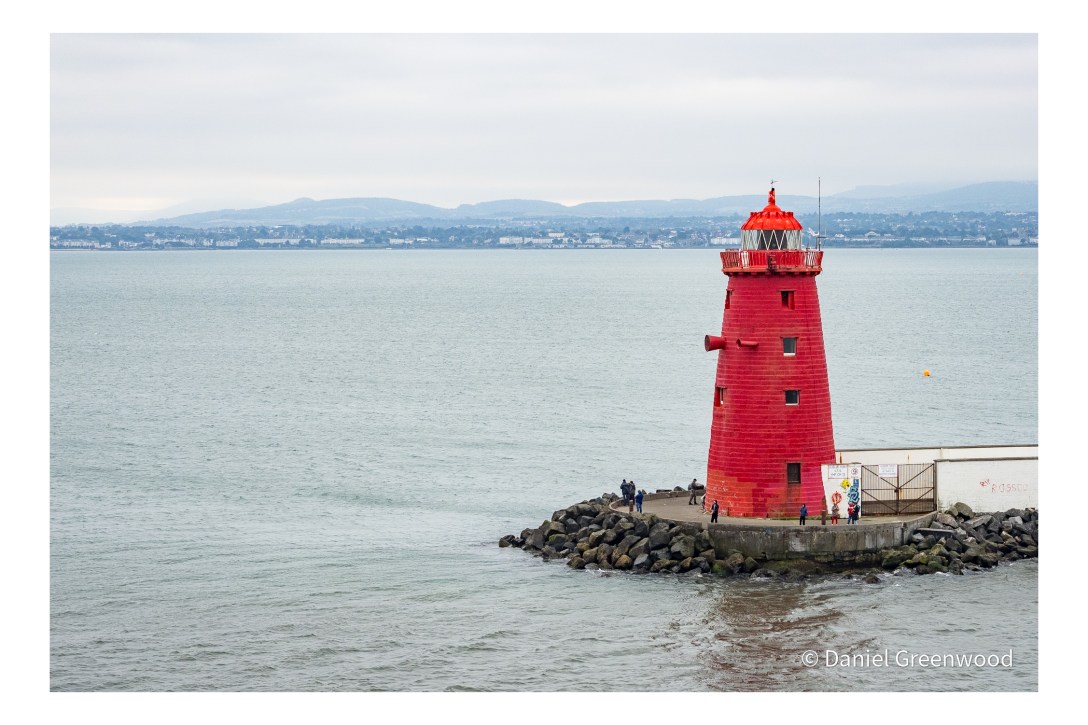
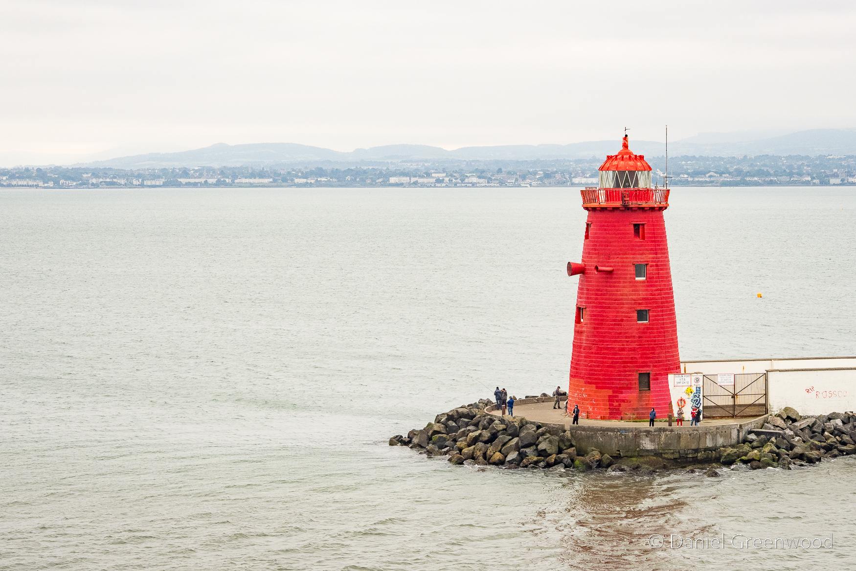
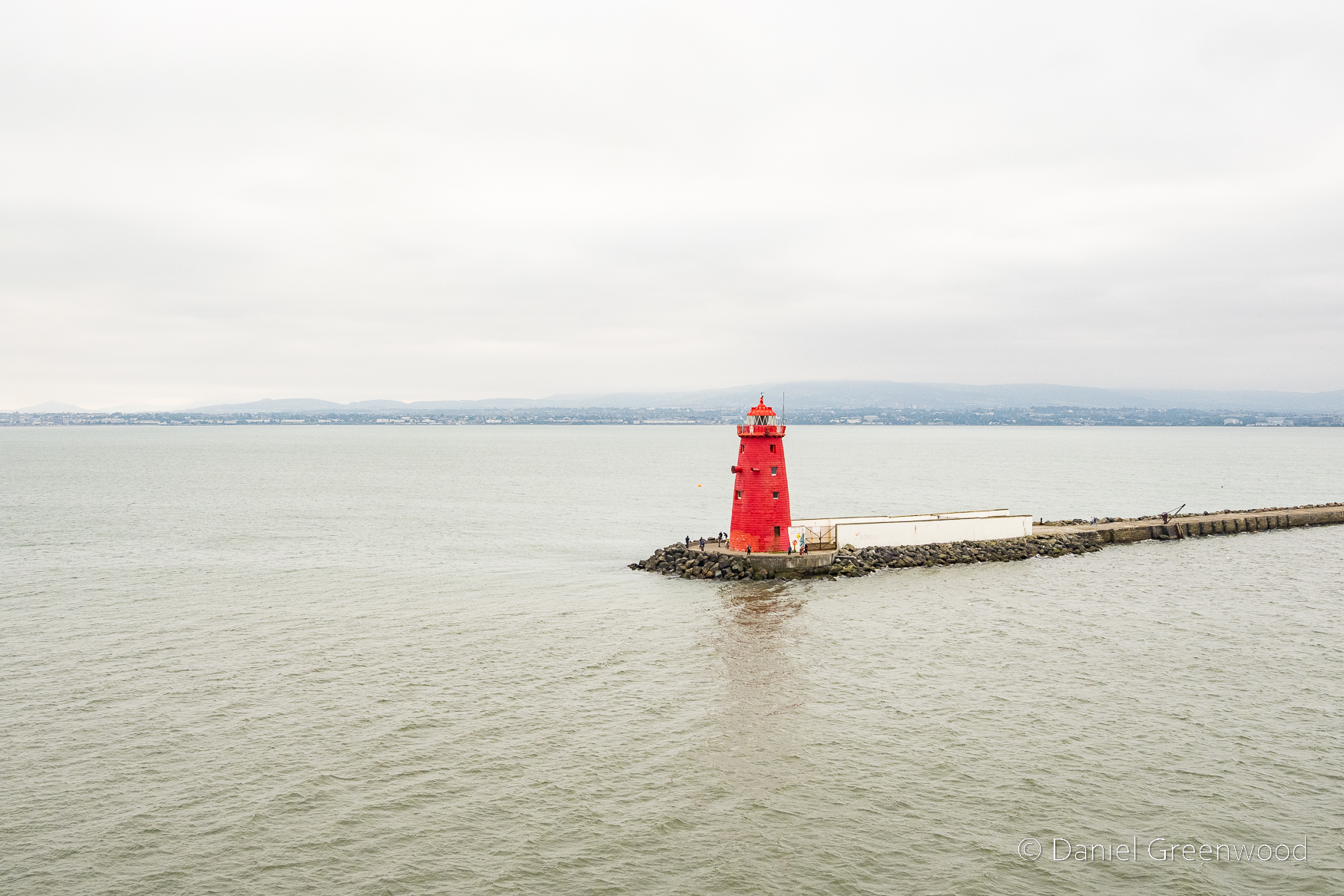
At the end of the Great South Wall the Poolbeg Lighthouse is impossible to miss, which I suppose is the point! A lighthouse was first here in 1767 and the current lighthouse was built in 1820.
Ciao for now, Poolbeg Lighthouse.
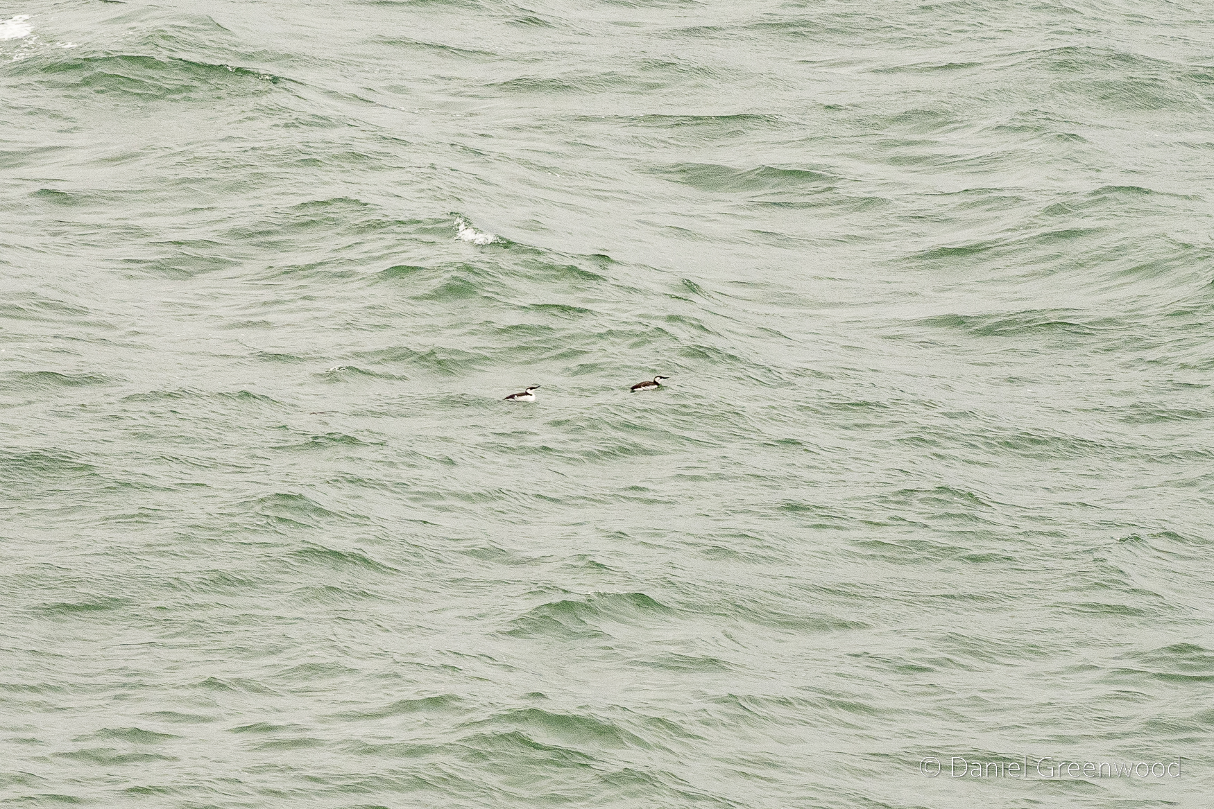
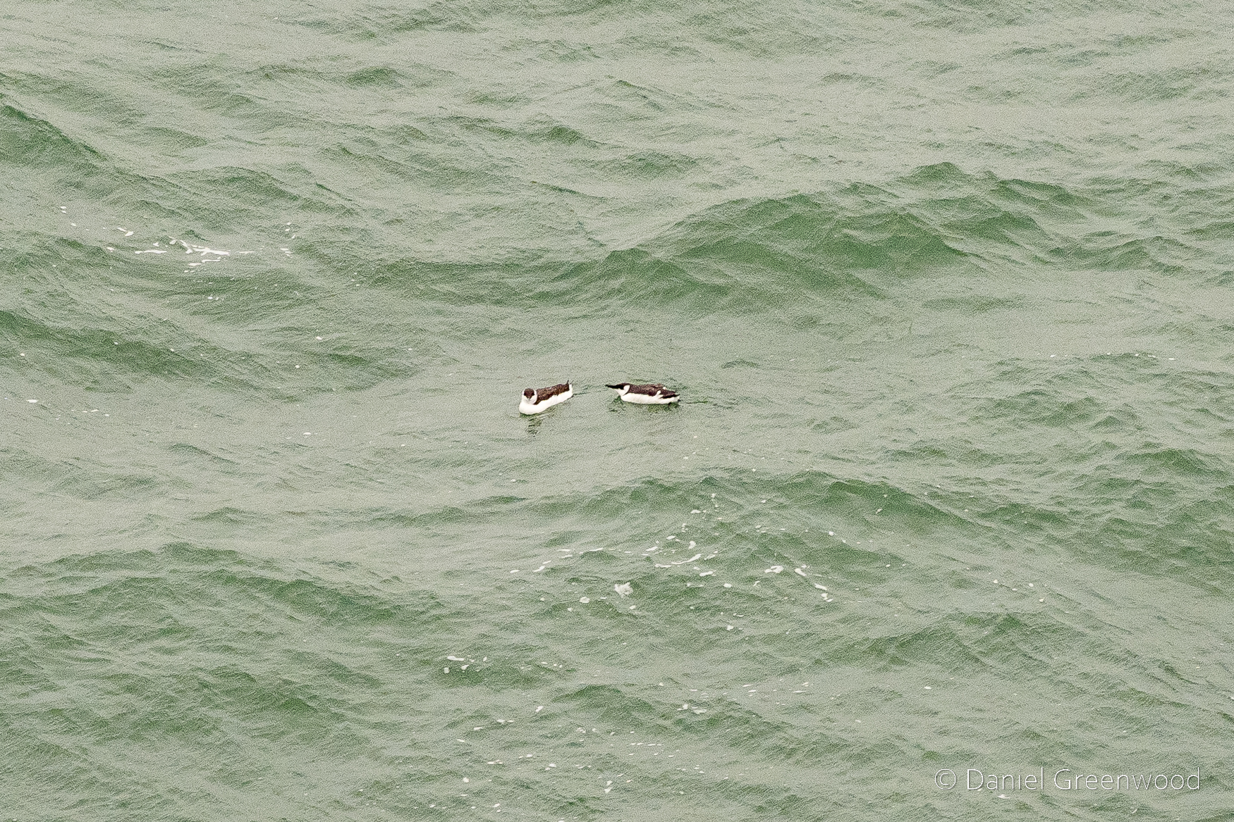
Passing out of Dublin Harbour and entering Dublin Bay proper, little auks were floating on the surface of the sea. Is there any more difficult form of birding than sea-watching?
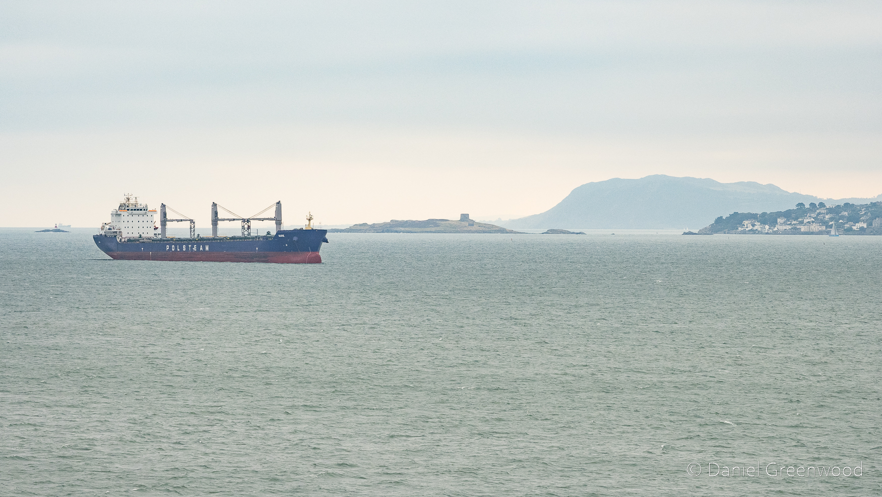
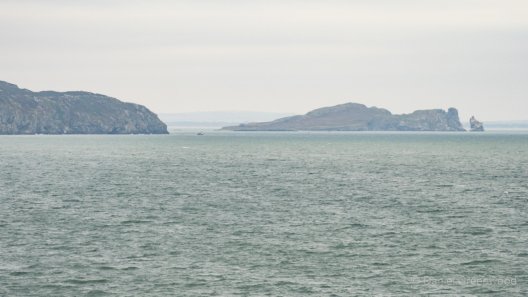
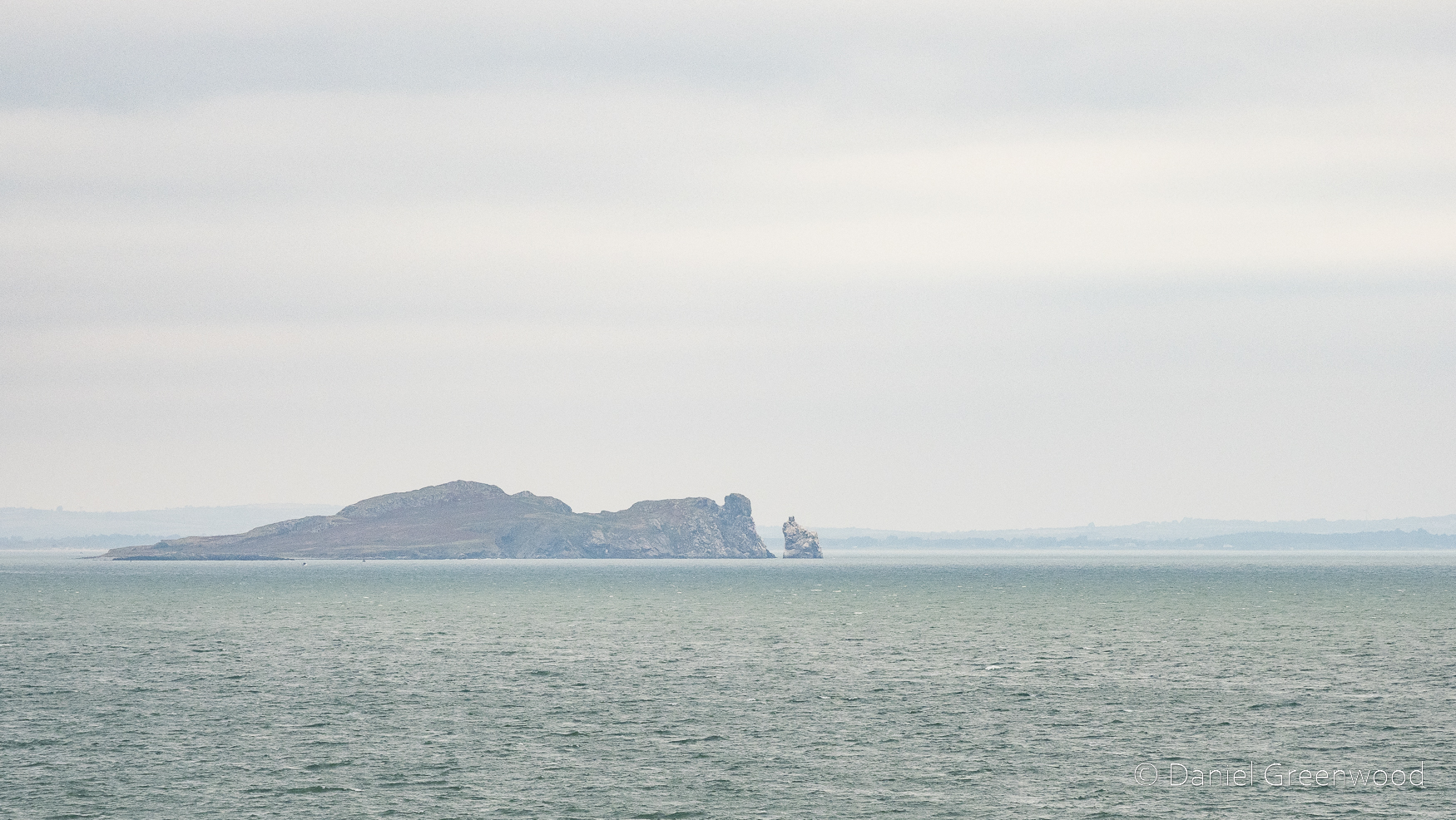
Beyond the Polsteam ship is Dalkey Island to the south-east of the port. You may not be surprised to read that Polsteam is a Polish shipping company.
The little building on the island is the Martello Tower, a building apparently constructed by the British to repel French invasion during the French Revolutionary Wars of the late 18th to early 19th centuries. Dalkey Island appears to be littered with archaeological and historical artefacts. In the distance is Bray Head, which Joyce describes in the early pages of Ulysses:
They halted, looking towards the blunt cape of Bray Head that lay on the water like the snout of a sleeping whale.
James Joyce, Ulysses, p.14 (1960)
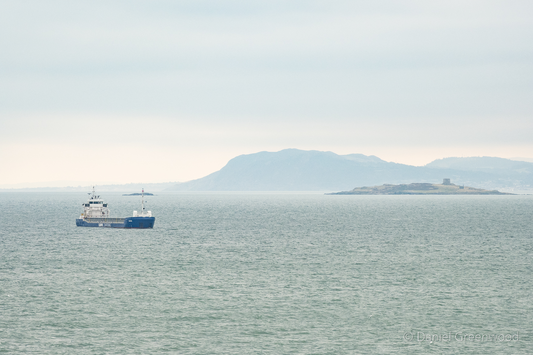
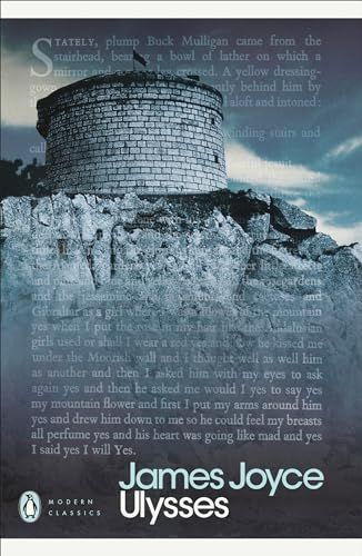
The Martello Tower in my photos is not the same as the one featured in Ulysses. I thought I recognised the shape, actually, and it was because of this Penguin Modern Classics front cover being lodged in my mind as a book I needed to read! This is now known as James Joyce Tower and is found in Sandycove on the coastal mainland of Dublin.
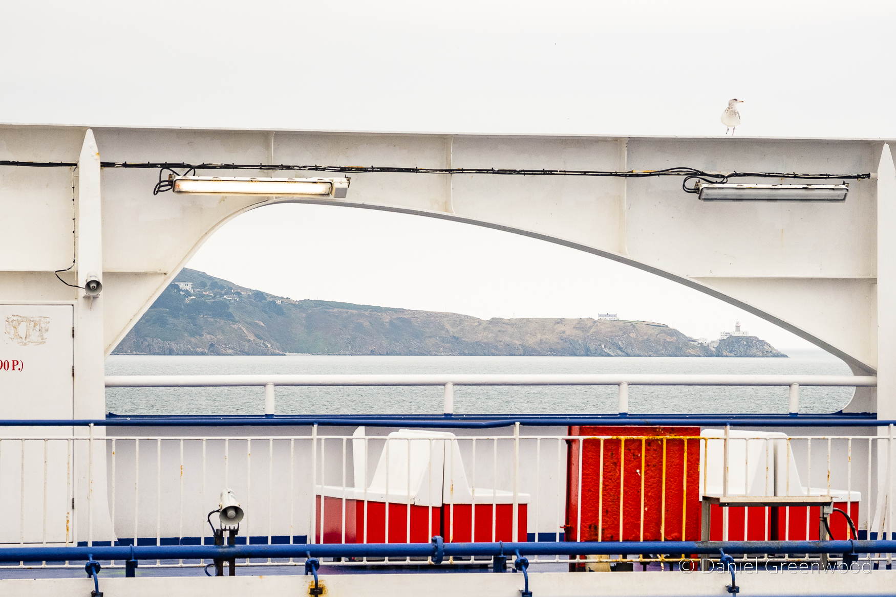
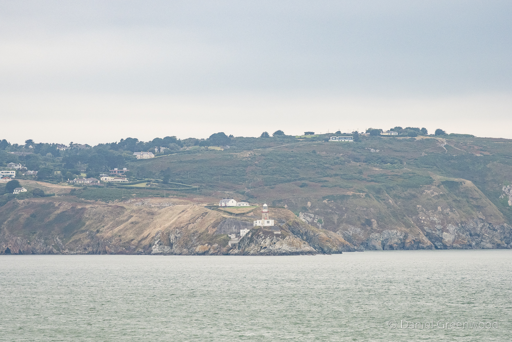
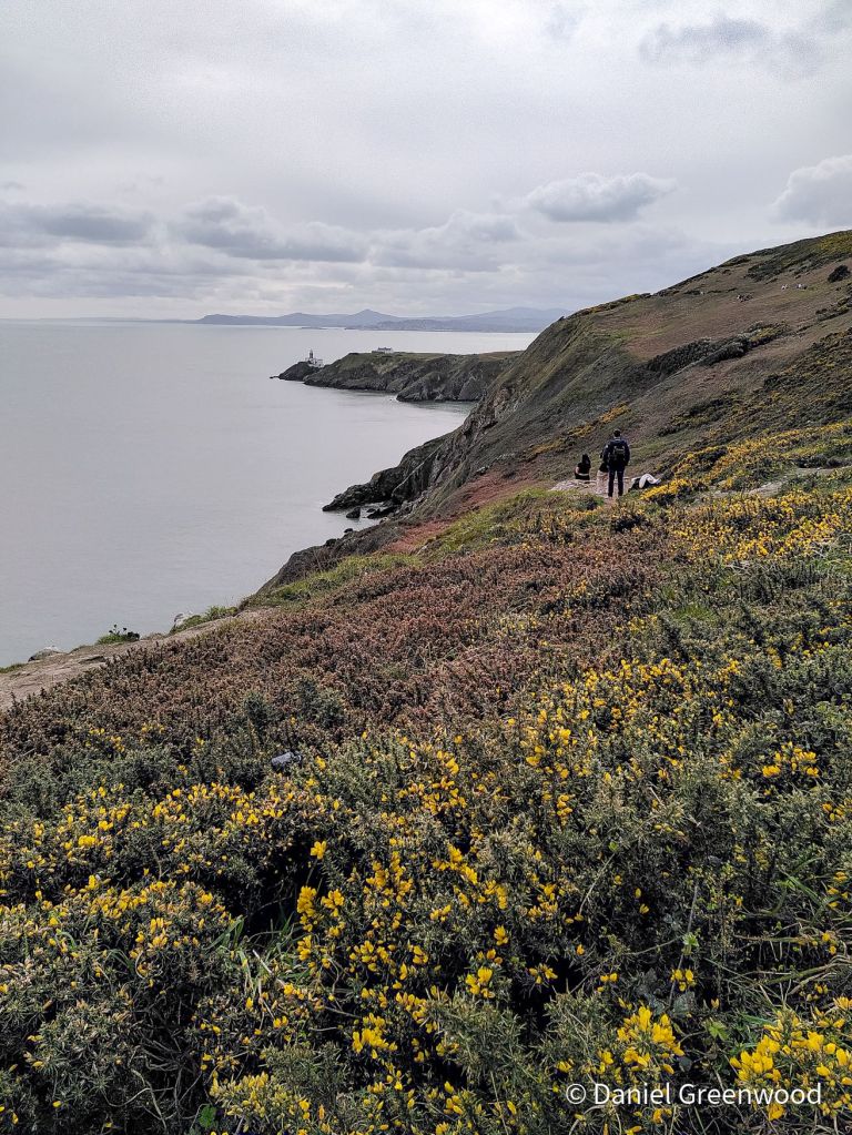
I switched to look north toward Howth on the other side of the deck. The ‘spit’ of Howth’s Great Baily was framed so nicely by the arch of the ferry, with Baily Lighthouse at the tip.
A more advanced view. A lighthouse has been on the site since 1667.
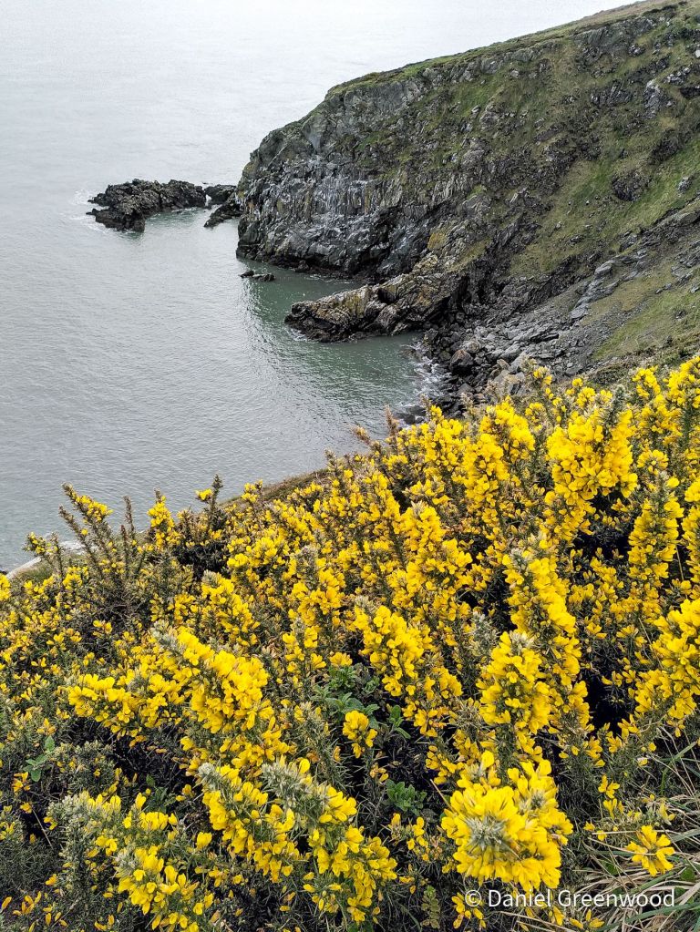
I visited Howth during my stag weekend in earlier in 2024 and did the cliff walk with friends and family. How sophisticated.
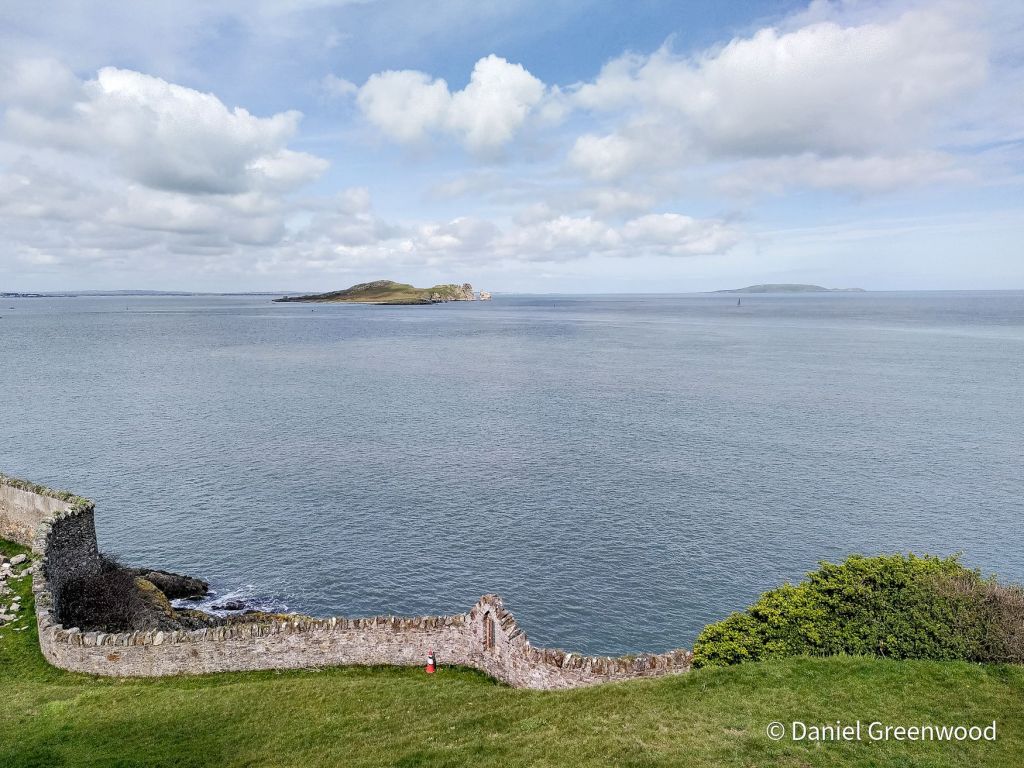
Ireland’s Eye is an uninhabited island that hoves into view beyond Howth as the ferry journey progresses. It’s part of the Dublin Bay Special Protection Area (one of the highest EU designations for nature) and is important for its breeding seabird populations and plants.
You can read the management plan if you’re into ecology PDFs.
Ireland’s Eye visible from the coast of Howth in better weather in March 2024, when I didn’t know what it was.
And that’s where this story ends (we made it to Holyhead, don’t worry). Keep an eye out for more Irish coastal blogs in the coming months, but those will be on the Atlantic coast of Ireland.
Here’s a short video of the ferry leaving Dublin Bay in better weather.
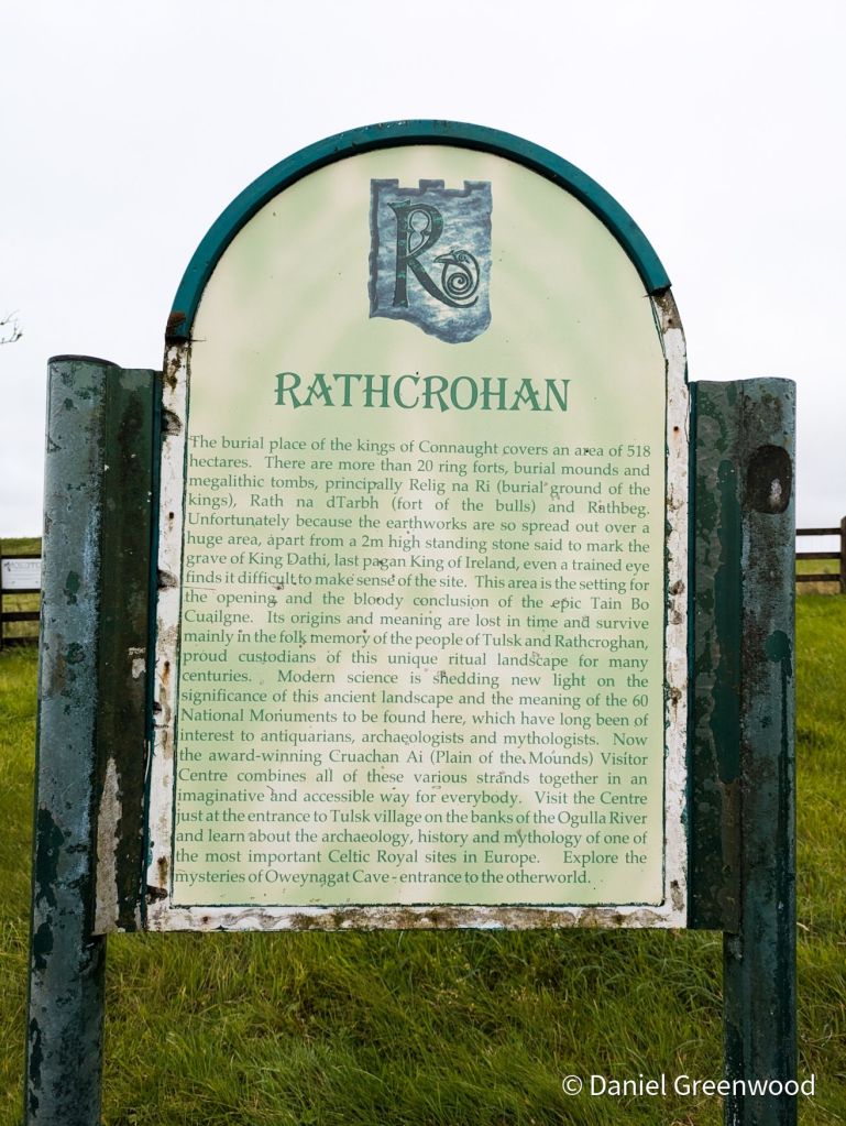
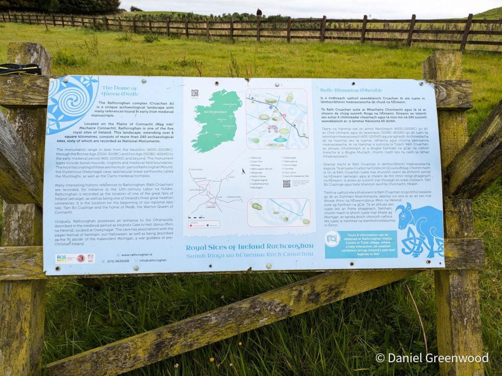
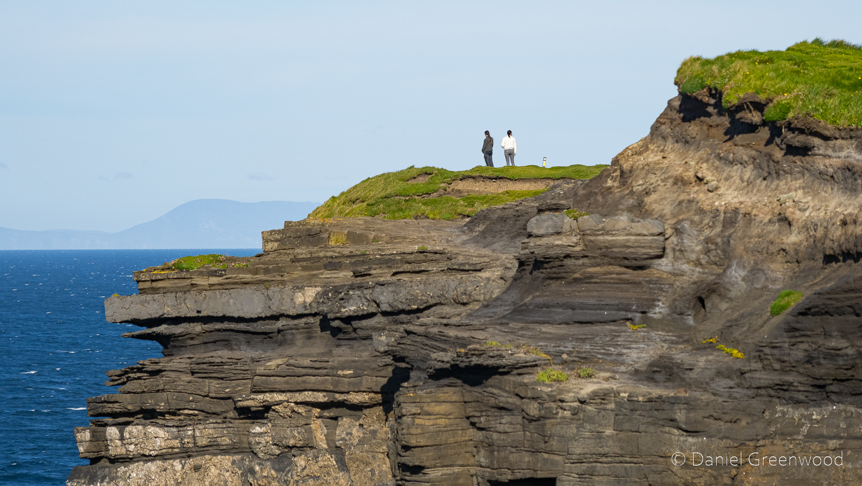
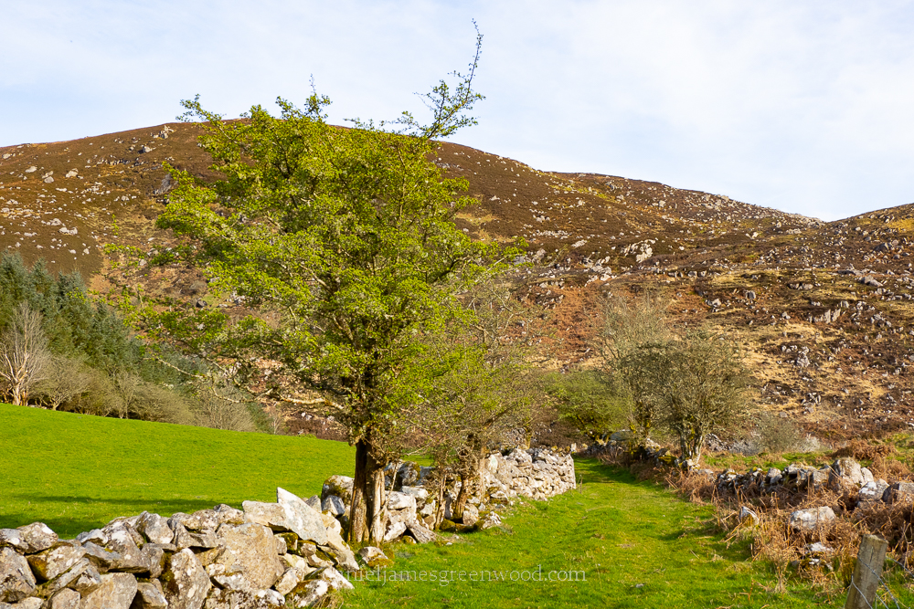
This short post shows some of the images I snaffled from a pit stop at the ancient Celtic landscape of Rathcroghan, while travelling from Mayo to Dublin.
Apologies if I mangle any of the Irish mythology, it is not a subject I’m at all familiar with.
Rathcroghan is one of the most significant archaeological and cultural landscapes in the whole of Ireland, and has influenced western culture in surprising ways. I definitely hope to go back to visit the museum and explore more of the landscape itself.
Rathcroghan, Cruachan Aí, is known as the Ancient Capital of Connacht, where the festival of Samhain (Halloween) is said to originate. This majestic landscape is the oldest and largest unexcavated Royal Site in Europe.
The modern Halloween is inspired by Samhain, an Irish festival taking place on the evening of 31st October to sundown of 1st November. It could be a product of Rathcroghan folklore. Samhain celebrates the end of the harvest period and the beginning of winter. It’s celebrated on the evening of the 31st October because Celtic days begin and end when the sun goes down.
The story goes that every 31st October at nightfall monsters would emerge from the cave to kill livestock. It’s a time when the living world and that beyond death was at its closest (something you also hear about the Winter Solstice).
The cave is said to be “Ireland’s Gates to Hell”.
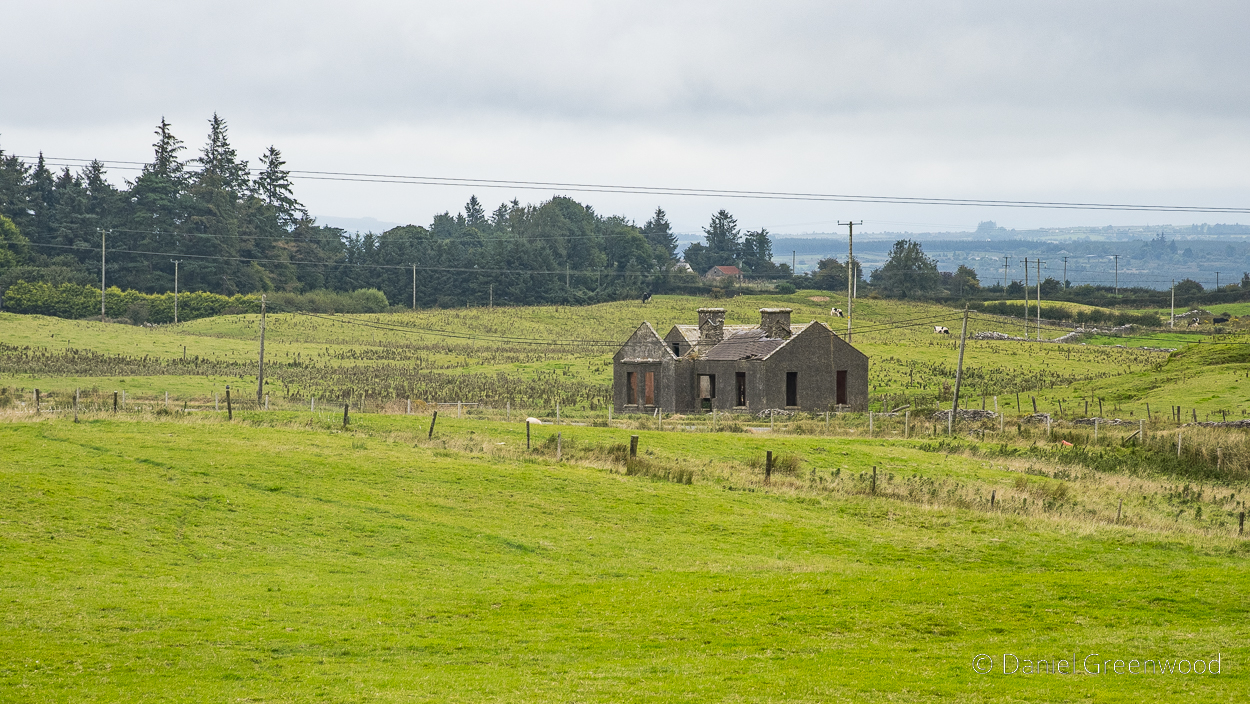
While not hellish, there is a melancholy to the sight of abandoned cottages across Rathcroghan, something that is so commonplace in Western Ireland (and which I love to see). I wonder if this cottage has older parts to it, where the tree (willow, maybe) is growing where the roof used to be. This is a bit like seeing an abandoned house on the site of Stonehenge (something you don’t see!).
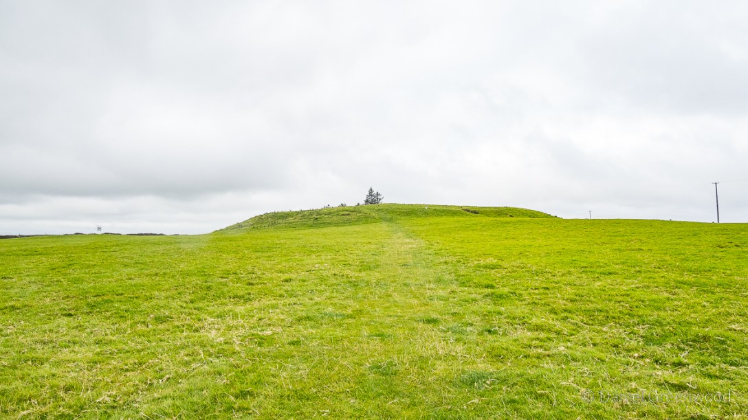
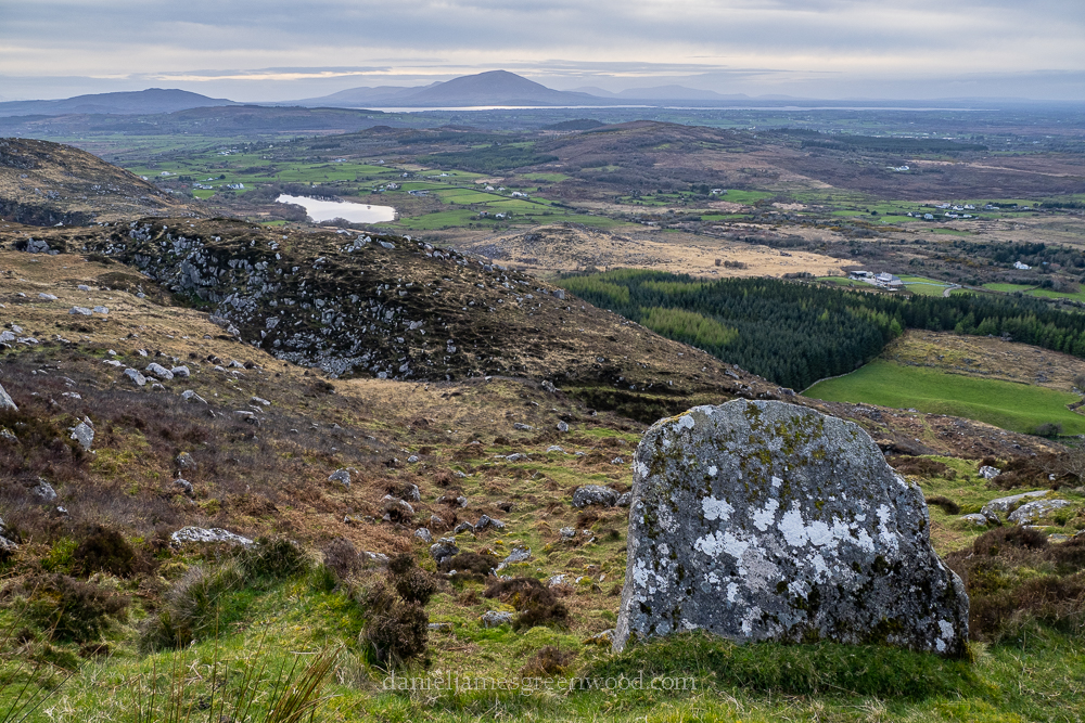
The ebb and flow of the archaeology is likely visible here on the left where the mound can be seen. The openness of the landscape shows the advantage of the location – you can see far and wide, and also be seen.
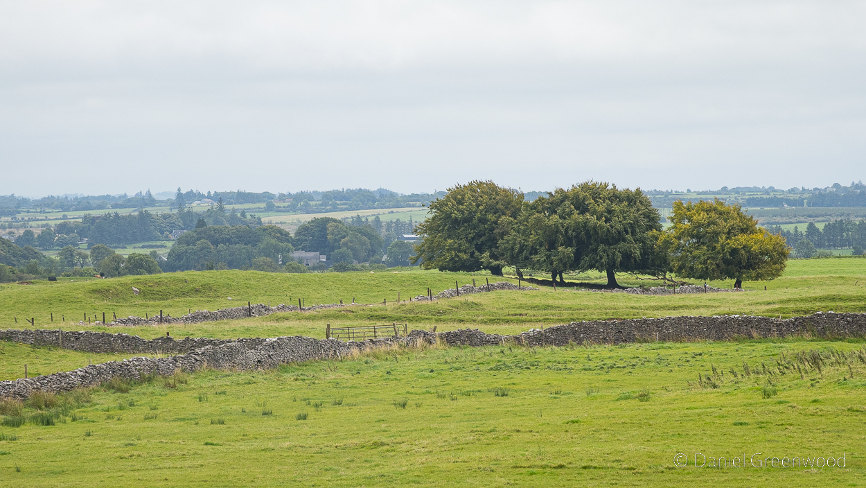
Rathcroghan is said to be one of Ireland’s most important Pagan cemeteries. The visibility of the site reminds me of the South Downs, and how one archaeologist once described it as a hundred-mile-long cemetery, visible to all in the valleys below.
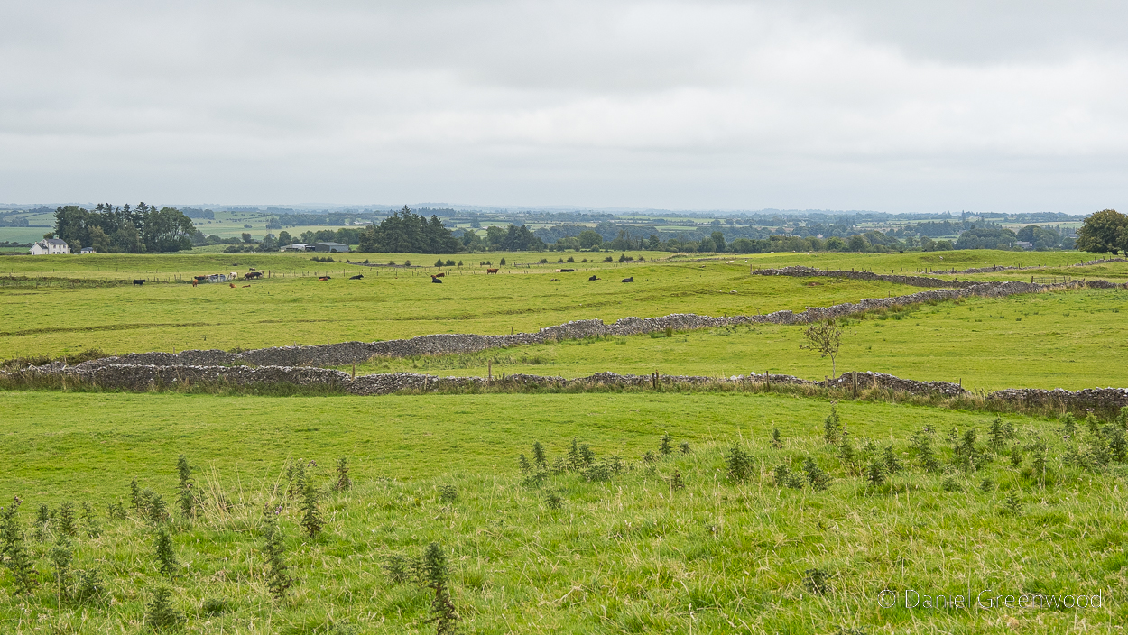
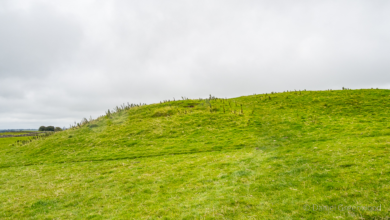
I don’t know about the age of the stone walls but presume they are post-medieval. You can see the land is farmed with cattle. The nettles in the foreground are the lip of the Rathcroghan Mound – seen in the next image.
The Ancient Capital of Connacht
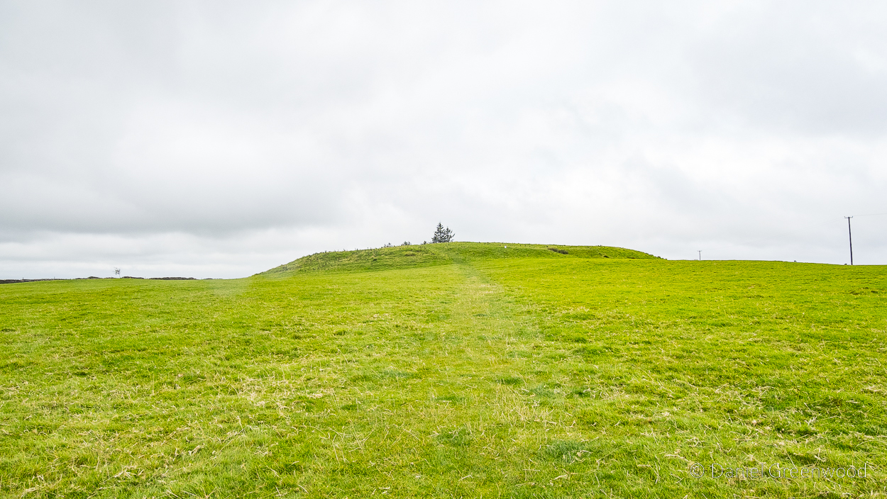
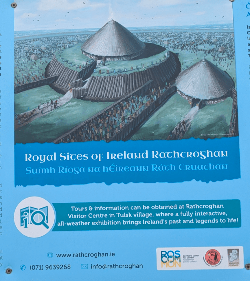
The Rathcroghan Mound has lost a lot of its grandeur over the millenia, but it still has an allure. And that’s coming from someone who knows very little about the history of the place.
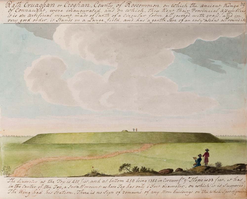
Apparently the mound looked like this in 1779 – which is quite hard to believe!
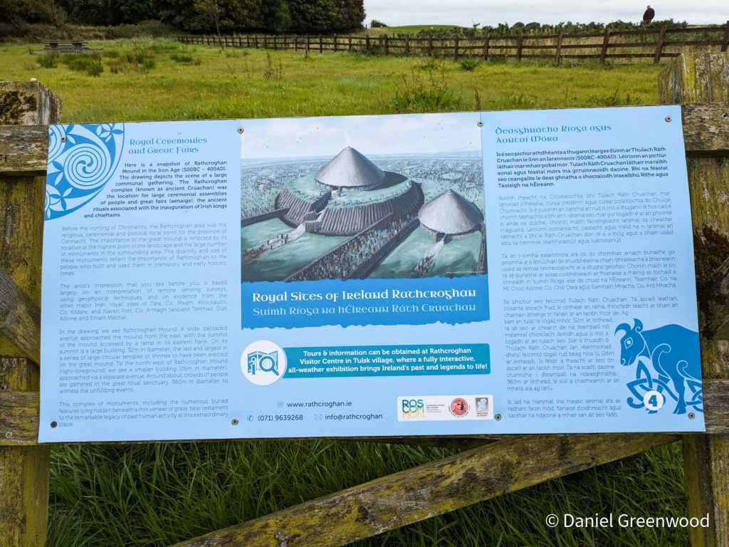
Now that’s more like it! For those who don’t know, Connacht is today one of Ireland’s four provinces which includes Mayo, Galway, Sligo, Leitrim and Roscommon. In ancient times it was a Kingdom. The ancient Kingdom of Connacht’s capital (until it was abolished in 1451) was Rathcroghan. People would have travelled from far and wide to visit Rathcroghan, having been described as home to one of the “great fairs of Ireland”.
Not anymore, unfortunately. Everyone’s at home watching short videos on their phones.
The desire-line that people take up onto the Mound can be seen through the centre-right of the image. The diagonal line is probably a cattle path.
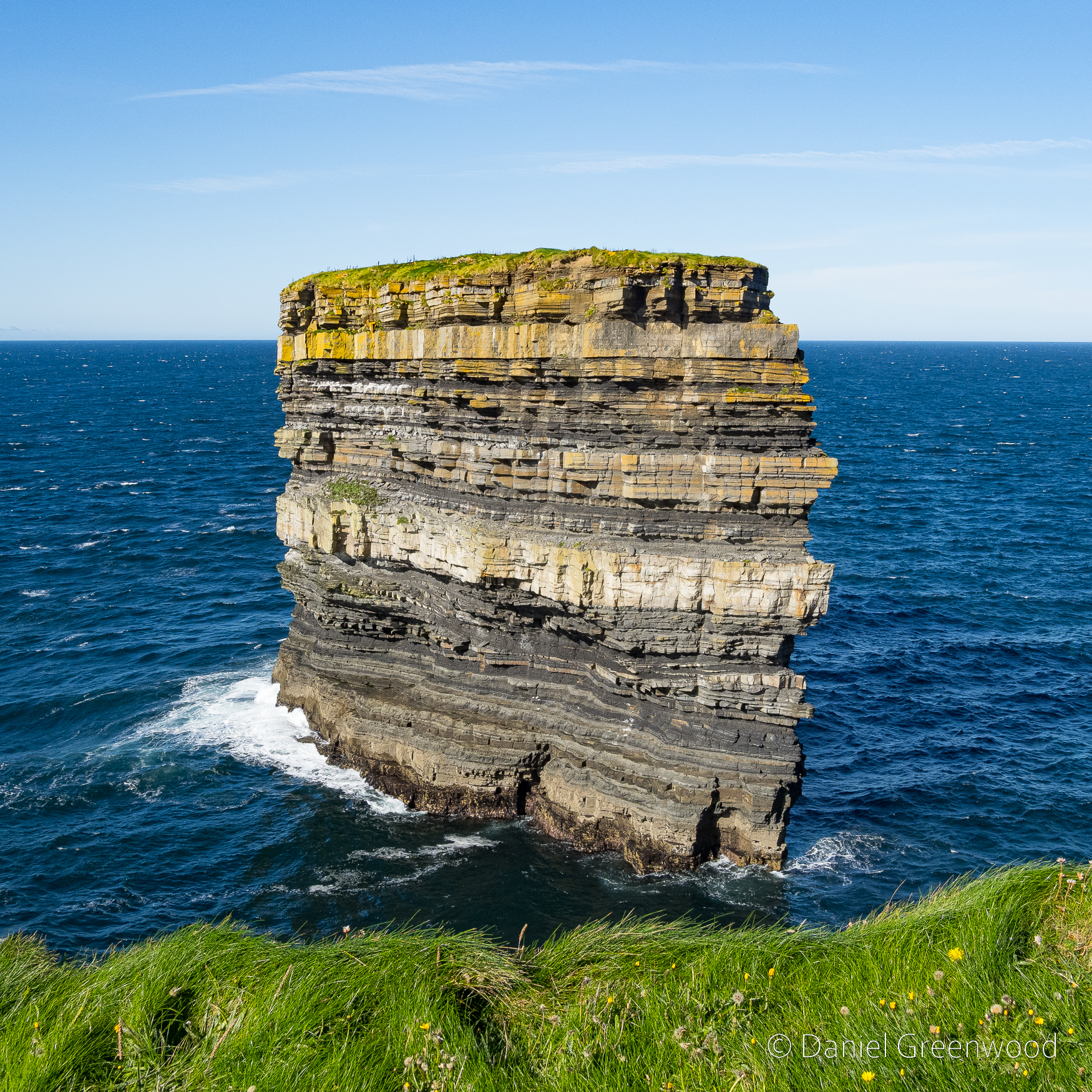
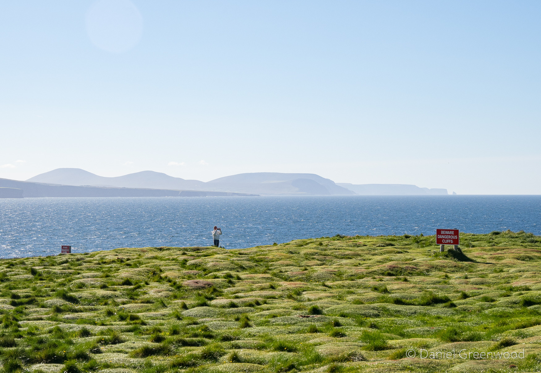
In September 2024 me and my mum drove to an area of the North Mayo Coast I’d never been to but had been hoping to visit for a while – the site of Dún Briste, otherwise known as Downpatrick Head. It’s the location of the iconic ‘sea stack’ that has become isolated from the mainland, apparently thanks to St. Patrick himself.
To get to Downpatrick Head you take the Wild Atlantic Way, the name for the road that wends its way around the Atlantic coast of Ireland.
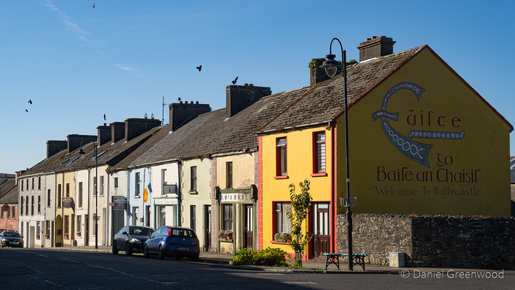
You pass through the village of Ballycastle on the way. The yellow house on the corner reminds me of the Ireland we visited as a family in the 1990s, especially around Cork. The birds on the roof are jackdaws.
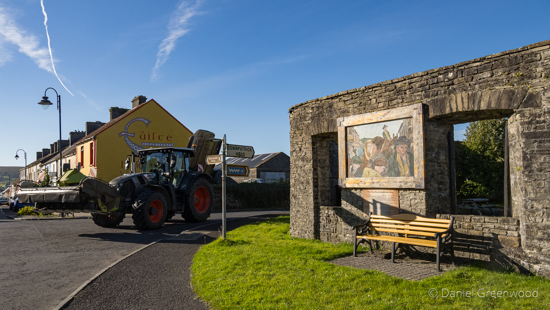
A tractor came roaring around the corner when I took this photo of ‘the Shambles’. It was once a market place and slaughterhouse that became a British military site temporarily during British colonisation (approx. 1500s-1931) in the 1800s. Don’t worry, it’s a picnic spot now.
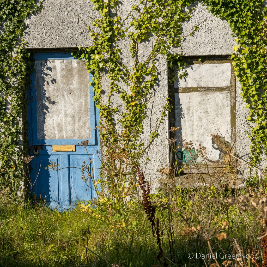
Ballycastle was home to this charming scene of an ivy-covered cottage, complete with cat and teapot.
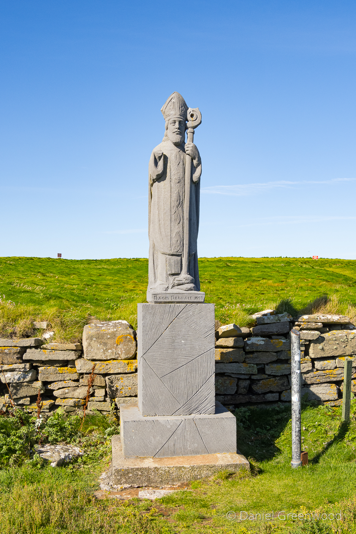
Fast forward a few miles, beyond the car park and up the hill towards Downpatrick Head, the statue of St. Patrick (Ireland’s Patron Saint) was installed in the 1980s. St. Patrick is said to have founded a church here, which the statue marks the site of.
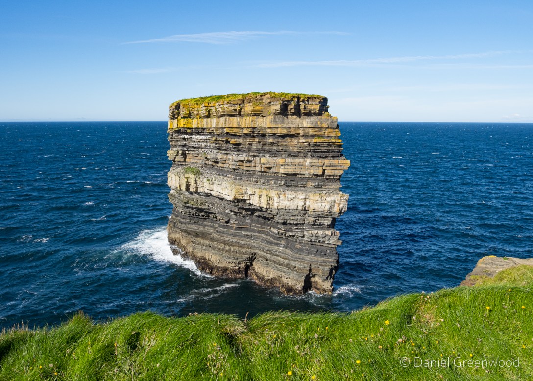
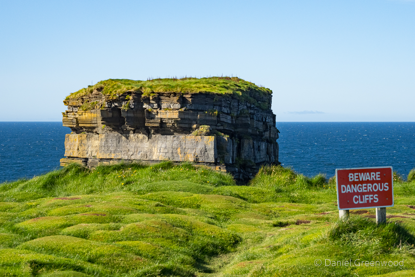
Dún Briste or ‘Broken Fort ‘ was once joined to the mainland on north Mayo’s coastline. The ‘Sea Stack ‘ stands forty-five metres in height. Formed approximately three hundred million years ago during the Lower Carboniferous period
Geologically (rather than mythologically), the sea stack is believed to have become isolated from the mainland during a storm in 1393 that caused extreme erosion to the coastline. I think the stack looks like a stone frog emerging from below the cliff.
In 1980 archaeologists accessed the stack via helicopter and found several interesting things. The video above shows an ascent from 2016, and includes some footage of an old wall that can’t be seen from over on the mainland. I am wondering what legal protection the nesting birds have, the stack reportedly is home to puffins due to the lack of terrestrial predators.
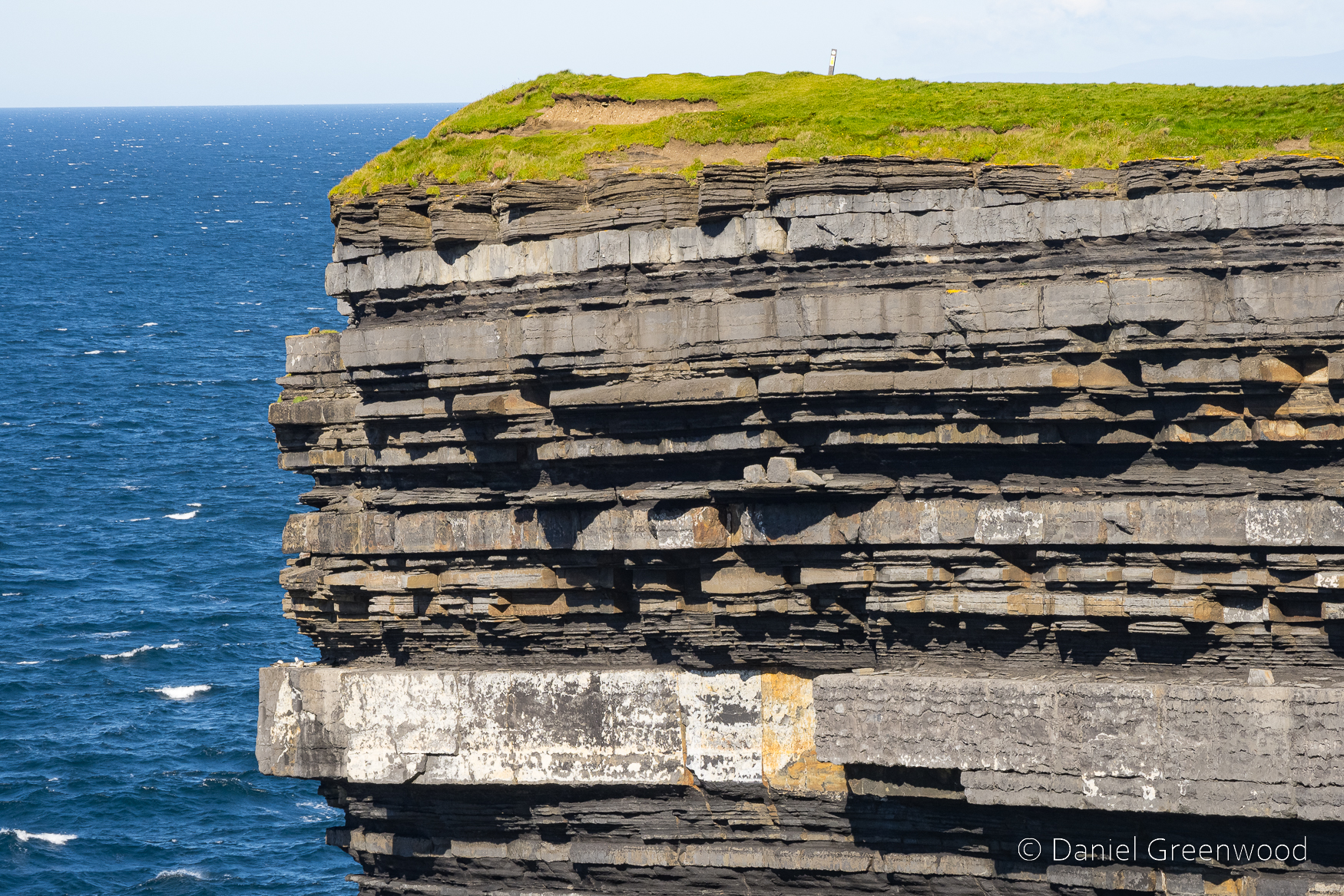
The rock strata are layered in wafer-like stripes.
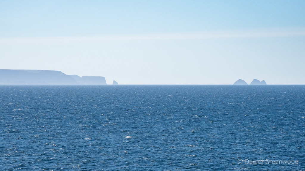
The coast to the east shows the different forms of erosion that’s taken place over the years, as the more recent soils have been hammered by wind and rain.
This person taking a photo among the strange tussock mounds reminds me a bit of St. Patrick’s statue. The coastal scene in the distance holds Céide Fields:
The remarkable neolithic site at Céide Fields in County Mayo, Ireland, contains the oldest known stone-walled fields in the world – dating back nearly 6,000 years.
A short video I filmed on my phone that shows how windy it was up there on the day the photos were taken.
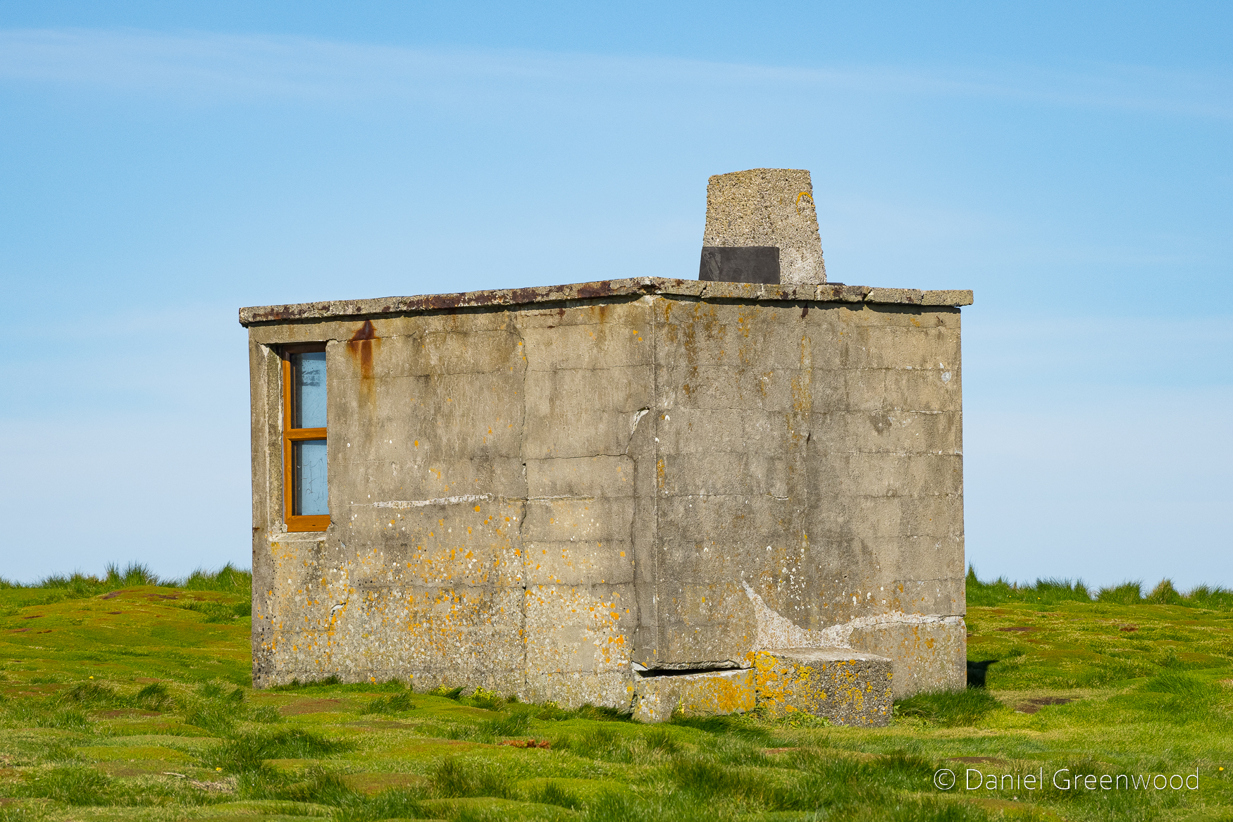
A mysterious concrete cabin, presumably for military or other coastal observation purposes.
Looking east along the coast towards Sligo and the Ox Mountains.
The golden pipes are part of an installation that allows you to safely view the sea through a ‘blow hole’ cutting into the hillside. Legend has it that the hole was created after an altercation with St. Patrick and Crom Dubh:
Crom Dubh in desperation set a fire with which to hinder Patrick. This did not go down well! Picking up a stone, the holy man hurled it in anger into the middle of the fire, sinking it deep into the earth. Today, this hole is known as ‘Poll na Seantine’ (‘Hole of the Old Fire’).
I’m back from my annual visit to the west of Ireland. I managed a couple of day trips to forage for photos, which will crystallise later this year into dedicated posts, all being well.
Like many people I enjoy the Blind Boy Podcast, none more so when I have the headspace to take in all that gets said in an episode. I listened to this hilarious one with Chris O’Dowd, including a couple of brilliant stories about rural island. Avoid if you don’t like swearing 😬
I also absolutely tore through A Star Called Henry by Roddy Doyle (1999) while away. If you need any evidence that fiction can be a great way to learn about history, this novel is it.
All the pics here are taken on my Pixel 7a (which Google tried to get me to promote FOR FREE). It’s an exceptionally good camera I think.
There’s an excellent bookshop in Ballina called Pangur Ban which you must visit and support if you’re in town.
I liked this sign and admired the blue tiles. Almost Everton blue, you might say. I don’t eat seafood though, can’t cope with it.
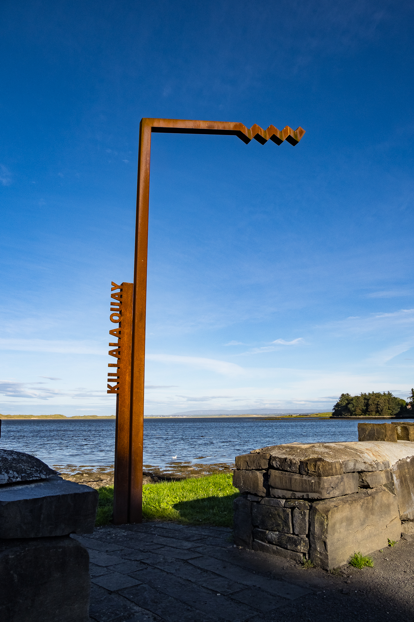
Nearby at Killala Bay I had a lovely walk along the shore. There were sandwich terns, rock pipits, oystercatchers, and curlews here (and the wind, always.) These are the beaches I love – wild and smelling of the sea. There will be a dedicated macro blog for my finds here.
Now then, the bard of Mayo Seán Lysaght has released his latest book – Unveiling the Sun. It’s a collection of more than two decades worth of short writings, describing walks and nature observations in the Nephin Beg area near Westport. I recorded a podcast with Seán exactly 3 years ago which you can listen to here (or by searching ‘Walking to Lough Conn with Seán Lysaght’ on any podcast platform).
I’ve read the first chapter (January) of Seán’s new book and I am enjoying the insight into a part of Mayo I don’t know so well but love to visit.
And just like that, here we are in the Nephin Beg mountains of Wild Nephin National Park. There’s a fantastic café here which is open in the spring and summer, closing at some point in the early autumn. I probably have a macro blog for here as well.
From Ballycroy I continued on to Achill Island, one of the most westerly points of Europe, and the Wild Atlantic Way (more a car touring route than a footpath). I tried some isolated rock and surf photos with my macro lens which I’ll share later on. I posted about Achill a few years ago.
On the drive around the island I passed this beautiful cottage with a thatched roof clinging on. I hope they’re able to repair it, which is evidently a longer term plan. Thatch is very expensive to maintain in England but I reckon there’s some local knowledge still lingering here on Achill. It’s facing the Atlantic Ocean so it has quite a lot to cope with!
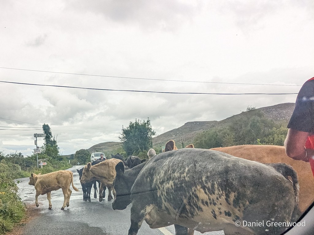
Back on home territory near the Ox Mountains I was forced to park up to allow these cattle to cross the road. I am sure that cattle have begun to replace sheep in this part of Mayo in recent years.
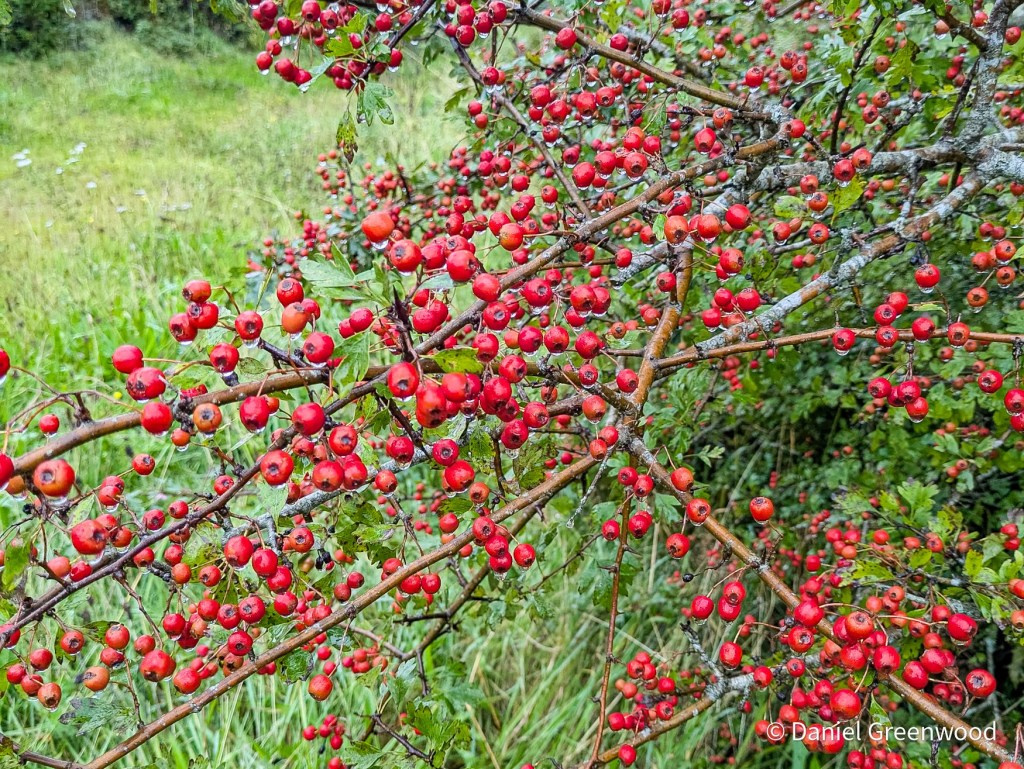
The number of hawthorn berries was amazing. This has been a bountiful year for wild fruit.
The bramble has had a very good year as well, creeping through doors opened by winter storms.
I saw quite a lot of red admirals around.
My aunt sent me a photo recently of a green-veined white where she lives in Mayo, and I saw plenty myself. In Sussex there have been lots of large whites this year, but in Ireland the green-veined were by far the more common pierid.
On the evening before I came home, I went out for a walk along the mountain path and found these huge moth caterpillars. They are buff-tips, the ones that look like broken twigs when they are adult moths. It was a highlight of the trip actually, watching these massive caterpillars munching on willow leaves.
2025 will be a year of catching up on last year’s photos. 2024 was a really busy year of travel and life events after the fallow pandemic years (2020-22).
I was in Dublin in March 2023 for – you guessed it – my stag weekend. It was more a spiritual visit, made by ferry, rather than an idiots’ weekend away. This post wouldn’t have been possible without my best man Liam’s work in booking the boat tour, the only one on the river.
For the visit I took my Olympus TG-6 Tough compact camera, but didn’t take photos as raw files so these are edited jpegs, which is obviously a crime against photography. The images from the water are taken through glass, so they have degraded even more (you probably won’t notice). The light was nice though, and image quality isn’t everything.
Passing the Liffey is carved into my memories of Dublin having travelled so many times on the ferry, across and along the river in the car after disembarking. It’s also where my parents bought me my first Everton shirt in 1995.
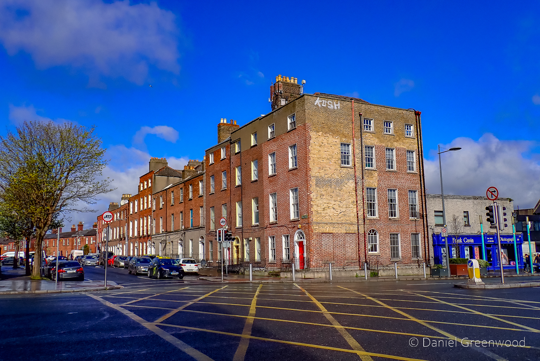
We were staying on the north side of the Liffey, the older part of Dublin.
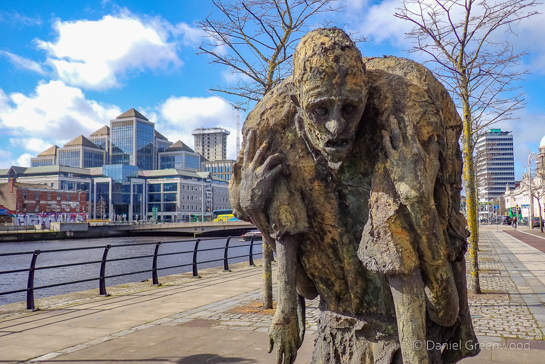
Who doesn’t like some unofficial street sculpture – if it’s fly-tipping that’s obviously different. Now for a handbrake turn:
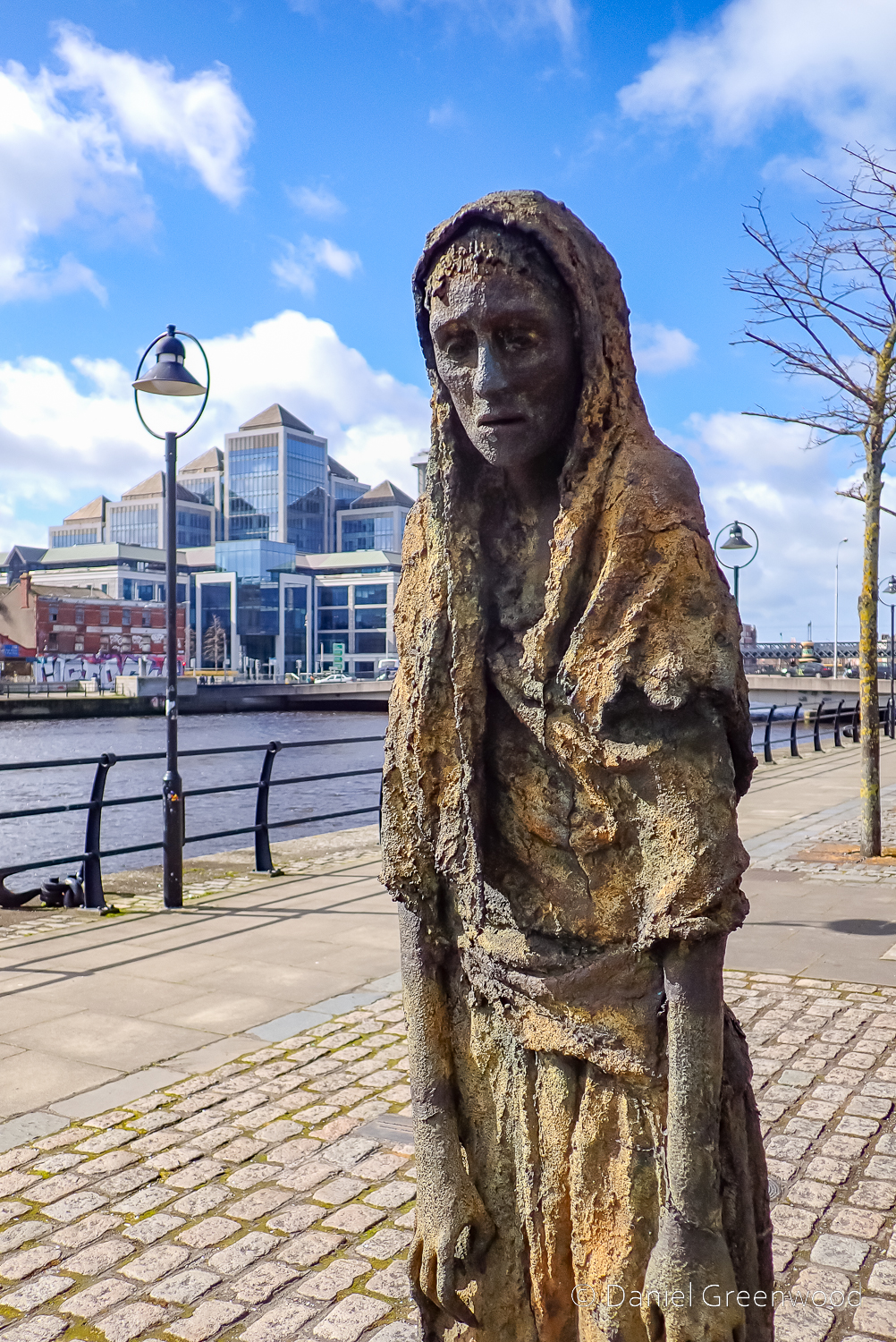
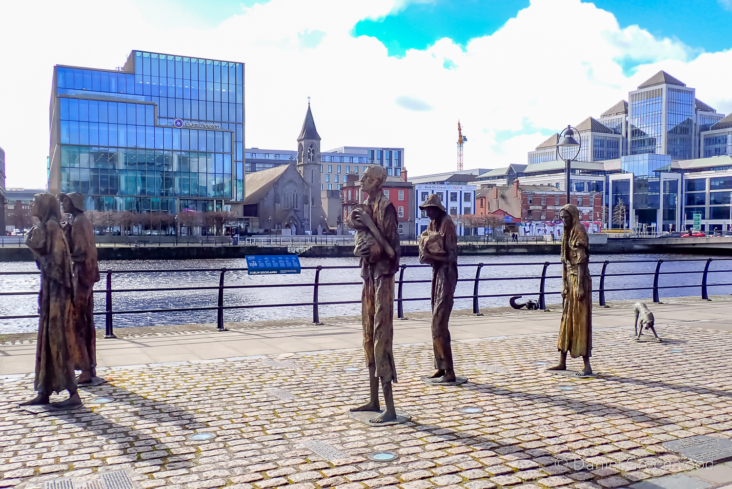
The Famine Sculptures are one of the most striking installations along the Liffey. They act to remind us of the millions of people forced to emigrate or leave their homes during the Great Famine (1845-49). It is a shocking event in British and Irish history and too few people in Britain are educated about it.
I don’t mean that from a place of “victimhood”, as one true British patriot put it to me once. It’s just that I’ve come to appreciate that the understanding of Irish history is very poor in Britain. Irish history is British history, too. There is so much more we could have learned in school about the role of the British Empire and how it explains the country we find ourselves in today.
On a lighter note, this Saturday Night Live sketch with Paul Mescal poking fun at those of us with ‘Irish ancestry’ is very funny:
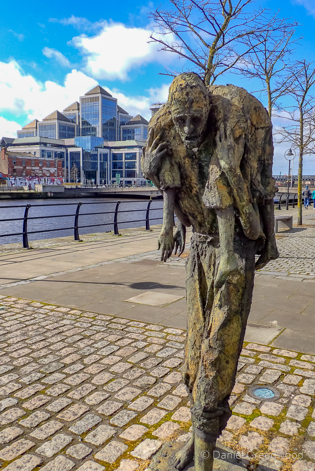
From a personal perspective the famine drove my Mayo ancestors to attempt new lives in North America. The statues here are in place alongside where one of the “famine ships”, the “Jeanie Johnston” departed for New York:
The original Jeanie Johnston carried 2,500 Irish emigrants across 16 journeys to North America during the Famine.
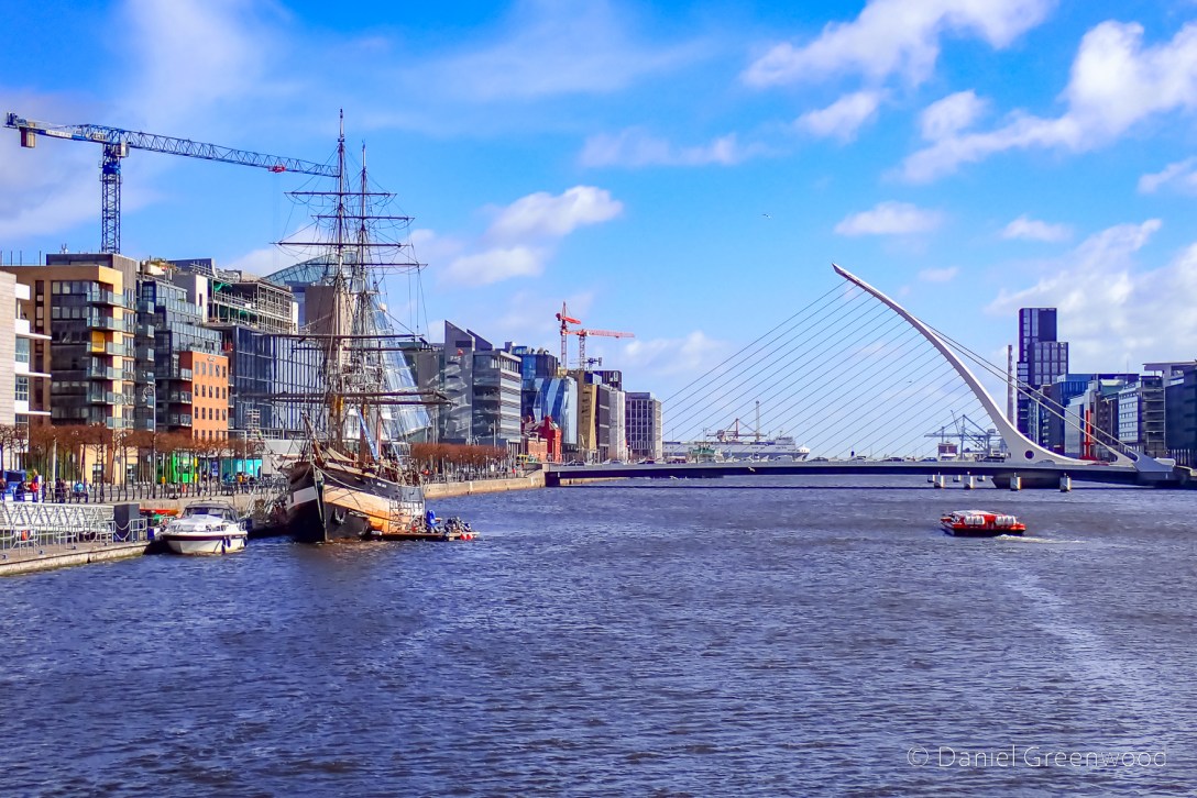
You can see the Jeanie Johnston moored in the left-hand side of the image below right.
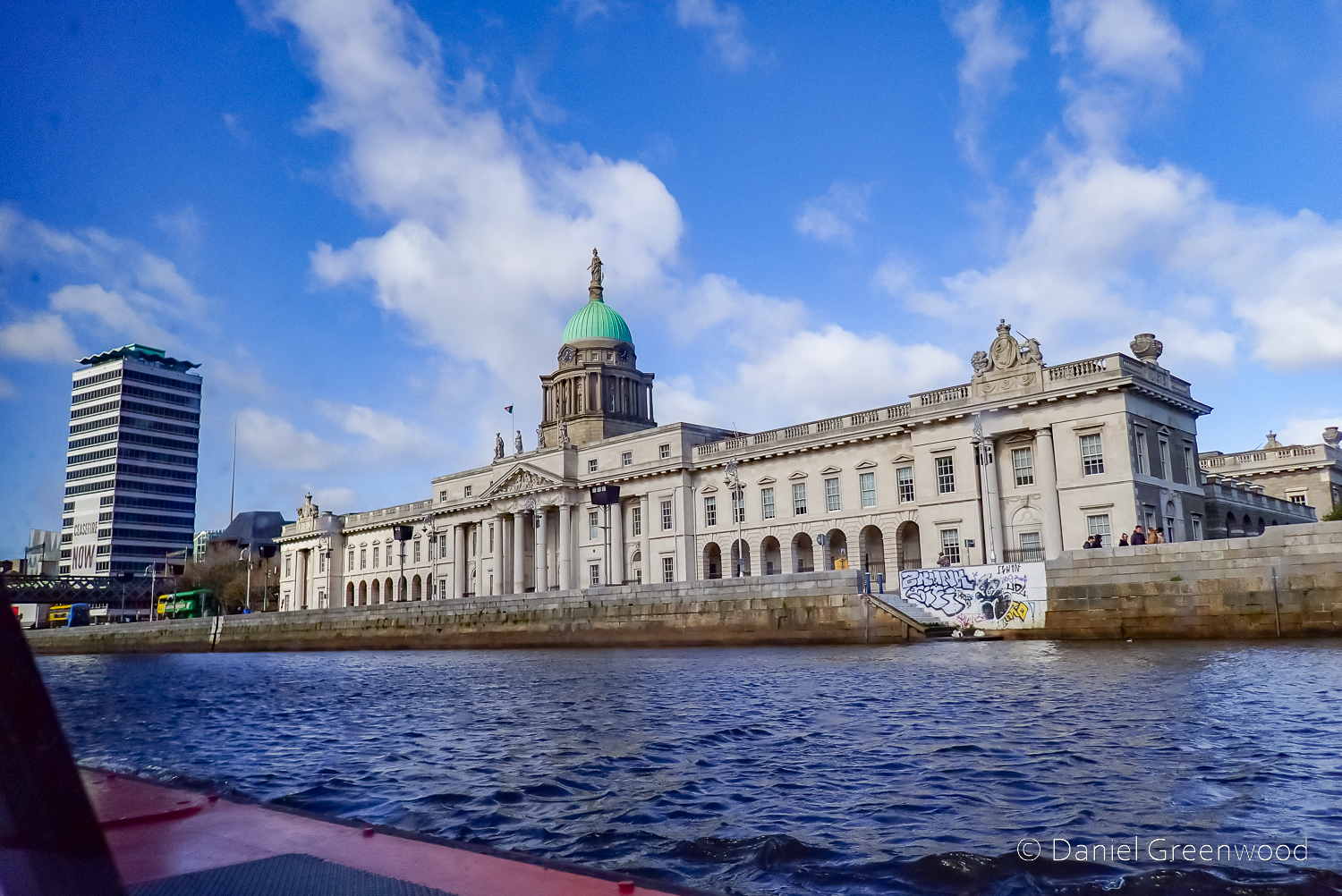
Custom House dominates part of the north bank of the Liffey. It was burnt down in 1921 as the Irish Republican Army attempted to destroy tax records in a raid.
This building once managed the movement of goods up the Liffey into Ireland.
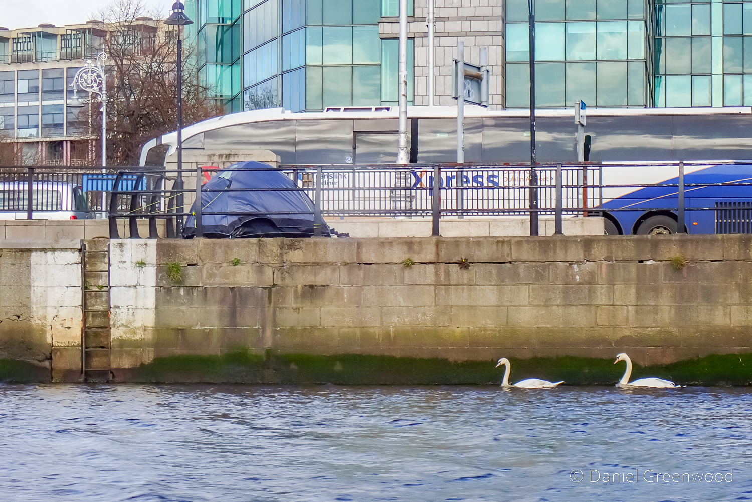
And here it is from street level. The tent on the left is where a person was rough sleeping. We were told that the river was once significantly wider than it is now.
Two swans in the river on the other side – taken a good half an hour later, don’t worry.
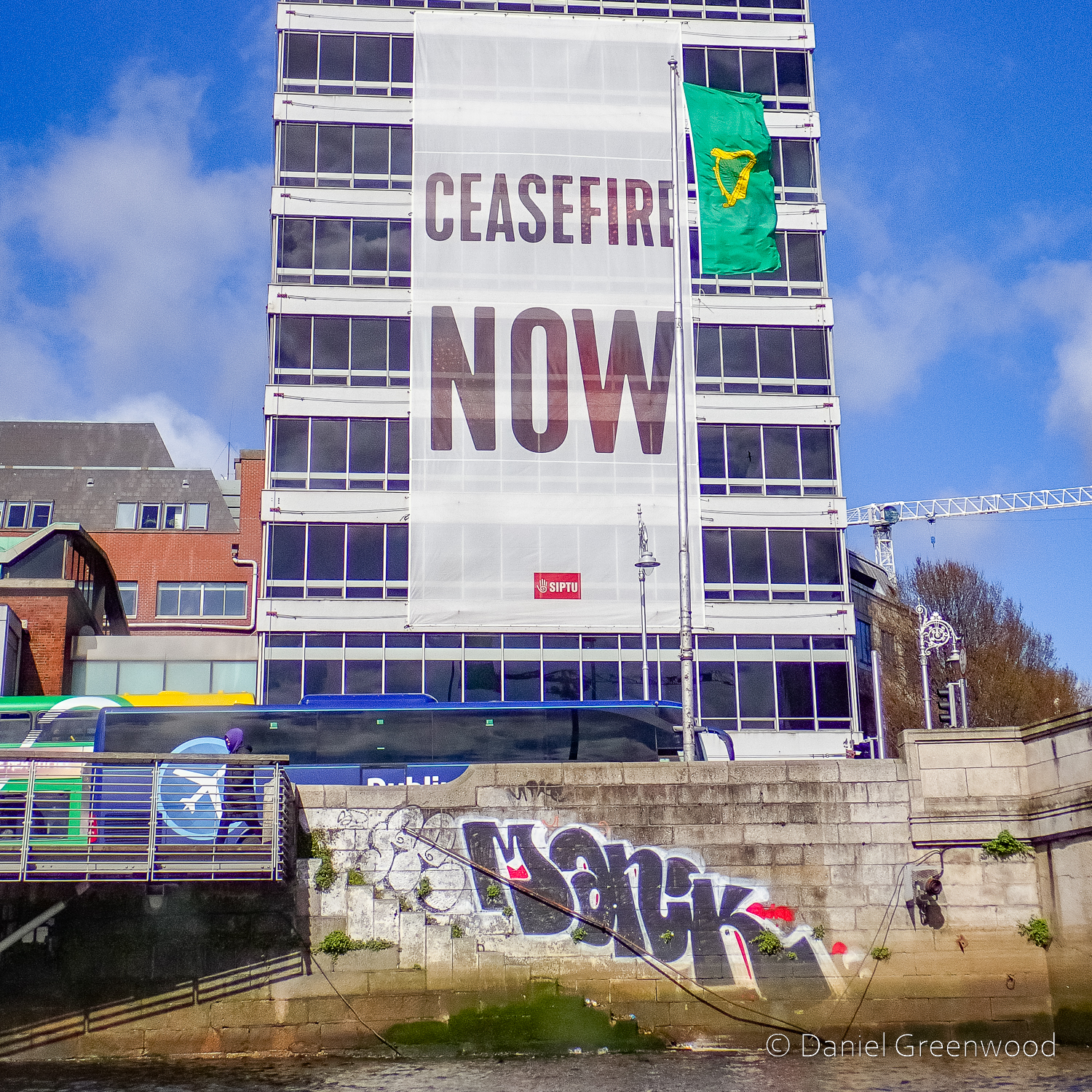
At first this tower looked disused but I’m not sure if it is. The banner’s related to the Israel-Hamas war in Gaza (at least 2023-present day). Ireland is outspoken on the need for a ceasefire, a two-state solution and for an end to the Israeli military’s occupation of Gaza and the West Bank. The banner seems to have the name of SIPTU – a trade union – branded on it. For the those who aren’t aware, the Palestinian cause is one of the most significant humanitarian and political issues for ‘the left’ in Britain and Ireland, probably more so than Russia’s invasion of Ukraine.
In September 2022 I had the privilege of walking through the woods of Enniscoe House in Co. Mayo, Ireland, to the shore of Lough Conn with Seán Lysaght. Seán is a poet and author who has taught me a great deal (through his books and poems) about the nature, landscape and heritage of County Mayo.
We cover a lot of ground and experience all the weathers, with Seán reading one of his poems at the close of the episode. It ends in dramatic fashion, with the rain sweeping in off Lough Conn and making further recording impossible.
This is fundamentally a conversation about woods and trees. We encounter a lot of different species which spur conversations about all kinds of things. We also discuss invasive species, bogs, Irish attitudes to nature conservation, and fit in a bit of wildflower identification on the shores of Lough Conn.
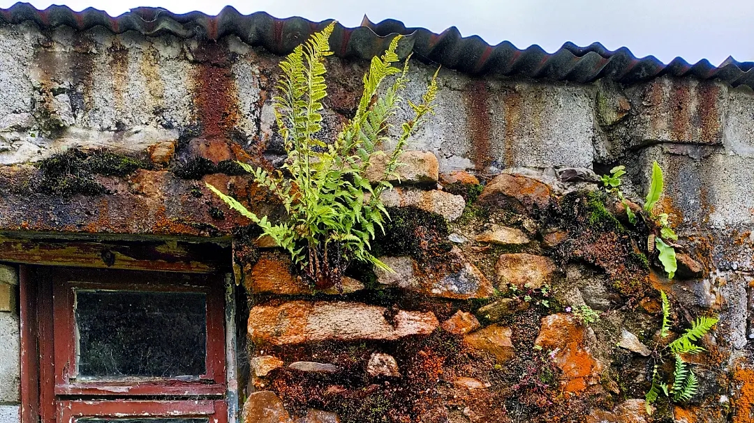
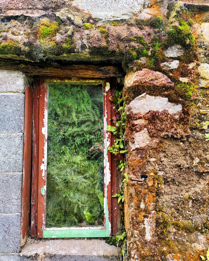
Phone pics of a shed that, year on year, ‘returns to nature’.
These are ferns growing on the inside. This is probably an old stone dwelling or animal shelter that was rebuilt as a tool shed and store in the second have of the 20th century.
The orange is algae or fungi, like a portal into the past.
In April 2023 I visited Achill Island in County Mayo for the first time in 10 years.
I have happy memories of a visit to Achill in March 2013 with my parents. Returning with my mum in April after the passing of my dad in 2021, we followed the same route as a decade ago, stopping at Cloughmore to see the Atlantic’s wild waves crashing against the rocks. It brought back strong memories of that last visit a decade earlier, and thoughts of dad heading out onto similar rock formations to fish, further south in Cork during 1990s summer holidays.
In the surrounding sheep-cropped grasslands pipits, likely the rock variety, skipped and flew between boulders. A man cast a drone along the coastal edge before packing his kit (and three generations of his family) into the car and went off again.
I walked around looking for lichens to add to my iNaturalist map and picked off two small pieces of quartz that came away with ease.
The power of the waves, the overwhelming sound of the sea – the hiss and crash – and the sheer beauty of the view north along the coastline silenced me. See for yourself.
If you were to head directly west from here by sea, you would arrive in Newfoundland or Labrador in eastern Canada. My relatives made similar journeys, some of them never came home but instead built lives of their own in New York City. Some were of Irish heritage and were born in America, but returned to Ireland.
I recently read Brooklyn by Colm Toibin. I’ve been on an Irish fiction streak, in some ways to try and understand the experiences of my Irish relatives, who made the same crossings and who also built lives in Brooklyn before the book’s setting of 1950. Other than Toibin I’ve read most of the Donal Ryan novels, where migration is again a key theme.
Eileen, my great-great auntEva, my long-lost great grandmother
Two of my relatives who went to America are my long-lost great-grandmother Eva Sugrue (right), and her sister Eileen (left). My family have confirmed Eileen was married in the same Brooklyn courthouse that progressed one of the many cases against ex-President Donald Trump, which is nice. No one in my family today, or even my grandmother, knew Eva (her mother) or Eileen. That mystery trickles down, and it was only through the diligence and commitment of my family’s desire to find out more that the photos above ever came to light.
On our way off of Achill we stopped at a craft shop. I wanted to buy some proper knitwear (oh yes) and a few gifts for home. We got talking to a woman called Kathleen who was running the shop. She had lived in London, Littlehampton, and Winchester, the latter when her husband was working on the creation of the M3 cutting through the South Downs at Twyford. They had lived in a caravan park while the work was being undertaken, a community of Irish families cropping up with all the workers there to do the job.
In talking we covered all the major issues: English nationalism, Brexit, Trump, Putin. She had a way of saying, ‘I don’t care either way, but…’. We also discussed the ‘shock’ of living in rural West Sussex compared to most other places, how beautiful the South Downs were.
Kathleen was readying herself for the influx of American tourists expected in line with a visit from US President Joe Biden, ‘a Mayo man’, as the whole world now knows. She asked if we would be staying around for Biden’s visit, but we were already planning to leave for Dublin before his arrival. The payment machine didn’t work as the signal was so poor, and she felt embarrassed that she’d have to ask the Americans to pay in cash.
Achill has a long history of people coming and going as Biden’s family did, though particularly to England, as the video above shows.
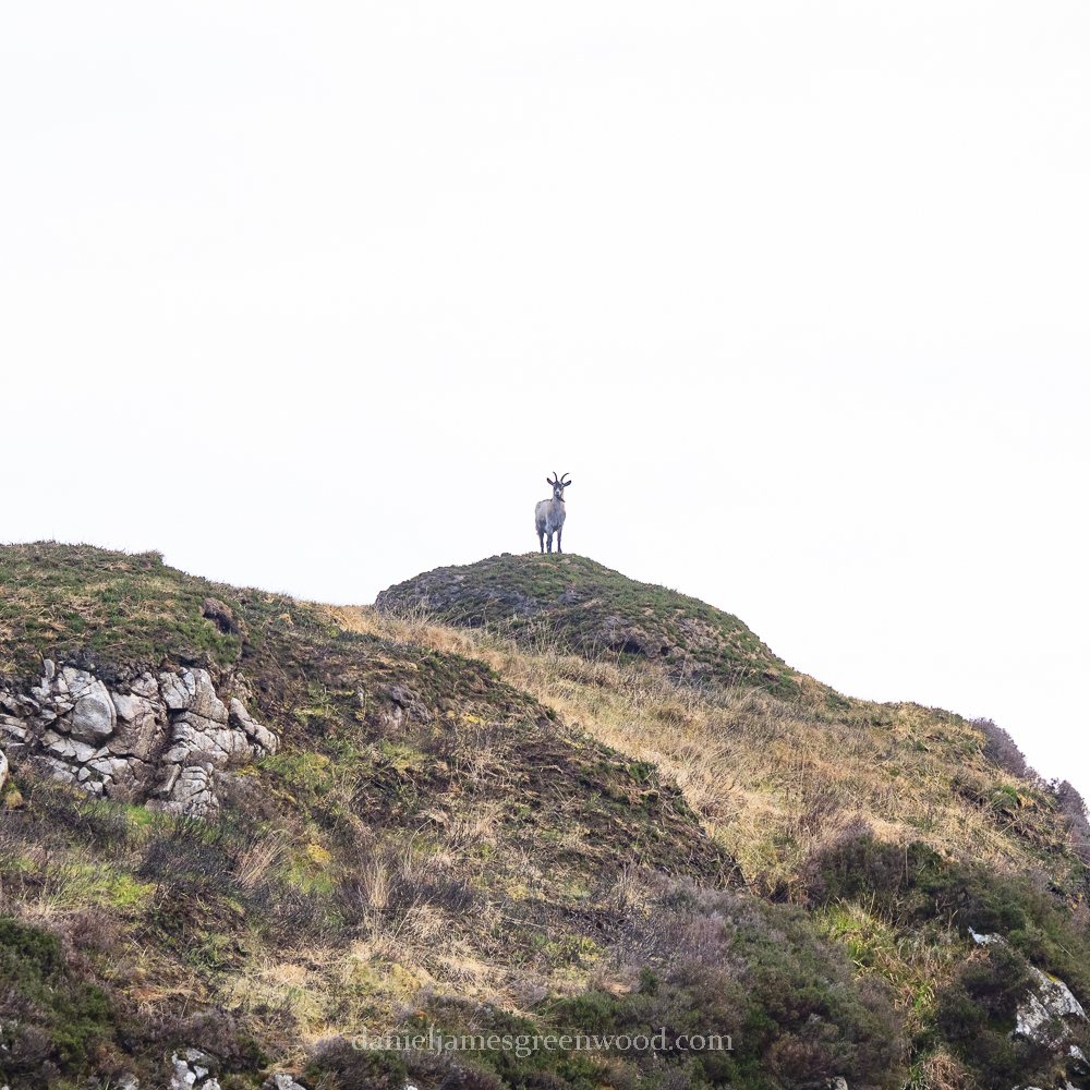
I went for an evening walk down the old trackway to the foot of the mountain. The track was flooded, meaning that without wellies I had to find tussocks and rocks to move further. Where the track turned, I noticed a ram of some kind grazing up ahead. After a time, I realised it was a goat, most likely a wild goat from the flock that roams the mountain. I had never seen one so close before and began to feel some concern for it. Why was it down here in the floodplain rather than up there out of reach among the boulders and bogs?
Its bleating was weak, distressed. I felt anxiety rising, that I needed to act. I looked at my phone about guidance for finding a wild animal of this size, but it was stuff I already knew and I realised I wasn’t acting rationally. I walked forward, a little fearful that the goat may show aggression, so when it turned to look at me, I backed away and waited.
The goat lowered itself to a sitting position, bleating in a way that suggested distress, weakness. Its voice was breaking, fading. It tried to stand but its legs gave way. It lay with its head on the ground, bleating again. I hadn’t moved, realising what was happening. Its stomach stopped moving. I approached it where it lay, its ears and lips were trembling. Then, stillness. Its eye remained open, and did not move. It had passed away.
A life lived wild on the mountain had ended at its foot, in a very short space of time. There was very little visible suffering, though some fear as it realised it was losing its ability to graze and trot.
I continued on and headed up the mountain. Seeing the death of the wild goat made me want to press on, a gentle reminder that all life has its limits. To the west, Nephin appeared in the distance, Lough Conn as silvery as ever at its foot. In the south-west Croagh Patrick could be see behind a rank of wind turbines. As I reached a curve in the path, where a cleft had been carved into the hillside, a small group of wild goats appeared on the hilltop. We watched eachother for a while, before they headed off out of sight.
I reached the top for the first time since 2017. A broken flock of sheep circled me against the horizon of rocky outcrops, mountains and distant loughs. Being up there will always remind me of the times me and my Dad made it up, always out of breath and red-faced.
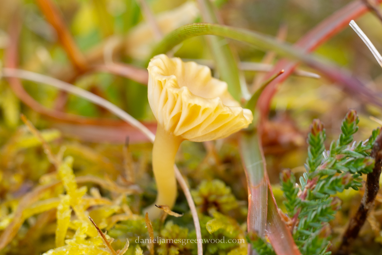
Surrounded by bogs and scars of turf cutting, I looked down to try find an unusual species of some kind that I might not see elsewhere, due to the remoteness of the place. Down in a small bit of bog, with sphagnum and other mosses, a group of golden mushrooms were growing.
I had a second camera with me that had a macro lens attached for ease. I took some photos, unsure of the species. Its gills were not unlike a waxcap (hygrocybe) but I knew so little about boglife that I was happy simply to find some shrooms.
I’m still waiting on feedback on iNaturalist, so this remains a mystery. Unless someone reading this knows and can add some information in the comments?
I headed back down the mountain and along the track. There the wild goat rested. I hadn’t imagined its death, and it wasn’t trying to fool me. I went back to the cottage unnerved, reminding myself of a life lived wild and free in the Ox Mountains.


